Range Rover Club of Australia, Victoria Branch Inc.

COLORADO - UTAH 4X4 TRIP
JULY 26TH - AUGUST 9TH, 1998

Trip Leaders: Donald McGann & Maggie Pinder in "Juanito" Jeep Wrangler
Participants:Jim and Pam Patterson in "Blue Heeler" Jeep Wrangler
                   Roger and Julie Smith in "Redback" Jeep Wrangler

Julie and I arrived in Denver from New York on the last leg of our 14 week world tour. Jim and Pam arrived 8 hours later from Melbourne via Los Angeles, and of course the Bushducks, Donald and Maggie, live in Denver on a semi-permanent basis.

Before we start our journey, a few facts and figures on Colorado will help to set the scene. Population is 3.3 million. All of the state is between 4,000-14,000 feet in altitude. Denver at 5,200feet is the mile high city. (The 1.6 kilometre high city doesn't sound the same). The city is situated 16km west of the Rockies and serves as a gateway for recreational activities. Somewhere between half to two-thirds of the vehicles are 4wds to be able to cope with the enormous snowfalls during October to March. Last year 8 people died in their vehicles from either asphyxiation from exhaust gases, or by freezing to death when their vehicles became stuck in the snow, on the freeways no less. If you look east from Denver, you have flat rolling plains to Nebraska and Kansas. Turning to the west with a line running north/south from Denver the mighty Rocky Mountains rear up to a height of 14,433 feet at Mt Elbert, with 59 peaks over 14,000 feet (over 4km high) in the state.

Due to a reluctance by 4wd hire companies to allow their vehicles off road, we had to journey to Buena Vista, 125 miles SW of Denver to be able to hire 2 jeeps for our 16 day adventure. Jim and Pam had a '95, blue, soft-top Wrangler which became known as "Blue Heeler", while Roger and Julie collected a '94 red, hardtop Wrangler with 90,000 miles on the clock, which was immediately called "Redback". Both were powered by a small but strong 2.5L, 4 cylinder engine, and horror of horrors, leaf springs! The Bushducks had their own '97 Wrangler, a green hardtop called Juanito who had a 4.0L, 6 cylinder engine, and coils!

Before leaving Denver on Sunday morning the rear seats were removed and portable CB radios fitted. Communication is everything with the Bushducks!

The girls had shopped the day before for food and supplies (except for Roger's fruitcake, which is only available in the supermarkets at Christmas). Maggie and Donald's organization for the trip was second to none. Everything from the magnificent travel booklet that included a very detailed travel itinerary, photos, cartoons and maps, camping procedures, bear country precautions, food and fuel stops and notes on altitude sickness and local flora and fauna. We were all anticipating a wonderful two weeks which was to exceed all our expectations.

Day 1 - Sunday 26th July - Denver to Buena Vista
We headed west up highway 285 with full tanks, sunny weather and great expectations of what we were to see, characters to be met and situations to be experienced. The first days driving was mainly on tarmac or well graded dirt roads, but non the less picturesque. We headed through the Pike National Forest (NF) following Goose Creek through areas of beautiful aspens, conifers and magnificent high plateaus of wildflowers - Sunbeams, Indian Paintbrush and the Rocky Mountains Columbine, Colorado's state flower. Then we crossed over La Salle Pass, 9,733 feet towards the San Isabel NF east of Buena Vista.

We camped at 9,272 feet overlooking the Arkansas River Valley and the 14,000 foot Collegiate peaks on the other side - still tipped with snow in the middle of summer.

After making camp, we found that Redback had a puncture - the only one of the trip - and the spare wheel was unremoveable due to the stud turning on the wheel carrier. The problem was temporarily solved by borrowing Blue Heeler's spare.

Day 2 - Monday 27th July - Buena Vista to Gunnison NF

Julie, Jim and Roger experienced high altitude sickness for the first 3 or 4 days of the trip in some form or the other; mainly headaches, nausea and loss of appetite. It was essential to drink large quantities of water to prevent dehydration due to the high altitude dry air.

The town of Buena Vista was not far from our camp, so the puncture and turning wheel stud were soon repaired. Jim was able to purchase parts to repair his CB aerial, which had been damaged the previous day in thick bush. Next stop was St. Elmo, a ghost town at the foot of Tincup Pass, 12,154 feet. St Elmo gave us our first glimpse of chipmunks, which delight the visitors, and the beautiful and delicate hummingbirds which hovered around the nectar feeder outside the general store, which had a swinging cowboy dummy hanging from a yardarm. This town was our first glimpse of what a 1880 western mining town would have been like.

The drive over the pass was driven in high range, stopping at the top for the view and photos. The pass forms part of the continental divide where the waters drain to either the Pacific or the Atlantic oceans. We watched a small marmot (a stout, burrowing rodent the size of a large rabbit) playing around on the rocks. The silence was broken by 8 All Terrain Vehicles (ATV's - four wheel motorbikes, otherwise known as Quads and very popular) driven by friendly Texans. The grass at this altitude grows at ¼" (7mm) per hundred years, with anywhere between 16-32feet(4.8 - 9.6m) of snow per winter it would have been a harsh environment to cross on a daily basis, particularly in the 1880's. These jeep trails open for a very short time each year when the snow clears sufficiently to let vehicles across. Mid July to late September is the only time it is possible, unless you are on a snowmobile or skis. Second nights camp in Gunnison National Forest We camped on a small ridge in a pretty valley in the Gunnison NF, not far from East Beaver Creek. Most days we saw signs of beaver activity around the waterways, fascinating dammed areas and beaver houses, called Lodges which form an important ecological role. However we were not lucky enough to see a beaver. That night Roger was woken early in the morning by a noise outside the tent, and knowing we were in Black Bear country didn't sleep well after that.

Day 3- Tuesday 28th July - Gunnison NF to Crystal River
We drove to Crested Butte (pronounced beaut), a pretty Victorian ski town, set in the vast Gunnison NF with towering hills and mountains on all sides. We walked around the town, which has many 2 or 3 storey timber homes and shops, plus timber sidewalks with seats made out of discarded auto body parts. An interesting place!

We left town to Irwin Lake, a beautiful spot with picture postcard views and had lunch sheltering from the rain under a spruce tree. Donald plunged into the lake for a quick wash. "Mad fools and Irishmen who wash in the ice-cold water at midday". We were hoping to drive over the difficult Schofield Pass, 10,707 feet, but due to an avalanche, the track was still blocked, so we had to cross to the west via the more sedate Kebler Pass, 10,007 feet. The scenery is beautiful, regardless of which route you use. Colorado would have to be one of the most beautiful high altitude areas in the world and you soon understand why Colorado is the wild flower capital of the USA and why the early settlers called it "God's Country".

We camped in a very tight, high cliffed valley with the Crystal River flowing through . In bygone days, the river powered the Crystal Mill with an ingenious hydropneumatic process to extract silver. Before dinner, we walked to see the mill and the century old Crystal township with well preserved timber buildings and a few summer residents , one of whom invited us in out of the rain. We declined in view of our soaking condition. Roger slept better that night (must have been due to the "Bear Mace" spray purchased in Crested Butte). Jim and Pam relied on less high-tech deterrents - they were sleeping with the mattock in their tent!

Day 4- Wednesday 29th July -Crystal River to Grand Mesa NF
It rained for most of the night which unfortunately resulted in Jim and Pam being extremely damp when they awoke due to faulty tent stitching. As luck would have it, the sun shone for an hour or two and enabled them to dry out most of their sleeping gear. When packed up, we drove back out of the valley to Marble, where, yes you guessed it, is a marble mine. The mine was not accessible, due to the road having to cross 14 designated avalanche areas in 4 miles. Poor odds! However we did see 20 ton super white blocks of marble waiting to go to market or wherever 20 ton blocks of marble go. The remains of an old marble processing mill still remains, with huge columns which supported the gantry for lifting the marble.

When the trip was almost over, the question was asked, "what part did you enjoy the most?" Julie and Pam's answer was the same - driving through the Gunnison and Grand Mesa NFs where the green valleys were lined on one side with huge stands of aspen, and Blue Spruce on the other side, the odd snow-capped mountain rising in the background and the valley floor a carpet of beautifully coloured flowers. This scene was not just here or there, but went on for miles and miles, colours changing all the time, yellows, mauves, whites, pinks and blues - and all to ourselves!

After lunch in our colourful surroundings we went real 4wding in an area where the track was less formed and defined. Julie and Maggie were travelling together in Redback (Roger had a migraine and was resting in Juanito with Donald). The two girls were immediately nicknamed Thelma and Louise (Julie and Maggie respectively from the film of the same name). and they hammed it up and took off into the wilderness to find the cliff edge of the Grand Canyon. Unfortunately, as they were disappearing into the sunset they got bogged. This was not meant to be part of their story! The black soil track was very easy to get stuck in, particularly with Redback's tyres. Blue Heeler pulled them out backwards. After sometime struggling through rock strewn creek crossings and more black soiled tracks we found the route we had planned to take turned into an ATV only track at a creek crossing. Jim bravely waded across to check out the far side - only afterwards finding the narrow bridge across hidden around the bend! So we had no alternative but to turn around and retrace our wheel tracks. This time it was Roger, now recovered, who got bogged and Donald who pulled him out.

Maggie and Donald's knowledge of history and geography of the area, and Donald's quick witted humour was adding plenty of interest and enjoyment to the trip. At that evenings campsite, Jim found that Blue had broken an engine mount and that Redback's mount was cracked and about to break, a problem indeed miles from anywhere.

We heaved a sigh of relief when we saw the bear country warning sign on the OTHER side of the fence to where we were camping!!!! Our camp that night was at 7,400 feet on the edge of the Grand Mesa NF - the overnight temperature was 2-3°C.

Day 5- Thursday 30th July - Grand Mesa NF to Gateway
We packed up and were on the track by 8.30am and headed into Collbran, the nearest town where we hoped parts would be available for the jeeps. However, no replacements were in town and would not be available for 1 or 2 days at the earliest. The local auto parts man suggested a welder who was very capable with the sticky rod machine. After tracking him down, we left the Jeeps and Jim with him and the rest of us shuttled into town in Juanito and had a much needed hot shower, attended to laundry, shopping and had a cooks tour of small, but extremely friendly Collbran. People allowed us to use their private phones, rang around town looking for things for us and generally could not do enough to help us.

The cars were ready by lunchtime. US$100 lighter in cash and we were on our way again through the westerly part of Grand Mesa NF, through Cedaredge to Delta for a top up of fuel for the long haul to Moab, Utah. We left town to the southwest leaving the sealed road to head into our first canyon, the Escalante, so named by Spanish fathers seeking a new route through the mountains. The vegetation changed dramatically, gone were the shale and mud tracks, aspen and pines. It was warmer, drier and lower with prickly pear and small barrel cactus the new greens against the red soil background.

The road climbed from 4,600 feet through the canyon up to the Uncompaghre Plateau in the NF of the same name to 10,400 feet with uninterrupted views in all directions. The sun was getting low as we started our descent into the small town of Gateway (Population 100) near the Colorado-Utah border. However dropping down over 4000 feet from plateau to valley in only a few miles of tracks makes for never forgotten views , particularly with the setting sun making the red rocks even redder and the shadows getting longer. A truly memorable descent.Camp at Gateway

We had dinner in the Gateway pub, eating hot pockets, hamburgers and pizza courtesy of the defrosting microwave. The pub had a license to sell alcohol only up to 3.2% strength, which automatically prohibits wine and spirits. Hope you like beer, beer or beer. We camped in a huge canyon a few miles from the town in amongst the prickly pear, dastardly little blighters, they can penetrate leather boots. Bed at 11.30pm.

Roger and Julie Smith

Day 6 - Friday 31st July. Gateway to Moab
A sleep in was declared, but thunder rolling around the valley and flashes of lightning had everyone up and packed up by 7am. The valley was just as spectacular in the morning light, the red rock buttes stood out very dramatically against the stormy sky. The storm was rolling along further down the valley, but in the way of Colorado summer storms was passing us by. Everyone walked up the hill behind our camp to be rewarded by a great view of the Dolores River, some interesting green coloured rocks and a few cactus spines in the boots.

We left up John Brown Canyon towards Utah. The dirt road wound up the canyon giving "Steven Spielberg", a.k.a. Roger several opportunities to video. We could tell we were coming into Uranium Mine country - bright yellow signs warned us about the radioactive gases around the old shafts and the tailings. We stopped for a group photo at the Colorado-Utah border - because we were on a small road the garish border sign was non-existent and there was only a small cardboard sign stuck on the fence post.

Into the Manti La Sal National Forest, and once again the vegetation and scenery changed as the elevation increased. By 8,000 feet we were back in pine and aspen forests and the temperature had dropped by about 10°C. We stopped at a viewpoint for morning tea . Jim and Pam, who were leading at this stage went on a bit further looking for a better viewpoint and came across a small campsite with a pit toilet. Jim took advantage of the find and whilst he was sitting contemplating, he was rudely interrupted by a truckload of National Forest Rangers who had come to paint the dunny and started to do so with Jim inside it. When we all regrouped, we had our morning tea overlooking the Castle Valley - a dry, dusty valley with red Navajo Sandstone buttes and outcroppings of rock with such names as The Priest and Nuns, The Rectory and Sister Superior.

Blue off the ground We took a short, dead-end track that climbed up back into the Aspens to Miners Basin, an old mining camp. Roger had a snooze in the shade, and the rest of us hiked up a further 1,000 feet to 11,000 feet to see the old log cabins. After a windy lunch, overlooking the Fisher Valley, we took part of the Kokopelli Trail, a combined mountain bike and Jeep trail. (Kokopelli is an American Indian deity - a hunchback flute player, renowned for his fertility and fornication). The red dirt track wound down through the stunted oak and juniper to wrap around the rim of the Fisher Valley before descending back to the dirt Sand Flats Road. The Smiths had once again stopped to film Blue descending down a wash and when finished, they jumped back in and drove straight off without looking. Straight over a huge slick-rock gully that waved one of Redback's back wheels about 2 feet in the air! Blue Heeler then went down a little more cautiously and at one point was perfectly balanced with only 2 wheels on the ground with Donald standing at the back rocking Blue back and forth until Jim was seasick. The track continued over slick rock pavements and sandy gullies until it rejoined the road over a big boulder dip. Both the hire jeeps waved wheels dramatically in the air as their leaf springs were unable to maintain traction, but Juanito with the coils and anti-sway bar disconnects stretched most impressively and was able to keep all four paws on the ground.

Heading into the town of Moab for the night, we stopped briefly at Porcupine Rim viewpoint. Donald escaped into the dunny, and when he hadn't emerged after an inordinately long time (about 3 minutes), the rest of the group started throwing pebbles at the dunny, some of them falling in the open top. First a streamer of toilet paper appeared over the top in surrender, followed by the man himself to loudly complain that wasn't ANYTHING sacred?

We rolled into Moab to Canyonlands Campground in town for two nights. Our first "civilised" campground since the start of the trip, and very comfortable it was too with a swimming pool, pay phones, laundry and within walking distance of the lively little town of Moab. Most people had a swim and took the opportunity for a shower and another fight with the American phone system before we all headed out to eat.

On to Part 2

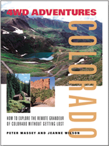
4WD Adventures: Colorado
This book lists 70 backcountry trails to help you explore the Colorado backcountry.

Read more about the book


View other recommended Colorado books

Home  Back Country Planning  Adventure Guides  High Country Pass Status  Adventure Reports  Bushducks Land Rover  Webbed Links 

Be informed when this site is updated:

Join the mailing list
Enter your name and email address:
Name:
Email:  
Subscribe      Unsubscribe