| TRAIL NAME |
NATIONAL FOREST NAME/DISTRICT |
PHONE NUMBER |
STATUS |
DATE UPD. |
| Argentine Pass/Waldorf Mine |
White River/Dillon |
970-468-5400 |
9/21/08 |
Open |
COMMENTS:
9/21/08 - Trail was steep, loose and partially snow-covered past Waldorf at the
first switchback past the turnoff onto 248.1V. Switchback is also off-camber -
swing wide! You need 4-wheel low to climb this first switchback - too much for
the Dodge Nitro in 4WD Hi. Had to back down to the 248.1V cutoff. Snow was falling
up higher and the shelf road had increasing amounts of snow as you ascend. No summit this year!
Good trail conditions - a few rough spots on the climb up to Waldorf but nothing
significant. Steep, wet, loose and snowy past Waldorf at the first switchback beyond
the 248.1V cutoff. Trail was likely completely snow covered up to and beyond the second switchback.
7/22/08 - Open all the way to the top. Trail in relatively good condition. Last
switchback before reaching the top was the toughest spot, will need low gears and
good ground clearance. Met two full size Dodge 4x4 pickups coming down and they had a
little trouble negotiating the switchback and also met a Jeep coming
up on the shelf road.
7/19/08 - It's clear to a point a few thousand feet past the Waldorf mine, but
there is a snowfield across the road at that point. An ATV tried to get over the
snowfield several hundred feet from the top of the pass and flipped. From
Georgetown on up to the Waldorf mine, it is easily traveled by any 4X4.
7/10/08 - Trail still closed about a mile above Waldorf due to two snowfields.
The rest of the trail was in very good shape.
6/28/08 - Argentine Pass is blocked by snow within .2 of mile beyond Waldorf
Mine. Could get up McClellan though to the Santiago Mine. McClellan was also
blocked by snow on a very narrow section probably about 1.5 miles beyond Waldorf
mine. Made it 7.9 miles in without snow!
6/25/08 - Argentine and McCllelan still blocked with snow a short distance above Waldorf.
Snow blocks trail at about one-mile above Waldorf.
6/8/08 - Open to the Waldorf Mine, impassable after that. The trail is dry to
within a half mile below the mine, then parts have a mix of running water and
slush, but nothing bad. Happy trails.
5/15/08 - Could not go all the way. There are tracks further than we went but the snow is deep.
From Georgetown we were able to go about 2 miles. Snow and melting snow all the way up.
|
| |
| Alpine Tunnel |
San Isabel/Salida |
719-539-3591 |
Open |
7/19/08 |
COMMENTS:
7/19/08 - The trail is open all the way to the parking area. The Alpine Tunnel
road is dry and in great condition, suitable for some higher-clearance passenger
cars. The road offers some views of Uncompahgre Peak and the San Juans on a clear day.
|
| |
| Ballard Road |
Fort Collins Region |
|
|
|
COMMENTS:
|
| |
| Bangs Canyon |
BLM |
|
|
|
COMMENTS:
|
| |
| Bill Moore Lake |
Clear Creek |
303-567-3000 |
Open |
9/21/08 |
COMMENTS:
9/21/08 - Trail open but quite rough and rutted with large rocks beyond the ATV
staging area up to the Conqueror Mine (the first 1/2 mile). I ran out of time and
had to trun around just past the steep switchback just past the mine.
Trail is quite rough at the start - not sure about the condition past the Conqueror Mine ruins.
7/12/08 - Yes, drove all the way to the lake. All dry, some mud by the pits before the lake.
6/29/08 - Completely clear to the top of the mountain. Did not attempt to drop
down to the lake based on advice from a group of Jeepers who had just freed
themselves from being stuck in the snow. It looks like you can not get to the
lake for another month.
6/21/08\- Open to the top of the mountain, before dropping down to the lake.
Deep snow still covering the last section down to the lake.
comments: Occasional patches of shallow snow as you work your way to the top. Snow becomes more frequent, and deeper as you reach the top.
5/10/08 - Open and clear from empire until you get to the first abandoned mine,
then deep snow from there on. Impassable.
|
| |
| Birdseye Gulch |
Uncompahgre/Ouray |
970-240-5300 |
Open |
7/24/08 |
COMMENTS:
7/24/08 - Open all the way. Mud bog slippery with submerged rocks and branches.
|
| |
| Black Bear Pass |
Uncompahgre/Ouray |
970-240-5300 |
Open |
7/22/08 |
COMMENTS:
7/27/08 - Trail is open all the way, flowers are best in years, some snow on trail
Road dry most of the way, some snow and mud on top of pass, small wash out on the
steps, but no problem for jeeps, switch backs seem normal.
7/22/08 - Made complete trip today. Trail is pretty rough compared to previous trips, some turns are considerably tighter, but
overall very do-able in a Jeep.
7/17/08 - Trail is open today per the San Miguel County Road and Bridge Department.
7/15/08 - Pending opening date is 18 July 08. San Miguel County is currently working on
some of the last snow banks towards the top. Expected opening 7/18/08.
5/22/08 - Closed, as is usual at this time of year.
|
| |
| Blowout Pass |
Rio Grande/Divide |
719-657-3321 |
|
|
COMMENTS:
|
| |
| Bolam Pass |
Uncompahgre/Ouray |
970-240-5300 |
Open |
7/16/08 |
COMMENTS:
7/16/08 - Open and trafficable.
|
| |
| Boreas Pass |
White River/Dillon |
970-468-5400 |
Open |
6/26/08 |
COMMENTS:
6/26/08 - Boreas Pass is open all the way from Breckenridge to Como. The trail is in
great condition. No major ruts or washboard areas. This was the first weekend
that it has been open, so it was a little busy.
5/8/08 - Sign at Como still reads closed.
|
| |
| Breakneck and Browns Passes |
Pike/Fairplay |
719-836-2031 |
Open |
6/21/08 |
COMMENTS:
6/21/08 - The trails are open and dry.
5/8/08 - Both ends of the loop from the Weston Pass road are clear and open, but
from the snowpack elsewhere and the closed in treed nature of these trails, I'm
sure they're still impassable.
|
| |
| Bunce School Trail System |
Boulder |
303�541-2500 |
Open |
5/18/08 |
COMMENTS:
5/18/08 - Trail is open from Camp Dick side all the way through to Highway 7.
Also did the loop on the north end and the trail to the top off the loop.
All clear of snow. Great ride, beautiful view at the top. There were a
few snow drifts off to the side, no problem getting past any of them.
First spur trail to the west on the Camp Dick end looked to be blocked by snow.
|
| |
| California Gulch |
Uncompahgre/Ouray |
970-240-5300 |
Closed; |
5/22/08 |
COMMENTS:
|
| |
| California Pass |
Uncompahgre/Ouray |
970-240-5300 |
Open |
7/16/08 |
COMMENTS:
7/16/08 - Now open.
7/3/08 - Open to the summit. A friend traveled it on the 2nd or 3rd of July.
It is open, but closed going to Corkscrew as there have been landslides on it.
Lots of snow on either side. A picture is worth a thousand words, so here is his picture.
5/22/08 - Still closed, according to the Forest Service.
|
| |
| Caribou Creek |
Boulder |
303�541-2500 |
Open |
7/26/08 |
COMMENTS:
7/26/08 - Open all the way. Mostly dry. No snow. Creek crossing about 1' deep. Lots of mud holes. Very fun.
|
| |
| Carnage Canyon |
San Isabel/Salida |
719-539-3591 |
Open all year |
5/8/08 |
COMMENTS:
5/8/08 - Clear and snow free. A fresh crop of oily marks at the start of this
extreme trail show that it is still well used.
Completely open all year.
|
| |
| Chinaman Gulch |
San Isabel/Salida |
719-539-3591 |
Open all year |
5/8/08 |
COMMENTS:
5/8/08 - Clear and snow free.
Completely open all year.
|
| |
| China Wall |
Pike/Fairplay |
719-836-2031 |
Open all year |
|
COMMENTS:
Completely open all year.
|
| |
| Cinammon Pass |
Uncompahgre/Ouray
BLM/Gunnison |
970-240-5300
970-641-0471 |
Open |
6/27/08 |
COMMENTS:
6/27/08 - Trail is open all the way, still has some snow on the side of the
roads. Good condition with some wet places.
6/5/08 - Open all the way.
5/22/08 - Open to the top on the Lake City side, but still being plowed over to
American Basin. The Forest Service were hoping to have it open by Memorial Day.
Lots of gullies from melting snow.
5/11/08 - Open to Milemarker 18 (Cooper Creek trailhead) on the Lake City side. That's where the D7 is parked :)
They're working on it, but have a long way to go.Good, but lots of avalanche
debris and free-flowing water in spots.
|
| |
| Coney Flats |
Boulder |
303-541-2500 |
Open |
7/16/08 |
COMMENTS:
7/16/08 - Open all the way. The water crossing is about 36" deep.
6/10/08 - Gate closed, trail closed.
|
| |
| Corkscrew Gulch |
Uncompahgre/Ouray
BLM/Gunnison |
970-240-5300
970-641-0471 |
Open |
7/22/08 |
COMMENTS:
7/22/08 - Open and in great shape! Evidently a pretty major landslide caused the
trail to be reworked into a really fun roller coaster ride. Nothing bad, just a
lot more fun to drive than it used to be.
7/11/08 - The trail is open all the way and boy, is it beautiful!! We were told
that it just opened, so I don't know exactly when it opened. Very little traffic
across it right now. Some switchbacks could be slippery if wet, but we had no
trouble. Obvious avalanche damage evident by debris left in the streams and
low lying areas.
5/27/08 - Still closed.
|
| |
| Cottonwood Pass |
San Isabel/Salida |
719-539-3591
|
Open |
7/20/08 |
COMMENTS:
7/20/08 - The trail is open all the way. The Taylor Reservoir side of the pass
is in good condition. It was wet down a little to control the dust, and there
are a few patches of small washboard, but other than that, the road is in
great condition for any vehicle.
|
| |
| Cumberland Pass |
San Isabel/Salida |
719-539-3591
|
Open |
7/19/08 |
COMMENTS:
7/19/08 - The trail is open all the way. The road up Cumberland Pass is in great
shape and suitable for nearly any vehicle. It was even wet down a little to
keep the dust down.
5/25/08 - Gate on the road right at the Pitkin Campground is still locked.
|
| |
| Cunningham Gulch |
Uncompahgre/Ouray |
970-240-5300 |
|
|
COMMENTS:
|
| |
| Eagle Rock |
Teller County |
Near Colorado Springs |
Open |
6/2/08 |
COMMENTS:
6/2/08 - Open.
|
| |
| Elwood Pass |
Rio Grande/Conejos
San Juan/Pagosa |
719-274-8971
970-264-2268 |
Closed |
7/11/08 |
COMMENTS:
7/11/08 - Called the Rio Grande NF, Del Norte District 719-657-3321 on 7/8/08
and they said there was a rock landslide low on the Pagosa side. The earth is
still moving up there because of all the water up there, so no estimate on
when it will be cleared.
|
| |
| Engineer Pass |
Uncompahgre/Ouray
BLM/Gunnison |
970-240-5300
970-641-0471 |
Open |
7/21/08 |
COMMENTS:
7/21/08 - Lake City to top no problem at all. Usual snow near top. Went down Alpine Loop
Alpine loop to 550 is in best shape ever. The
really bad spots have been improved somewhat,
and the last stretch that was always really bad
near Hwy 550 is no longer a loose boulder
road, now just an average part of a jeep trail.
6/27/08 - Drove the entire pass in a 4-door Jeep Rubicon. The road is very wet
near the summit due to melting snow. The trail is moderate to slightly difficult
at the switchbacks on the west side of the pass, very steep rocks to drive on
and wet from the melting snow. High clearance definitely suggested. The overlook
drive to Oh Point is completely clear and easy to drive.
6/16/08 - Open from 550 to Engineer pass, seems to have just been cleared.
Completed the trip from 550 to Animas Forks, then down to Silverton in a
Ford Explorer.
5/20/08 - Closed.
4/24/08 - Trail is closed, with 3-feet of snow covering trail from trailhead on Ouray side.
Rumor is the USFS plans to open/plow around June 20.
|
| |
| Fourmile Travel Area |
San Isabel |
719-486-0749 |
Open |
5/8/08 |
COMMENTS:
5/8/08 - Seasonal closure gates opened on April 15 and everywhere is open
and dry, both sides of Hwy 285. Trails in good condition. The best camping
in Colorado, and excellent vistas.
The majority of this region is open all year.
|
| |
| Georgia Pass |
White River/Dillon |
970-468-5400 |
Open |
7/30/08 |
COMMENTS:
7/30/08 - Pass is open. We traveled from Jeferson up and over to the north side where Swan River trails begin.
7/6/08 - Made it all the way from Jefferson over Georgia Pass down to Tiger Road
(Breckenridge). All was clear except 1 small part with ice. Small ice bridge
formed on trail with good traction on the drivers side but partial collapse
and slip on passenger side. I was headed downhill so a lot easier than up hill.
Other than that, all clear my friends. Great condition other than the ice
bridge. Ice on trail was about .75 miles toward Breckenridge from the pass.
6/29/08 - Made it .4 miles past the gate from the Breckenridege side in my Jeep.
Blocked by snow drift, but 2 guys on ATV's told me they made it all the way
to the top. Looks do-able in an ATV!
6/15/08 - Came in from Rte 285 at Jefferson. Made it all the way to the switchback
at the bottom of the last open climb to the top. ATV's had no problem with the
still deep snow on the road up. Needs till July 4th to MAYBE melt out enough on
both sides. Still not open Some snow still across the road in the shady spots
as you get closer to the top. Needed the extra vehicles, tow straps, lockers,
to get through those areas today.
6/15/08 - Tried the trail from the Jefferson side this time and it's still
blocked by very deep snow up top. Still don't know if the gate's even open on
the Breckenridge side as I don't know anyone that's made it that far.
6/7/08 - We basically opened this trail plowing through snow drifts and towing each other up.
Made it about 2/3 of the way to the top of the pass from the Breckenridge
side until there was impassable snow without a winch.
Another week or two and it should be good to go.
6/6/08 - Can only go about 2 miles - snowpacked in spots.
Didn't get to gate, but assume it's still locked.
|
| |
| Gold Hill/Switzerland Trail |
Boulder |
303�541-2500 |
Open |
9/22/08 |
COMMENTS:
9/22/08 - Trail open. Trail is basically a slightly rough dirt road
(abandoned railway grade) all the way to Boulder Canyon from Gold
Hill. Some great views along the way! Some rocky spots where you must slow down to protect your
tires from sharp rocks - mostly done in 2WD.
|
| |
| Governor Basin |
Uncompahgre/Ouray |
970-240-5300
970 |
Partially open |
7/24/08 |
COMMENTS:
7/24/08 - The trail is open to the Sydney Basin/Governor Basin intersection.
Snow packed higher and may not clear all summer. Hiked to the top and is really beautiful.
There is a dangerous, tippy hole just above the shelf traverse. Be aware!
|
| |
| Grizzly Lake |
San Isabel/Salida |
719-539-3591
|
Open |
6/15/08 |
COMMENTS:
6/15/08 - The trail is open all the way to the lake however there are still large
drifts caused by avalanches to climb, but they are manageable and fun. That being
said, go and have fun, but stay on the trail, don't follow the ATV tracks,
they are not part of the trail.
5/25/08 - Plowed through several snow drifts for about .8 miles until stopped by a large drift on slopping face.
|
| |
| Guanella Pass |
White River/Dillon
Pike/South Platte |
970-468-5400
303-275-5610 |
Open |
5/24/08 |
COMMENTS:
5/24/08 - Trail open all the way from grant to Georgetown. Still some
snow at top of pass,mainly slush.easily passable.
4/13/08 - From Georgetown, closed due to snow 8 1/2 Miles up. The sign at the
bottom was correct but of course we had to go see anyway..Lotsa soft snow...
Wet/slushy to the closure at 8.5 miles.
4/9/08 - From Grant, impassable due to snow at plow limit, about 6 miles up.
|
| |
| Gunsight Pass |
White River/Sopris District |
970-963-2266 |
Open |
8/30/08 |
COMMENTS:
8/30/08 - Trail became difficult about two switchbacks from the top (from the Slate
River Road side). Large 'whoop-de-doos'/double berms crossed the trail; these berms
were ostensibly created by water/snowmelt that ran down the slope from the basin
up above. They seemed to be too steep for my Jeep Rubicon to negotiate, so
I backed down to a flatter area on the talus slope and turned around. ATV's or
motorbikes could negotiate these berms, but I suggest that Jeeps/SUV's park at
the uppermost lake and walk to the top.
|
| |
| Hagerman Pass |
San Isabel/Leadville
White River/Sopris |
719-486-0749
970-963-2266 |
Open |
7/21/08 |
COMMENTS:
7/21/08 - Open all the way from Leadville to Ruedi Reservoir. Trail condition good but
rought in places, nothing any 4x4 can't handle. Plow has cleared a path through
snow near the top, 10-12 feet deep. Scenic quality of drive excellent, as always.
7/20/08 - Good news. The pass just opened. There is a hugh Cat up at the top and
he cut through about 12' deep snow drifts at the top. His cut was about
200 yards. Road is good, only need high clearance to get over it. Dry for the
most part and rocky as usual. Lots of traffic going from Leadville over to Aspen and back.
7/16/08 - Open all the way. Went from Basalt to Leadville. Still grading on
Basalt side. A little rougher than usual above the gate and down to Leadville
from the pass, but still passable by a stock 4WD. Great photo ops with all
the remaining snow.
7/5/08 - Still blocked by snow from Leadville side. First snow on trail at
11,510ft (shelf section before the ski hut). Blocked by deep drift at 11,650ft
(the ususal spot on the big curve past the ski hut).
6/21/08 - Can only get to just past the Busk Ivanhoe Tunnel where the 4x4 road
starts. This where Busk creek crosses the road. Large snow drift block the
road starting right after the Tunnel. Guys on ATVs made it up about a half mile
past this point,but said the road was covered by hugh drifts. Based on the
amount of snow, it is possible this road may never open this year.
6/16/08 - Lots of snow. Can only get about a mile past the water tunnel above
Turquoise Lake on the Leadville side. Deep snow up high so will be awhile
before it opens.
5/18/08 - Road from Leadville is open only to the dam at Turquoise Lake. Once you cross
the dam, it is closed, although some plowing has been done on the closed
portion. It will be awhile before the pass opens due to very heavy winter
snows. Weather had been warm for the last few days which will help.
|
| |
| Halfmoon Creek |
San Isabel/Leadville
White River/Sopris |
719-486-0749
970-963-2266 |
Open |
7/23/08 |
COMMENTS:
7/23/08 - Both north and south forks open.
|
| |
| Hancock Pass |
San Isabel/Salida |
719-539-3591 |
Open |
8/14/08 |
COMMENTS:
8/14/08 - Open from St. Elmo over the top and down. Made it in a Chevy Avalanche.
Lots of rocks, yes. Washed out, yes. One minor ding on the underside. Took my
time and was careful. Snowed at the top of the pass. Heck of a lot of fun.
8/3/08 - Open all the way. Traveled route in a stock Wrangler. Very rocky and slow going on St. Elmo side.
Downhill portions of trail on other side are eroded and washed out, but still passable.
7/26/08 - Road open all the way.On St Elmo side, it is really bad and rocky.
Expect vehicle damage and recommend only very experienced 4x4 drivers do it.
I made it in an ATV but this road gets worse every year. Tincup is a piece of cake compared to Hancock.
7/18/08 - The trail is open all the way. Besides being very rough and rocky,
the pass is dry. Any vehicle without a lift kit may bottom out in a few places.
6/29/08 - This trail is open from the Alpine Tunnel Road all the way to the top
of the Continental Divide. But you have to cross a little snow right before
the top. On the other side it is completely impassable because of snow
over the trail.
6/22/08 - NFS has "Road closed" sign just above the Alpine Tunnel Trail turn off.
Continetal Divide road is closed by a sign 1 mile above the afore mentioned
turn off.
5/25/08 - Hancock pass road is closed just past the entrance to Grizzly by the forest service with baricades.
5/8/08 - Closed by a barrier from the St Elmo Road. The County Road is clear to St Elmo.
|
| |
| Hayden Pass |
Rio Grande/Saguache
San Isabel/Salida |
719-655-2547
719-539-3591 |
Open |
7/7/08 |
COMMENTS:
7/7/08 - Pass is open and free of snow.
7/2/08 - Trail is open all the way both directions. Very steep and rocky on
east side and requires high clearance four wheel drive vehicle. Trail has been
cleared of all downed timber.
|
| |
| Holy Cross City |
San Isabel/Leadville
White River/Sopris |
719-486-0749
970-963-2266 |
Open |
07/19/08 |
COMMENTS:
7/19/08 - Open all the way. No snow on trail. French Creek is a tough crossing.
Pretty much everything with tires smaller than 38" suffered damage or needed a
winch - or both. Creek level was moderate - maybe 18" max.
6/8/08 - Trail is open to the tippy tree or about .3 miles below French Creek.
Trail still has a lot of snow above the one way exit but is drivable up to
where tippy tree was. When we broke trail, snow was very off camber be careful
and know your limits. French Creek is still under several feet of snow all the
way across.cant see the creek but you sure can hear it running. Even with
all the snow there is still a lot of trail open to have fun on. Worth a drive.
06/01/08 - Access road, FS 703, is clear and open. Holy Cross Trail is open.
However, just over a mile up the trail there is still some snow. From what I
could see, it was not that deep but could be worse further up.
Trail condition is better than I expected with the high amount of snow melt.
05/05/08 - When exiting Highway 24, FS703 (access road) is plowed open to the Blogett
Campground. After the campground, FS703 is still snowed shut with 2-4 feet of snow.
|
| |
| Hurricane Pass |
Uncompahgre/Ouray |
970-240-5300 |
Open |
7/22/08 |
COMMENTS:
7/22/08 - Clear and dry, minor puddles from snowmelt patches from Califoria Pass.
6/27/08 - We made it pretty close to the summit before meeting the bulldozer
that is clearing the trail. The trail that we were able to drive on was in
good condition.
5/27/08 - Closed.
|
| |
| Imogene Pass |
Uncompahgre/Ouray |
970-240-5300 |
Open |
8/13/08 |
COMMENTS:
8/13/08 - Did not seem any rougher than usual. Some of the slide areas repaired.
No big rocks on the trail. Creeks crossings easy on this day, did not even get
the sliders wet. Wildflowers are peaking. Ran Hancock on Monday, it was rougher than Imogene.
7/22/08 - Open all the way. Rough, rough, and rougher. Plan on taking plenty
of extra time, mainly due to loose, big rocks.
Will probably get better as more people travel over it...would have been better
to do by ATV than getting beaten half to death in a Jeep.
7/2/08 - The trail is open at the top. We drove all the way up from Telluride,
parked, and watched the last tractor grade back down to Telluride. Trail was
wonderful all the way. A little wet from melt-off in spots but, nothing too
terrible. It's a bit sloppy before the last switchback on the Telluride side
due to slushy snow but, it's definitely passable.
7/1/08 - Officially open. We drove on the Telluride side of the pass on
Tuesday, 07/01/08. The road is very rough and washed out in a few places.
We drove this in our Jeep Grand Cherokee in 2007, but definitely do not suggest
that this year. High clearance definitely needed. This side of the pass all
the way to Tomboy ghost town and above is fast approaching becoming "difficult"
instead of "moderate."
5/27/08 - Closed. No plowing as yet.
|
| |
| Independence Trail |
Canyon City |
|
Open |
5/14/08 |
COMMENTS:
5/14/08 - This is an extreme trail in Southern Colorado,
it's outside of Penrose, just north of Brush Hallow Resevoir. You will know
that you are at the trail head when you see all of the trucks with trailers
hauling rockcrawlers. The trail is open year round but if the area has a
big snow don't plan on making it to the end of the trail. Independence Trail
is an extreme wheeler's dream come true. To take on this black diamond of a
trail you must have atleast 35" tires, lockers, low gears, a winch, and
spare drive train parts. The reason for the name is due to the first day it
was run on. The first day that the trail's founders drove on it was the fourth
of July, so they named it for the day. DO NOT TRY THIS TRAIL ALONE!!!!!
|
| |
| Iron Chest |
San Isabel/Salida |
719-539-3591
|
Partially open |
6/22/08 |
COMMENTS:
6/22/08Trail will be open by next week-end (6-29-08) as the contractors have
to go up and pump dye in some of the mines so the gov't. can find out which adit
is producing the bad water. They will not disturb the rocks in the hard part
of the trail, but will get all the snow off of the trail.
6/15/08 - The trail is open to the last set of switchbacks. The snow has not been
kind to the trail, there are many avalanche areas on the trail. You can go quite
a ways up until you reach the first cabin along the trail; you will need to turn
around here. A large avalanche has blocked the trail with 7-8 foot of deep snow
covering a very off camber spot. I think this is the last switchback before the mine.
Still there is some good wheeling in the boulder field so give the trail a try but
don't go beyond the cabin or you will be backing down the shelf road.
|
| |
| Italian Creek Road/Upper Reno Divide |
Gunnison/Gunnison |
970-641-0471 |
Open |
8/10/08 |
COMMENTS:
8/10/08 - Traveled from Crested Butte to Taylor Park. Trail was wet but in good condition.
Took Upper Reno Divide. One tricky spot on trail requiring a spotter.
8/4/08 - Italian Creek Road is open from end to end. I don't know about Reno Devide.
7/6/08 - Italian Creek is muddy in spots, but passable for an ATV or motorcycle
until about a mile past where Reno Divide trail rejoins the trail (nearing
American Flag mountain). At that point there is a large snowdrift blocking
the road. Small snowdrifts up to that point might cause issues for some other
vehicles, but probably will not last much longer. Storms kept us off Reno Divide.
|
| |
| Jenny Creek Trail |
Clear Creek |
303-567-3000 |
Partially open |
6/16/08 |
COMMENTS:
6/16/08 - Jenny Creek Trail itself is still blocked by a huge snow drift.
We blasted through some good drifts, but you get about a mile from Yankee
Doodle Lake before the drifts get big enough to stop you.
|
| |
| Jones Pass |
Clear Creek |
303-567-3000 |
|
|
COMMENTS:
|
| |
| Kebler Pass |
|
|
Open` |
7/22/08 |
COMMENTS:
7/22/08 - County crew has completed mag chloride treatment and road is very
smooth and dust free from Hiway 133 to Crested Butte. Watch for cows.
6/24/08 - Heading throuh in a couple of weeks. Reported open and dry by CDOT.
|
| |
| Kelly Flats |
Canyon Lakes |
970-498-2770 |
Open; |
6/04/08 |
COMMENTS:
6/04/08 - Kelly Flats Road is open from Highway 14 to Pingree Hill Road
(County Road 69) via Forest Roads 172 & 168. Trail is dry but rocky on
Heart Attack Hill.
|
| |
| Kendall Peak and Kendall Mountain |
Uncompahgre/Ouray |
970-240-5300 |
|
|
COMMENTS:
|
| |
| Kennebec Pass |
Uncompahgre/Ouray |
970-240-5300 |
Open |
7/16/08 |
COMMENTS:
7/16/08 - Open.
6/20/08 - Slide areas at entrance to basin still block road. ATV's are going up, should melt out soon.
5/21/08 - Closed.
|
| |
| Kingston Peak |
Clear Creek |
303-567-3000 |
Partially open |
7/13/08 |
COMMENTS:
7/13/08 - Trail is open all the way, and in great shape!
6/29/08 - THIS TRAIL IS NOT OPEN ALL THE WAY!!! From the Apex side - the snow
drift is bigger than I've ever seen it at this time of year. I don't think it
will be passable until maybe mid July. A lot of people are taking the illegal
bypass around the drift. Don't be tempted to do the same!!!
|
| |
| Lamartine/Saxon Mountain |
Clear Creek |
303-567-3000 |
Open; |
7/5/08 |
COMMENTS:
7/5/08 - Open all the way. There were a couple of boulders on the trail during
the Saxon Mountain descent into Georgetown which presented some tight
manuouvering on the outer portion of the trail. Other than that, just a bumpy ride.
|
| |
| Lead King Basin |
White River/Sopris District |
970-963-2266 |
Open |
7/13/08 |
COMMENTS:
7/13/08 - There is snow from an avalanche covering about 50 yards of the road.
Several vehicles from different groups made it through today. It still may not
be passable for everyone.
7/13/08 - There is a snow slide on the lower portion of the Lead King side.
Several jeeps got thru today, including ours. It is tricky. Try putting down
pine branches first. The Crystal Side is fine.
7/10/08 - I heard but did not see that Lead King Basin is blocked by a landslide.
6/29/08 - The left fork above Daniels hill had a "mild" stream crossing about
3/4 of a mile up and is completely blocked at 1 1/2 miles by a deep slide. The
road into the basin from the Crystal mill side is in good shape but as of June
29 the river was over the banks. There used to be a bridge but the FS or someone
took it out last fall and it has not been replaced.
6/22/08 - Still closed about .5 miles above the Schofield Pass "Y" from the
Crystal Side. Snow Slides across narrow scree section. We had to pull an
aggressive Jeep out of a sticky situation, after he had tried to cross one of
the slides. Also note, the Crystal River is running on the road about 1 mile
below the mill at 6-8" deep.
|
| |
| Left Hand Canyon |
Boulder |
303�541-2500 |
Open |
3/29/08 |
COMMENTS:
3/29/08 - Open all the way, some melting snow at the top.
|
| |
| Maggie Gulch |
Uncompahgre/Ouray |
970-240-5300 |
Open |
7/2/08 |
COMMENTS:
7/2/08 - Open all of the way to Intersection Mill. Road was in very good condition. No problems.
|
| |
| Marshall Pass |
San Isabel/Salida |
719-539-3591
|
Closed |
05/10/08 |
COMMENTS:
05/10/08 - The main Marshall Pass road is open from Highway 285 on the east side
to 0.1 miles west of the Saguache County Line (5.5 miles west of the O'Haver Lake
Campground). Past this the snowpack is deep. The alternative Poncha Creek Road
is open from Shirley Townsite as far as 0.1 miles west of the Starvation Creek
hiking trailhead. Past that, it is blocked by a 50 yard snowpack. It's clear
immediately past this, but it's likely to be blocked in the trees.
|
| |
| McAllistair Gulch |
White River/Holy Cross |
970-827-5715 |
|
|
COMMENTS:
|
| |
| Medano Pass |
Rio Grande/Saguache
San Isabel/San Carlos |
719-655-2547
719-269-8500 |
Open |
8/31/08 |
COMMENTS:
8/31/08 - The trail is still completely open. Trail still in excellent shape.
Heavy traffic. Noticed no stuck vehicles. Creek crossings completely passable.
6/19/08 - Pass completly open according to National Park Service at Great
Sand Dunes National Park. Creek levels have dropped, soft sand first 2 miles
on Sand Dunes side.
|
| |
| Mettberry Gulch |
Teller County |
|
Open |
4/25/08 |
COMMENTS:
4/25/08 - A few wet spots, but in good shape, open all the way to the river.
4/19/08 - Trail was reopened last summer. It is in the Haymen Burn area near Divide Co. Trail is dry and open to the river.
|
| |
| Middle St. Vrain |
Boulder |
303�541-2500 |
Closed |
5/18/08 |
COMMENTS:
5/18/08 - Gate at Camp Dick still closed. Still massive snow drift.
|
| |
| Mill Creek/Red Elephant Trail |
Clear Creek |
303-567-3000 |
|
|
COMMENTS:
|
| |
| Minnie Gulch |
Uncompahgre/Ouray |
970-240-5300 |
Open |
7/2/08 |
COMMENTS:
7/2/08 - The right fork is open all of the way to the Esmeralda Mine. Road was
in fair condition up to the Esmeralda Mine. There were a few rough spots but
generally OK. Going up the left fork to the Caledonia Mine, we got stuck at a
narrow point in the road where avalanche damage had covered the road with large
spruce trees, and we had to back down the very steep road about 100 yards to
the nearest switchback. Recommend that one turns around at the switchback
if you see trees over the road ahead, or at least stop and walk up to the
trees to see if there is enough room to turn around.
|
| |
| Moody Hill |
Canyon Lakes |
970-295-6700 |
Open |
7/26/08 |
COMMENTS:
7/26/08 - Went up about a mile or so to the main obstacle. Quite a few OHVs running this trail.
Trail is rough all the way up. Watch a group in a Wrangler lose traction on the
obstacle. Rock and loose dirt. Tough back down from there to a turn around, so be careful.
|
| |
| Mosquito Pass |
Pike/South Park
San Isabel/Leadville |
719-836-2031
719-486-0749 |
Open |
10/3/08 |
COMMENTS:
10/3/08 - Trail is still open crossed the top at noon Oct 03,2008 and the road
was dry all the way from Alma to Leadville. Began light snowing on the way down
west side toward Leadville. The usual loose rocky parts on the ascent from Alma
above London mine are pretty loose and rocky. Storms this weekend will make crossing tough.
9/28/08 - Perfect Conditions. Slight Flurry on the top but no accumulation.
9/27/08 - Came from Fairplay, all the way to Leadville. No Snow or wet spots.
Trail is fully open. Drove Mosquito Pass from Fairplay all the way to Leadville.
No problems with snow or any very wet spots. Section above the London mine was a bit
rough and rocky, but managable in a stock 4-Runner. Met someone in a stock Explorer
who decided it was too rough for them and turned around after the mine. Shelf road
and switchbacks down towards Leadville were a bit rough, and switchbacks are heavily
worn. Watch for the drain pipes on the Leadville side, the drops on the back are deep.
Drive around the ends. In the late afternoon, encountered some light flurries at the top,
but nothing stuck - Temp was in the mid 40s. Aspens in lower areas were spectactular.
9/14/08 - Not Open. The trail was clear to the top from the Breckenridge side,
and snow drifts start immediately on the Leadville side (from the top).The trail
could have improved since the trip because at the time there was an abandoned Rodeo
in the snow blocking the trail. With the right rigs and winches, an attempt
could have been made but the drifts looked pretty endless.
Pic from the top of trail and stuck truck
8/17/08 - Snow has melted on the entire trail, only a couple slushy and muddy
spots at the summit which are no problem, although it was lightly snowing at the summit.
We traveled the pass from Alma to Leadville in a Jeep Rubicon Unlimited with no problem.
7/31/08 - Pass is open. We drove over it from Alma to Leadville this morning. One small snow bank.
7/20/08 - From the west side Leadville approach, made it all the way to the pass
and Father Dyer marker. Did not try to go down the east side as we were told there
was still snow blocking the trail. A little rough on a couple of the switchbacks,
should be okay with any 4x4 with low gearing and moderately high clearance.
7/22/08 - Finally made it to the top of Mosquito pass albeit on foot. Came from
the Leadville side on 7/22/08. Made it to the switchbacks near the powerline in
a Hummer H2. Small snowdrift still present, but seems to be passable. Road is
in rough condition above this. I walked to the top from this spot, and no
additional snowdrifts present from the Leadville side. Try to ascend from
the Alma side the day before, and road still impassable from this side due
to snowdrifts. I was happy to see that the drainpipe was replaced at the
creek making it easy to cross.
7/6/08 - From the Leadville side, you can get to the top but there is one bad
spot at the switchback under the power lines. I was in an ATV and could make it
past snow on one side and a sharp dropoff on the other side. I think only
experienced 4x4 drivers could get thru this spot until some more of the snow
melts. Just over the top, there is a hugh snow drift that has the road blocked.
Some have been trying to bypass it, but dont do it! Stay on the road and wait
for it to melt off. We all get a bad name from the jerks that are bypassing
the road on the tundra.
7/2/08 - Deep snow drift toward the top of pass make it still impassable.
6/21/08 - We got just past where the Birdseye Gulch road intersects before
hitting large snowdrifts. This was at the 12,100 foot level, so we still had
over a thousand feet of vertical to go, with deep snow drifts in front of us.
Looks like the upper part of the road is ok after you get past the large drifts
at the switchbacks, but I suspect it will be at least a few weeks before the
road opens up to the top.This is the west side of the pass from Leadville.
6/16/08 - Leadville Forest Service office reports that you can only get a short
distance out of Leadville before you get blocked by snow and mud. This is on the
Leadville side of the pass.
6/15/08 - The sign at Park City says its close due to snow, but we decided to
head up. The snow is clear on the road, some spots still have drifts on them.
After you pass the London Mines on the left, you'll run into a section where
they have taken a water tube out of the ground. This will restrict many vehicles
from crossing. I could not cross due to huge boulder in the middle of the
water this is where I couldn't get my LR across. The trail looks to be clear to
the top of the pass.
|
| |
| Mount Antero |
San Isabel/Salida |
719-539-3591
|
Open |
7/18/08 |
COMMENTS:
7/18/08 - The trail is open all the way to the top. The trail is open all the
way and in great condition. The stream crossings were around 14 inches deep
and mellow when we drove the trail. We witnessed some fresh snow fall on the
summit of Mt. White, but it melted off quickly. The foot trail from the top of
the road to the summit of Antero is in good condition, as well.
5/9/08 - Blocked by snow within 0.5 miles from the junction with the St Elmo Road. |
|
|
| Mount Baldy/Captain Jacks |
Pike National Forest/ El Paso County |
719-836-2031 |
|
|
COMMENTS:
|
|
|
| Mount Blanca/Como Lakes |
Rio Grande/Saguache
San Isabel/San Carlos |
719-655-2547
719-269-8500 |
|
|
COMMENTS:
|
|
|
| Mount Bross |
Pike/South Park |
719-836-2031 |
Open |
7/28/08 |
COMMENTS:
7/28/08 - Trail open all the way to the top.
|
| |
| Mount McClellan |
White River/Dillon |
970-468-5400 |
9/21/08 |
Partially Open |
COMMENTS:
9/21/08 - Trail open all the way to the summit. Some snow patches encountered
with one long section completely covered (about 1 foot deep). Ran slowly up
the snow in the tire ruts of others. Summit was clear with great views of Grays
and Torreys Peaks. Beware of deep hole just above switchback that overlooks the
Santiago Mine. It was filled with snow and it's about 2 feet deep! It almost s
wallowed the Dodge Nitro! Trail is in good condition except for deep hole above
Santiago Mine overllok switchback. Road was partially snow-covered in a few
places except one stretch of about 1/4 mile completely snow-covered - but it was passable.
7/10/08 - Trail was open to within about 1/4 mile of the top of Mt. McClellan.
Negotiated a couple of snowfields about halfway between the Santiago Mine and
the summit. Ran into a huge, impassable snowfield just before getting to the
top. Still able to take a short hike and enjoy the view into Stevens and
Grizzly Gulch.
|
|
|
| Ohio Pass |
Gunnison |
970-641-0471 |
Open |
6/27/08 |
COMMENTS:
6/27/08 - Pass open all the way.
|
| |
| Ophir Pass |
Uncompahgre/Ouray |
970-240-5300 |
Open |
6/30/08 |
COMMENTS:
6/30/08 - Drove the trail both ways this day. The Ophir side of the pass is rough
and there are at least two places where the road is washed out some from the
water runoff. Any 4-wheel drive vehicle could do this without a problem.
6/13/08 - Open today, as per San Miguel Road and Bridge info.
5/20/08 - Open to the top on the Silverton side. This one is usually open by
Memorial Day.
4/25/08 - Trail was open, well-plowed and easily passable a few miles up from Ouray side. Did not drive all the way, but trail is NOT open on the Ophir/Telluride side yet.
|
| |
| Owl Creek Pass |
Uncompahgre/Ouray
BLM/Gunnison |
970-240-5300
970-641-0471 |
Open |
6/19/08 |
COMMENTS:
6/19/08 - I called a Montrose County info. line and found out that the pass is
open but quite muddy. They have received several reports of vehicles getting stuck.
|
| |
| Pearl Pass |
Gunnison/Gunnison |
970-641-0471 |
Open |
11/8/08 |
COMMENTS:
11/8/08 - Trail is OPEN, but snow on trail. I was coming from the Crested Butte side and
we turned around at the log/bog section. We had to get back and get to class :)
We were breaking trail since last snow and the deepest area was prolly 12-15 inches.
Was in a samurai. Locked f/r on 35s. No problem for us.
9/28/08 - Trail is still open all the way from Crested Butte to Aspen.
There was some fresh snow at the top but none in the road. Rivers were about 6-12
inches deep. Was driving a 4Runner which proved to be a bit difficult on the
north side with the wet flat rock outcrop. The aspens are getting near the
peak on either side, less greens, more yellows and reds.
9/20/08 - Trail is open all the way from Crested Butte to Aspen.
There was no snow remaining in the road. Rivers weren't flowing very fast.
Maybe 6-8 inches deep. The North Side of the Summit had some snow, but not
in the road. Colors were getting good, especially on the North Side. We had
sun, rain, snow, and light hail. There was a bog area at around 12 miles that
was a little interesting to get over, but it's doable with a spotter and some patience.
9/06/08 - We went over from Crested Butte to Aspen. The snow patch listed in
previous posts just over the top on the north side only covered about two thirds
of the roadway, allowing tires on one side to be on dry ground. The ground is wet
under the rocks, but we had no trouble or slippage problems passing this area.
We just drove through with two CJ-5's and put the outside tires on the dry ground
and had no issues or scares. The snow field further down, mentioned in previous posts,
is melted enough it was not on the roadway at all. I think it is finally passable
till the next snow changes things. Not much time this year to enjoy the beauty of this trail.
8/30/08 - The south side was opened all of the way, but the north side snowfield
still existed, just below the pass summit. This entailed fastening tie down
straps to the frame of the Jeep Rubicon, with two men (on the uphill side)
pulling on each strap to prevent the vehicle from sliding downhill. This
snowfield is dangerous since it is more ice than snow at this time of the year,
and the trail is narrow and off-camber at this spot. It was about fifty feet
across and six to eight inches deep during the last days of August 2008.
There was a snowfield that still existed a bit further down on the north side,
but it was on level ground, so it was easier to cross.
8/29/08 - Trail is now open all the way. We tried two weeks ago from the North
and blocked by snow before the pass. Today we tried from the South and watched
four Jeeps struggle on an off camber snow patch just North of the pass but they
made it. We returned back to the South as we had already been on the North side.
8/29/08 - Forest Service Office says Pearl Pass is still closed from snow at the
top. They indicated a couple of motorcycles broke through last weekend but so
far no reports of Jeeps or ATVs getting through. They said Taylor Pass and
Reno Divide are both open as an alternate route between Aspen and Crested Butte.
8/5/08 - The local Forest Service office says Pearl Pass is still closed.
7/12/08 - From Aspen closed past Tagert/Green Wilson huts. From Aspen the trail
is blocked by snow just past the first switchback after the Tagert and
Green-Wilson huts. There are numerous deep snow fields across the road further
up making it completely impassable even by bike. A lot of melt water coming
down the road in the more difficult areas reduces traction considerably.
7/6/08 - From Crested Butte, the first creek crossing is a raging river.
On motorcycles we did not dare to cross. Another person at the crossing
(who also did not cross) said a person died recently trying to cross.
6/18/08 - Passable for about the first 1.5 miles from the turn off at Castle
Creek on the Aspen side. Stream crossing is open and running at about 18"-20".
The trail is covered by an avalanche path a few hundred yards past the crossing.
Due to the hard winter, large avalanches have damaged the trail at several
points. The footbridge at the stream crossing is also damaged. Most of the
fallen trees have been cleared enough to allow vehicle travel.
|
| |
| Peru Creek Road |
White River/Dillon
Pike/South Platte |
970-468-5400
303-275-5610 |
Closed |
6/16/08 |
COMMENTS:
6/16/08 - The Peru Creek Road is also closed at the parking lot.
|
| |
| Picayune/Placer Gulch |
Uncompahgre/Ouray |
970-240-5300 |
Open |
7/2/08 |
COMMENTS:
7/2/08 - Traveled up Picayune and down Placer on 7/2. Picuyane was quite
rough in places but relatively dry. Lots of snow at the top and very snowy
and wet on the Placer side.
|
| |
| Pomeroy Lake |
Rio Grande/Saguache
San Isabel/Salida |
719-655-2547
719-539-3591 |
Open |
8/4/08 |
COMMENTS:
8/4/08 - Open all the way from the bottom to the top where the 4x4 trail ends at the old mine.
|
|
|
| Poughkeepsie Gulch |
Uncompahgre/Ouray |
970-240-5300 |
Open |
8/23/08 |
COMMENTS:
8/23/08 - Open all the way. Flowers mostly gone. I traveled North to South. The
difficult uphill section that used to have 3 choices has been reduced to only one
choice; the most difficult trail on the right.
7/24/08 - Trail open all the way through. Ground was still wet at the wall, requiring a
winch up to the top. At the very end of the trail snow is covering half of the last
switchback, making it very tricky to get around.
7/16/08 - The Forest Service expect to have it open by Aug 1.
5/21/08 - Closed.
|
|
|
| Ptarmigan Pass |
White River/Holy Cross |
970-827-5715 |
open |
7/2/08 |
COMMENTS:
7/20/08 - Open all the way in both directions. Creek Crossings on the lower
end of the Wearyman Gulch side are deep and fast but passable to most 4x4s.
7/2/08 - From the Camp Hale side the trail is blocked by snow just before the
top. I walked the rest of the way to see the other side and it had even more
snow. There was LOTS of damage to the pass made by ORV's from people trying to
go around the snow. PLEASE stay on the pass!
|
| |
| Radical Hill |
White River/Dillon
Pike/South Platte |
970-468-5400
303-275-5610 |
Open |
8/30/08 |
COMMENTS:
8/30/08 - Open, dry and a total hooot...
8/2/08 - Open. We drove from the bottom to the top today.
6/16/08 - Drove up the Deer Creek road that goes up to Radical Hill.
The closure gate about .7 miles from the large parking area is still closed.
On the Deer Creek road there were two snow drifts left but easily passed
and should melt in the next week or so. Most of these roads were dry
except for some seasonal water runoff.
|
| |
| Rampart Range |
Pike/Fairplay |
719-836-2031 |
|
|
COMMENTS:
|
| |
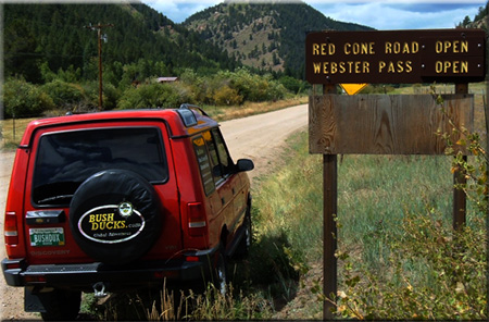
| Red Cone |
White River/Dillon
Pike/South Platte |
970-468-5400
303-275-5610 |
Open |
8/31/08 |
COMMENTS:
8/30/08 - Open, dry and a total hooot...
7/27/08 - Trail is open all the way. No snow.
7/13/08 - Trail is still closed at the gate.
6/14/08 - Still closed, according to the sign at Hwy 60 & 285.
5/8/08 - Still closed, according to the sign.
|
| |
| Red Canyon Park |
Canyon City |
|
Open |
6/1/08 |
COMMENTS:
6/1/08 - The OHV Park is open. They have made some changes to stop those who like
to tear across the cactus-filled terrain, but all of the trails are open and a
lot of fun. The main entrance to Red Canyon Park is from Red Canyon Road, Road No. 9,
leading from Canyon City to Cripple Creek. There are no 4x4 trails on the east side
of the seasonal gate. Once past the gate, the road gets a little bit rougher and you
will start to see the trails on the left and right sides of the roads. The trails in the area range
from 1 - 7, depending on the aftermarket products that are on your vehicle.
|
| |
| Rollins Pass - East Side |
Clear Creek |
303-567-3000 |
Partially open |
7/27/08 |
COMMENTS:
7/27/08 - Not open. Coming from Rollinsville, trail is blocked after entrance to Jenny Lake.
Blockage is snow across trail at a point beyond entrance to Jenny Lake.
(You can get around next right-hand bend and through cut, but not to next left-hand bend.)
7/7/08 - Trail is open all the way to Yankee Doodle Lake, completely snow packed
past the lake. Trail is in decent condition all the way to Yankee Doodle Lake.
6/20/08 - Trail is not open all the way. Trail is rough and rocky. No
maintenance and no snow removal. We got as far as 1/4 mile past the Spruce Wye
where we were stopped at the next rock cut due to snow. We parked and hiked
the rest of the way to Yankee Doodle Lake. We crossed over two large avalanche
areas across the road and the rest of the route from Yankee Doodle Lake is
covered in huge snow and ice falls. I would be very surprised if access to
Yankee Doodle happens prior to August. I would think that driving to the
Needle's Eye Tunnel parking area may not happen at all this year without
professional road maintenance work.
6/16/08 - The Rollins Pass road to Yankee Doodle Lake and Jenny Lake is
impassable.
|
| |
| Rollins Pass - West Side |
Clear Creek |
303-567-3000 |
|
|
COMMENTS:
|
| |
| Red and White Mountain |
White River/Holy Cross |
970-827-5715 |
|
|
COMMENTS:
|
| |
| Saint John |
White River/Dillon |
970-468-5400 |
Open |
7/30/08 |
COMMENTS:
7/30/08 - Open all the way.
7/6/08 - Trail was open from Montezuma up to close to the intersection with
North Fork of the Swan where snow blocked further travel. Had to return to
Montezuma.Trail was in good condition up to the snow block.
|
| |
| Schofield Pass |
White River/Sop`hris District |
970-963-2266 |
Open |
9/20/08 |
COMMENTS:
9/20/08 - Traveled from Marble to Crested Butte. Met a lot of traffic from Marble
to Crystal Mill area. Road was in great condition even after rain had passed
through. No problems with the Jeep Wrangler X Unlimited. The trail from Devil's
Punchbowl was a little slick, but had a spotter walk in front. The wet rocks wanted
to bring us close to the edge a few times, but taking it slow and cautious,
we had no problems. Trail condition was in good shape, just a little wet because of the rain.
9/7/08 - Traveled from Marble to Crested Butte. We contacted the Forest
Service Station on Friday, and they said the road was still closed. We also saw
a sign on the highway into Marble reading that Scofield Pass is closed! We drove
over Leadking Basin, backtracked to the Crystal mill, and then went over Scofield
Pass. There was absolutely no problems anywhere. In fact, the road is in the
best shape I have personally ever seen it in! The snow plugs are WAY off the
road, and virtually completely melted away. I don't understand why everyone
that should be in the know is saying it is closed? Have fun, it is definitely safe, and open....
8/21/08 - No problem traveling from Marble to Crested Butte in our Jeep Rubicon
Unlimited. The water crossing is not very deep above the Devil's Punchbowl.
8/9/08 - Traveled from Marble to Crested Butte. Trail is in great shape seemed much easier than last time.
8/5/08 - The local Forest Service office says Schofield Pass is still closed.
7/29/08 - While in Crystal we ran into several groups of 4 wheelers from
Crested Butte. They had just come over Schofield and said the snowbridge
was fine but there is a new rock slide close to it. They weren't clear
which side but said it was ok for them however it may be hard for a jeep.
7/25/08 - The Slate and Gothic Roads are open all the way with lots of water crossings
at the top end of Schofield Pass. I did not attempt Schofield to Crystal.
7/10/08 - This trail is open all the way to the town of Crystal. Several groups
traversed this trail besides me. The river is on part of the trail in one small
area but not deep and easily traversed. The bridge at the first descent of this
trail looks newly repaired and very stable. I heard but did not see that
Schofield Pass proper is blocked by a high snowfield.
7/6/08 - From the Crested Butte side, Slate and Gothic roads are blocked by huge
snow drifts about 2 miles from Schofield Pass. Impassable even on a motorcycle.
|
| |
| Scotch Creek |
Uncompahgre/Ouray |
970-240-5300 |
Open |
7/16/08 |
COMMENTS:
7/16/08 - Open.
5/21/08 - Closed.
|
| |
| Sevenmile |
Roosevelt National Forest |
970-498-1100 |
Partially open |
3/16/08 |
COMMENTS:
3/16/08 - Open but impassable half way due to deep drifts.
|
| |
| Shrine Pass |
White River/Sopris District |
970-963-2266 |
Closed |
6/20/08 |
COMMENTS:
6/20/08 - Closed up from Red Cliff probably due to creek over the road.
6/10/08 - Trail is closed. Seasonal forest service gate is locked 1 mile up Shrine Pass Road from the Red Cliff side.
|
| |
| Slaughterhouse Gulch |
Pike/Fairplay |
719-836-2031 |
Open all year |
5/3/08 |
COMMENTS:
5/3/08 - The trail is open all the way.This past Monday I and a friend ran the whole trail.
I was in a stock '08 Wrangler and my friend was in a '01 Pathfinder. There is some snow in the
shady parts, but most of the trail is free and dry. But the gate into Harris Park area was closed.
4/21/08 - Several people have reported that this and other trails in the Harris Park area are temporarily closed due to wet conditions, with the gates locked.
3/15/08 - The trail is open but probably not even worth trying to go through it.
About eight inches of snow at the bottom on the 4WD loop. I personally didn't even make it to the turn for Slaughterhouse (WAY TO RISKY). Make sure if you attempt to make the run, you have other cars with you and you will probably want/need a winch!
1/5/08 - Though they aren't posted, the mud pits at Slaughterhouse are closed and should not be driven in. Someone tore down the signs.
Completely open all year.
|
| |
| Spring Creek |
Pike |
|
|
|
COMMENTS:
|
| |
| Spring Creek Pass |
Clear Creek |
303-567-3000 |
Open |
7/13/06 |
COMMENTS:
7/13/08 - The trail is open all the way. No snow at all.
6/6/06 - Coming from the bottom my dad and I made it just past the rock garden
then there was too much snow. Quite a bit of snow throughout the rock garden
made it very challenging due to tire slippage even on the bypasses. Completely
dry until you get to the rock garden.
|
| |
| Stony Pass |
Uncompahgre/Ouray |
970-240-5300 |
Open |
7/16/08 |
COMMENTS:
7/26/08 - Trail is open all the way. Trail is clear and dry all the way, creek
crossing normal water only 20 inches.
7/16/08 - Take care crossing Pole Creek. It's deep and swift.
7/11/08 - The trail is open all the way, and in good condition. After the summit
from Silverton there is a stream crossing a few miles ahead that is pretty deep
and swift. This is approx 47 miles from the Creede side. Our Jeep (3.5" lift
and 35" tires) was up to the front bumper, so don't plan on an easy crossing
with an ATV or Rhino.
5/21/08 - Closed.
|
| |
| Swan and Wise Trail, middle fork |
White River/Dillon |
970-468-5400 |
Open |
7/30/08 |
COMMENTS:
7/30/08 - Both are open all the way.
7/13/08 - North Fork is open all the way to the top and clear off all snow.
Haven't taken Middle Fork yet, but via Deer Creek or St John's can get all
the way from Breckenridge to Montezuma.
|
| |
| Taylor Pass |
Gunnison/Gunnison |
970-641-0471 |
Open |
8/3/08 |
COMMENTS:
8/3/08 - Open all the way through. Took Taylor from the South to the North. We
where in a Toyota FJ Cruiser with skids and a 3" lift. There is not problems
with snow. The trail is rocky as always. The exit up from the creek is a little
more challenging than normal but is doable with not body damage problems. I needed
the rear locker for this section. I pulled the trailer through with out any difficulty.
The section from the Creek to the Lake is rocky and ruff. I recommend only for vehicles with a lift and skids.
8/2/08 - Trail is open at the top - no snow on the road. We went from north to south,
but had to backtrack at the point where the road enters the stream on the south
side of the route. At that point, the stream entry is partially blocked by two
very large rocks - not passable for a vehicle larger than a Jeep Wrangler,
unless vehicle damage is OK! From top south to this point is very rough -
worse than in the past.
7/16/08 - From the Aspen side, you can now make it to the top of Taylor Pass.
However, a huge snowdrift is blocking passage towards the Taylor River Road side.
Some dirt bikes were noticed driving off trail on the tundra to bypass the
snow. Please stay on the trail!!!
7/9/08 - From the Aspen side I am now able to get to the last switchback
(within .5 miles from the top). I dug through one snowdrift. However, there were
two larger ones still blocking this last switchback. Once on the top of the pass
there is a HUGE snowdrift, which won't melt naturally until August. I guess I
need to do more shovelin'!
7/4/08 - Made it above Taylor Lake coming up from south but deep snow drift
blocks road right up near the summit. Trail up from south rocky and rough as
expected. Creek was running over foot deep and fast down middle of road for
longer than usual, probably 200 yards or more
6/18/08 - Coming from the Aspen side (via Express Creek Road), the trail is
impassable due to snow after about 3.5 miles. I removed some avalanche debris
at 3.5 miles from the snow to encourage melting and clear the trail. The last
switchback is in sight at this point, and is completely covered in snow. It
will be sometime (after 4th of July) before this pass opens!
5/23/08 - Open on the Ashcroft side but only for about 1/2 mile. Deep
but passable patches of snow in shade. Trail is blocked by snow
at first water crossing.
|
| |
| Tincup Pass |
San Isabel/Salida |
719-539-3591
|
Open |
9/10/08 |
COMMENTS:
9/10/08 - Backhoe completely blocking trail about 500 yards up from the St.Elmo
(east)side. Appeared to be digging down 12 to 18 inches. Only signage was "Road Work."
8/24/08 - As previously stated, the trail is open all the way on both sides. Trail is very
rocky and rough; slow going all the way but passable. There is a LARGE mud hole (more hole than mud)
on the east side below the summit that stretches across almost the entire trail. It must be
over three feet deep and about three feet wide. I chose to go around it
although I had to scrape brush to do it.
8/3/08 - Open both way. I went to the summit on eastern side and back down,
however, folks were coming up from the west as well. Could be my imagination,
but the trail on the eastern side seems to be much rockier (bigger rocks) than in years past.
8/1/08 - On the St. Elmo Side there is still a small snowfield at the top
(approx 50 yards from the top) Area is marked with a warning sign. Approximately
8 feet of travel space. Came over from Taylor Lake side. Was able to drive Land
Rover LR3 with about a foot to spare.
7/29/08 - Was on motorcycles and made it all the way. Narrow road because of snow drift
at top. Was half blocked there by a jeep from Kansas which was about to tumble
off the hill. Another jeep made it through after one hour of shoveling.
7/28/08 - Looks like it may open by next weekend. There is still a large
snowdrift near the top on the St Elmo side, but it is almost possible to get through it.
Road still has barricades just below this point. Owner of the the ST Elmo store
says it should open real soon. People at the top who came over from Tincup
said road is good on that side.
7/18/08 - The forest service has closed the road on the St. Elmo side about 1/8 mile from the top.
The St. Elmo side is blocked by a snow drift about 100 feet long and 10 feet
high. Other than that, the trail is open and dry (though a bit rough).
7/5/08 - Open to top of pass coming up from the west but blocked on east side
by very deep snow drift near summit. Could be a while before that is clear.
6/22/08 - Closed 4 miles from St. Elmo, 2 miles from the top.
5/8/08 - Socked in by snow less than half a mile past St Elmo on the east side.
Will be a while for this one.
|
| |
| Tomichi Pass |
Gunnison/Gunnison |
970-641-0471 |
Open |
9/25/08 |
COMMENTS:
9/25/08 - Open all the way now. The muddy area on the north side has been repaired
with rocks and the trail is open all the way. The mud bogs on both sides of the pass
had damage from ATV's-PLEASE STAY ON THE TRAIL!
8/21/08 - Trail is closed. Traffic barricades on the North end. Can see big
orange diamond shaped signs up on the shelf road. Forest Service may be
repairing the bog area or a slide further up. No other information.
7/27/08 - As you know, the trail is open. I really wanted to say how disgusted
I was at the damage that is being done by the ATV's in the wet meadows. These
idiots are going to ruin it for everyone. If I see them doing it I will do my
best to turn them in. The wooden bridge installed by MHJC at the bottom is in
need of repair, yet still passable. The ATV's have destroyed this area as well.
7/19/08 - The trail is open all the way. The narrow shelf road has some tippy
spots and a snowdrift that makes the road even narrower, but most SUVs can
make it up to the pass. The log "bridge" across the muddy area is very rough
and slippery. There are very few areas wide enough to pass above timberline,
so wait until the road is clear before ascending/descending (especially on the Alpine Tunnel side).
6/29/08 - From the Alpine Tunnel Road to Hancock Pass the Trail is closed almost
imediately after you get onto Tomichi Pass Trail. The snow is still draped over
the trail as far up as we could see.
6/28/08 - South side blocked by impassable drifts starting at about 11,500 ft.
Above the town of Tomichi, the road is often wet, with occasional flowing water.
Recent vehicle (ATV?) damage to meadow at 11,500 ft, where the impassable
drifts started that day.
|
| |
| Treasure Mountain Loop |
Uncompahgre/Ouray |
970-240-5300 |
Open |
7/16/08 |
COMMENTS:
7/16/08 - Open!
5/25/08 - Closed.
|
| |
| Twin Cone |
Pike, South Platte |
719-836-2031 |
6/28/08 |
Open |
COMMENTS:
6/28/08 - Talked to a friend who made it all the way w/o any snow obstacles at all.
6/27/08 - Dry all the way to the top.
5/26/08 - The gate was opened this weekend after being closed for work on the
mud hole. The trail is passable to the top of the first big hill. The trail is
blocked by many feet of snow at the top of the first big hill. My guess is
it will take a month of good weather to melt it off. It was snowing while
we were up there.
5/25/08 - A large drift blocks the trail just above the loose hill climb.
From the looks of it, there's a lot of snow up top. Will be some time before
it's completely open to the top. Some snow drifts within the pine trees
that have been driven through and pose no problems for most vehicles.
As expected, muddy conditions up in the rocky section.
|
| |
| Uncompahgre Plateau Area |
|
|
|
|
COMMENTS:
|
| |
| Wager Gulch |
Uncompahgre/Ouray
BLM/Gunnison |
970-240-5300
970-641-0471 |
Open |
7/25/08 |
COMMENTS:
|
7/25/08 - Open all the way to the top; easily passable to the lower town of
Carson and a little rougher on up and over to Old Carson. Fairly rough for the first
mile or so; trail has been freshly bladed out around rock/dirt slides; 2 creek
crossings running about 8-10 inches deep each; Really enjoyable drive!
| |
| Wearyman Creek (FS747) |
White River/Sopris District |
970-963-2266 |
Open |
8/30/08 |
COMMENTS:
8/30/08 - Trail is open and passable from Shrine Pass Road turnoff up to Ptarmigan Pass.
Stream crossing running, but not too deep. Some minor washouts, but drivable with a bit of
vehicle clearance. Road is extremely narrow, one vehicle only in some spots. A good
ride, up or down.
|
| |
| Webster Pass/Handcart Gulch |
White River/Dillon
Pike/South Platte |
970-468-5400
303-275-5610 |
Open for ATVs |
8/8/08 |
COMMENTS:
8/13/08 - Open all the way to top from Montezuma side. Washout 200 yards down from
top on Webster side forced us to back 3 Jeeps back up to top. 4-Wheelers did come
to top from Webster side while we were there. It will take SOME work to repair the washout.
8/8/08 - Open all the way for ATVs. Not sure if jeeps could make it past washed out
section near top of pass.Also small amount of snow near top.
7/29/08 - No. Snow blocked at top. May be closed for a while due to the road washing out near the top.
7/20/08 - Still closed went up on the 285 side and the saddle is still filled
with snow give it another 2 weeks maybe less and it will be open all the way.
6/17/08 - Drove up from the Montezuma Road direction. The Forest Service closure
gate located about .6 miles from Montezuma Road is still closed. Most of
these roads were dry except for some seasonal water runoff.
5/27/08 - The trail will be closed for sometime to come. Most of the trails in the Summit
oounty area don't open all of the way until the 4th July weekend, due to the mass
amount of people who converge onto the county that weekend the NFS has to open
access to the trails to allow people to camp and explore the area. It wasn't until
August of last year that we were able to cross over from Webster Pass to the Handcart side.
The trail is blocked by quite a bit of snow right now but it is melting fast. So
with any luck from our changing environment we will be able to cross over to both
sides of the pass by the middle of July.
5/8/08 - Still closed, according to the sign.
3/16/08 - From the 285 side, there are signs that say the road is closed! Once you come to the Y, left goes to campgrounds/picnic area and right goes to Webster Pass and Georgetown. Left, there is at least one and a half feet of snow that you can see a truck was stuck in as well as car tracks that were able to stay above the snow and not sink in to it. Right, there is a unknown amount of snow but it is truely impossible to pass in a truck.
|
| |
| Weston Pass |
Pike/Fairplay
San Isabel/Leadville |
719-836-2031
719-486-0749 |
Open |
6/21/08 |
COMMENTS:
6/21/08 - Weston Pass is now open end to end, there are no snowdrifts or obstacles
on the trail anymore. Most of the side trails are clear as well.
6/16/08 - Can get about 4.5 miles past the National Forest boundary where the
road is blocked be deep snow. This is on the Leadville side of the pass.
6/8/08 - East (Fairplay) side is open to the top of the pass. Snow drifts still on the
west side within a 1/4th of a mile from the top. East side is in pretty good
shape. Don't drive too fast as some were doing yesterday! There are some pot
holes and small rocks every now and then. Plus people hiking and fishing on
and along road.
6/8/08 - East side of pass and the summit is clear and dry. Ran into snowfield
1/4 mile west of the summit. We could not see the other side of the snowfield.
5/31/08 - Started from the Fairplay side and made it to the top of the pass.
Had to cross 2 small sections of snow(easy). Beyond the top of the pass it
is still blocked with heavy snow.
5/8/08 - From the east (Fairplay) side, we got to 2 miles beyond the Weston
Pass Campground, about 13 miles from Hwy 285. Solid snowpack across the road
at that point, and no one had tried to go through.
|
| |
| Wheeler Lake |
|
|
Open |
7/28/08 |
COMMENTS:
7/28/08 - Trail open all the way to the lake. No snow on the trail.No problems other than the normal obsticles.
|
| |
| Williams Pass |
San Isabel/Salida |
719-539-3591 |
Open |
8/10/08 |
COMMENTS:
8/10/08 - The trail is open. We came over from the St. Elmo side.
We had driving rain for most of the trip. Trail is rocky and wet. The bog near
the top is long and deep but passable. Please stay on the trail at the bog and don't
go around. This is another trail that we are fortunate to access but off-road
travel may jeopardize our access.
8/2/08 - The trail is open all the way. Mud pit is passable with some momentum.
|
| |
| Yankee Boy Basin |
Uncompahgre/Ouray
BLM/Gunnison |
970-240-5300
970-641-0471 |
Open |
7/20/08 |
COMMENTS:
7/22/08 - The trail is open almost all of the way but is blocked by a snow drift just short of the end of the road.
6/14/08 - Open to toilet - 4WD recommended by Atlas Mill/Sneffels Townsite/Governor Basin turnoff.
Trail is rocky/muddy past Atlas Mill but no probs w/4WD. Snow blocks travel to
Yankee Boy Mine past toilet. Lots of wildlife, Twin Falls and streams are high,
no wildflowers yet due to snow - some avalanche damage visible. Great water
cascades off the overhang.
6/10/08 - The trail is open to the public outdoor toilet. Still worth the
drive with huge walls of snow on each side. Twin Falls is beautiful with snow
all around. Muddy in some areas and water on the trail due to the large snowmelt.
5/23/08 0pen nearly to Twin Falls. Lots of snowbanks and water run off on the
trail.
4/23/08 - Trail is open and easily passable to at least the turn for Imogene Pass. There was a D9 out there working on the rest of the road.
|
| |
| Yankee Hill |
Clear Creek |
303-567-3000 |
Open for ATVs and bikes |
6/2/08 |
COMMENTS:
6/2/08 - The trail is open all of the way, Central City to Alice.
5/11/08 - Trail is still snowbound for four wheel vehicles. ATVs and
motorcycles can get to the top from the Central City side.
Snow was wet and ruts are deep. It should melt off soon. Snow is melting.
Conditions are snowy, wet and muddy. Care needs to be taken!
|
| |
|
|
|
|
 This is the page for the 2008 Colorado Pass page. we're already updating regularly. You can add to this page and
 As a guide, you can view the dates and information from the
 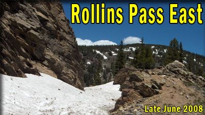 This
list is intended as a guide only and no responsibility is taken for any
incident arising from mis-information. The ultimate responsibility as
to whether the trail is safe to travel, within the capabilities of
yourself and your vehicle, or indeed open at all, is taken by YOU. If
in doubt, DO NOT TRAVEL. The inclusion of any trail on this page does
not mean it is open or legal to travel. Conditions change, and trail
status may change, sometimes without warning. Use common sense, and do
not go around closure barriers.
This
list is intended as a guide only and no responsibility is taken for any
incident arising from mis-information. The ultimate responsibility as
to whether the trail is safe to travel, within the capabilities of
yourself and your vehicle, or indeed open at all, is taken by YOU. If
in doubt, DO NOT TRAVEL. The inclusion of any trail on this page does
not mean it is open or legal to travel. Conditions change, and trail
status may change, sometimes without warning. Use common sense, and do
not go around closure barriers.