| TRAIL NAME |
NATIONAL FOREST NAME/DISTRICT |
PHONE NUMBER |
STATUS |
DATE UPD. |
| Argentine Pass/Waldorf Mine |
White River/Dillon |
970-468-5400 |
Partially open |
6/9/07 |
COMMENTS:
6/9/07 - Our trip started in Georgetown, and we were able to make it up
to the lower half of the Waldorf Mine. The river was running fast with
all the melting snow, and there were several groups of people trying to
dig through the snow drifts but it is still too early.
4/15/07 - My dad and I tried to ATV up to Waldorf yesterday but only
could made it about 2 miles from trail head due to huge snow drifts
covering the roads.
Lower road was cut off by snow drifts just before you get to the road
that
leads back up to upper road. Upper road was also unpassable due to 5 ft
snow drifts we did not want to drive over. Great for snowshoers, which
there was one who was leaving as we pulled up to unload.
|
| |
| Ballard Road |
Fort Collins Region |
|
|
|
COMMENTS:
|
| |
| Bangs Canyon |
BLM |
|
|
|
COMMENTS:
|
| |
| Bill Moore Lake |
Clear Creek |
303-567-3000 |
Open |
7/7/07 |
COMMENTS:
7/7/07 - The Trail is open all the way to the Lake. There is still snow at the end of the trail, but it does not cross the road.
6/10/07
- Tried from two different trails (West from inside the gate and East
up the switchbacks on the right). Got to within .9 miles of the lake at
11500 ft with ~5' of snow.
|
| |
| Birdseye Gulch |
Uncompahgre/Ouray |
970-240-5300 |
|
|
COMMENTS:
|
| |
| Black Bear Pass |
Uncompahgre/Ouray |
970-240-5300 |
Open |
9/26/07 |
COMMENTS:
9/26/07 - Officially closed now per San Miguel County.
8/7/07 - Open all the way between 550 and Telluride. Had the entire mountain to ourselves on Tuesday, August 7.
A terrific ride all the way. Four of us in a Rubicon rented from Riverside Inn in Ouray. This was my
sixth trip over Black Bear (first one was in 1968) and the best ever. Trail was in great shape, certainly made
easier by the Rubicon. A bit rough on that steep slope just above the old mine. Did some cutting and backing
on the first three switchbacks. VIEW PHOTOS FOR THIS DATE
8/4/07 - We traveled Black Bear Pass on the 4th and it was in good condition.
The steps seemed easier than last year because not as much loose rock.
The switchbacks seemed somewhat more intimidating than last year.
8/3/07 - According to
information on Web forums the County sent heavy equipment up to Black
Bear and it is now open. There is reference to through travel as of
July 17, 2007. Also video of the road/washouts being cleared.
8/2/07 - Reopened as of 8/2/07, according to the Forest Service!
7/24/07 - Black Bear experienced a substantial washout the night of 7/23/07 on the switchbacks between "The Steps"
above Ingram Falls and the lower switches to Bridal Veil Falls. We had a group of five Suzuki DR's travel to the top of
the pass from Hwy 550 (no problems) and on to the switchbacks at the Telluride side. This is an East-to-West only trail.
We pushed through a couple of minor slides on the top switches only to be defeated by a 30-ft deep washout that cut
through the next three switches, which forced a retreat back up the steps (not advisable) and back to 550.
The bottom switches are open to Bridal Veil Falls from the Telluride side. It is very doubtful that the switchbacks
will be open this season. However, the East side of the trail is a great ride with a beautiful view at the top.
Definitely check ahead of time if you are planning to travel Black Bear.
Closed!...maybe for the season.
7/24/07 - Trail closed to all traffic. Multiple rock slides across the
switchbacks, including complete washout of the road in at least two
places as seen from the end of Telluride. Word from tour company is
that the road is most likely closed for the season. From personal
observation, I would agree.
7/13/07 - The trail is open all of the way. I was part of the FJ
Cruiser Summit, I run a heavily modded rig and Black Bear was a piece
of cake. The switchbacks were made in 1 move each with the exception of
one that took two. The only spot that is slightly nerve-wracking
(Unless you have a major fear of heights) is the section when you begin
descending by the falls. You have to ride up the wall a bit to line up,
as the road is very very narrow ahead and has a wash on the left side
near the edge. This portion is off camber as you ride up the wall but
the trail is in great condition, only one or two spots where I believe
a stock vehicle may need to be spotted and that would depend on driver
skill; Furthermore the scenery is unmatchable; definitely worth the
trip.
7/13/07 - Black Bear is open all the way to Telluride, Did the pass
today with a Group of FJ cruisers in my Rubicon Unlimited. Some of them
were fairly stock and did not have much of a problem.
7/4/07 - Still Closed. When I spoke with the Marshall in Telluride, he
told me it could be open by the 10th and would be open by the 14th.
7/2/07 - Still closed!
6/19/07 - No, definately closed! They will open Imogene Pass first, then begin plowing Black Bear. It is still blocked by snow
about a quarter of a mile in.
6/17/07 - Open, according to the Ouray road conditions report. Bushducks says: this seems amazingly early... Can anyone confirm
|
| |
| Blowout Pass |
Rio Grande/Divide |
719-657-3321 |
|
|
COMMENTS:
|
| |
| Bolam Pass |
Uncompahgre/Ouray |
970-240-5300 |
Open |
7/11/07 |
COMMENTS:
7/11/07 - Open, road conditions good. My book rated it "easy", some
places might be a little more difficult than "easy", but any stock SUV
should have not problem. A beautiful trail to get some experience on,
or just view the countryside. Nice shortcut from Highway 550 to
Telluride.
|
| |
| Boreas Pass |
White River/Dillon |
970-468-5400 |
Open |
6/17/07 |
COMMENTS:
6/17/07 - Open all the way. Road in good condition, traveled in SUV.
5/26/07
- Gate was still locked from the Breckenridge side. (Also went to
Cottonwood Pass this same trip, It's open, but there is still just a
lot of snow anywhere you go up high).
|
| |
| Breakneck and Browns Passes |
Pike/Fairplay |
719-836-2031 |
Open |
|
COMMENTS:
6/18/07 - Trail open all the way. Browns is very rough on the west side. West side water crossing is deep. Scenery is very nice
|
| |
| Bunce School Trail System |
Boulder |
303�541-2500 |
|
|
COMMENTS:
|
| |
| California Gulch |
Uncompahgre/Ouray |
970-240-5300 |
Open |
6/23/07 |
COMMENTS:
6/23/07 - Yes, open all the way. Plowed, clear, water from melted snow covers trail in some parts.
6/14/07 - Open according to Ouray road conditions report.
|
| |
| California Pass |
Uncompahgre/Ouray |
970-240-5300 |
Open |
6/27/07 |
COMMENTS:
6/27/07 - Open all the way. Pass itself is clear and dry. Shelf road is wet with walls of snow.
|
| |
| Carnage Canyon |
Boulder |
303�541-2500 |
Open all year |
|
COMMENTS:
Completely open all year.
|
| |
| Chinaman Gulch |
San Isabel/Salida |
719-539-3591 |
Open all year |
|
COMMENTS:
Completely open all year.
|
| |
| China Wall |
Pike/Fairplay |
719-836-2031 |
Open all year |
|
COMMENTS:
Completely open all year.
|
| |
| Cinammon Pass |
Uncompahgre/Ouray
BLM/Gunnison |
970-240-5300
970-641-0471 |
Open |
6/1/07 |
COMMENTS:
6/1/07 - Open all the way, 12 feet snow on top... Beautiful!
5/30/07
- Open in both directions and passable. It's narrow up top where plows
have carved passages through snow. Some running water on the Lake City
side, bone dry down to Silverton.
5/18/07 - Open all the way, although wet and muddy, with melting snow and high water levels. Good tires needed.
|
| |
| Coney Flats |
Boulder |
303�541-2500 |
6/1/07 |
Closed |
COMMENTS:
6/1/07 - Coney Flats was blocked by snow drifts.
|
| |
| Corkscrew Gulch |
Uncompahgre/Ouray
BLM/Gunnison |
970-240-5300
970-641-0471 |
Open |
6/23/07 |
COMMENTS:
6/23/07 - Open all the way. Absolutely perfect conditions.
6/10/07 - 6/10/07 - Supposedly this is open, according to the local Jeep rental company.
|
| |
| Cumberland Pass |
San Isabel/Salida |
719-539-3591
|
Partially open |
5/27/07 |
COMMENTS:
5/27/07 - On ATV's, left Pitkin. Was able to get 9.1 miles up from
Pitkin. Snow was first across the road at about 8 miles up (Bon Ton
Mine). For the most part we were able to stay on top of the snow. When
we turned around the snow was getting deeper and didn't want to press
our luck. Last year over Memorial Weekend we made it to within 100 yds
of the top.
|
| |
| Cunningham Gulch |
Uncompahgre/Ouray |
970-240-5300 |
Open |
7/2/07 |
COMMENTS:
7/2/07 - Open, according to the San Juan Forestry office.
|
| |
| Eagle Rock |
Teller County |
Near Colorado Springs |
Open |
6/23/07 |
COMMENTS:
6/23/07 - Open all the way. Ran it all the way to FS379. It was a little wet and muddy in spots. Ran FS379
all the way to the "Seven Lakes" road and back down to Gold Camp road.
6/20/07 - Headed up to Captain Jacks, Mount Baldy and turned around at rock slide area, came down to other
forest rode on the other side. Open all the way to there, I went across the river, but turned around so that's
as far as I made it. Dry and dusty.
6/11/07
- Actually, this has been snowed in for the last few months. Snow and
Ice have blocked the trail at about the 2/3 point around the last water
crossing. FSR 379 to Mt. Baldy is equally locked in. Maybe another 2-3
weeks of sun?
6/1/07 - Usually completely open all year.
|
| |
| Elwood Pass |
Rio Grande/Conejos
San Juan/Pagosa |
719-274-8971
970-264-2268 |
Partially open | 8/10/07 |
COMMENTS:
8/10/07 - The trail is open over the pass, but you can only go about 3-5 miles west-northwest along
the trail then you come to a wonderful road closed sign where the road is now a waterfall. This is passable for
four wheel ATVs and motorcycles, but my new Wrangler Unlimited could not cross. At least my wife would
not let me attempt this. The trail is washed out about 1/2-1 miles east of McCormick cabin as listed on USGS Topo maps.
Otherwise the trail was in good condition. Any water crossings were less than 12" deep.
7/8/07 - Open all the way. Clear and Dry. Great condition. Good dry
surface all the way. Low range required for steep sections. Water
crossings were maybe 15 inches at the deepest.
|
| |
| Engineer Pass |
Uncompahgre/Ouray
BLM/Gunnison |
970-240-5300
970-641-0471 |
Open |
7/8/07 |
COMMENTS:
7/8/07 - Took my stock '06 LR3
over the pass on a fine Sunday morning out of Ouray and the trail was
in great condition. It does "get down to business" as the book stated
in the first five miles but thereafter it was smooth sailing into Lake
City. The alpine tundra above tree line at the top was gorgeous. Still
had a substantial snowbank (12 feet) on one side of the road after the
summit on the descent towards Lake City but nothing impassable.
6/9/07 - The trail is open all the way and is in good condition. (Did
not travel the entire route due to time, but we verified with the
locals) There are a few rough sections and when nearing the summit
there is a a decent amount of muddy water, should be no issue for stock
vehicles.
6/3/07 - No..opened just 1/2 mile beyond Roses Cabin on Lake City side.
Snow pack and slippery there. One couple got there jeep stuck within
150 feet of getting through.
5/31/07 - Trail now open all the way. Muddy but passable with good tires.
5/17/07 - Open from Silverton to Mineral Point. Extremely slippery and muddy conditions. Spring melt!
|
| |
| Georgia Pass |
White River/Dillon |
970-468-5400 |
Open |
7/8/07 |
COMMENTS:
7/8/07 - The trail was open all the way. It was very easy from Jefferson up to the pass. However, from the pass to
Breckenridge was a little hairy in places. Not long after the pass, you come to an area of deep mud that has a sudden
drop of about 18". In my stock Jeep Liberty, there was no going back after that. Down was tough, but up would have
been impossible. After that spot, the rocks get tricky in a few spots, and I bottomed out twice. I am a novice,
though. There are several stream crossings, but none are more than a few inches deep.
7/7/07 - Completely open from Jefferson to Breckenridge. We started on
the Jefferson side after reports of snow on the trail but did not find
any snow throughout the trip. The only trick was the 40 feet of mud
about 5 minutes down trail 355 after the Georgia pass summit. The truth
here, is that the mud is not deep but the terrain ungulates working
against long wheel-based vehicles. We were traveling in an 2001 F-150
SuperCrew Off-Road edition and made it without much effort. There are a
ton of great campsites next to the stream approximately 20 minutes down
the pass. One thing to be aware of is two confusing intersections on
the trail. The first is a four-way intersection about 35 minutes over
the summit. Straight ahead is a camp site, to the left is a dead-end
site (rather rugged) and the path you want (into Breck) is on the
right. It can be confusing as there are two trails marked 355. Neither
suggests from or to Georgia pass. The next confusing part of the trail
is another four-way intersection with orange spray paint indicating
several paths (indicated on logs and large rocks: left, right, etc).
You want the path on the right which takes you down onto Tiger Road.
From here it's like a highway into Breck.
6/30/07 - Trail is open all the way. Trail opened completely. Gate was
closed due to snow, but Ranger opened seasonal gate July 1st, in the
morning.
6/23/07 - Georgia Pass from the Breck side was blocked by 2-3 foot snow
approx 1/4 mile beyond the seasonal closure gate. It appeared as if
some motorcycles had ridden on top of the snow but it is impassable for
vehicles at this time. Probably a couple more weeks (unless the heat
wave continues). |
| |
| Governor Basin |
Uncompahgre/Ouray |
970-240-5300
970 |
Open |
7/25/07 |
COMMENTS:
7/25/07 - Trail is now open all the way. We dug through the last 100 feet of snow drift at the top.
7/6/07 - Closed by snow 50 yards past the turnoff for Sydney Basin.
|
| |
| Grizzly Lake |
San Isabel/Salida |
719-539-3591
|
Open |
6/16/07 |
COMMENTS:
6/16/07 - Open all the way to the lake.
|
| |
| Gunsight Pass |
White River/Sophris District |
970-963-2266 |
Partially open |
7/1/07 |
COMMENTS:
7/1/07 - As of 1 July it was open to just above the Daisy Mine where
the road was blocked by a snow field approx 2 feet deep. The Slate
River crossing at the start of the trail was approx 30 inches deep.
|
| |
| Hancock Pass |
San Isabel/Salida |
719-539-3591 |
Open |
6/30/07 |
COMMENTS:
6/30/07 - Trail is open all the way. From the top, it looked like Tomichi Pass was still blocked by snow.
6/16/07 - Blocked by a 100+ yd drift at the shelf road just before the summit on the St Elmo side.
5/27/07
- Not open from Pitkin side. On ATV's we couldn't even get to the
turn-off from the Alpine Tunnel Rd. Got to within about 1/4 mile of the
turnoff.
|
| |
| Hagerman Pass |
San Isabel/Leadville
White River/Sophris |
719-486-0749
970-963-2266 |
Partially open |
7/1/07 |
COMMENTS:
7/1/07 - Open all the way from
Leadville to the top. I stopped at the top, but vehicles are getting
thru ok to Aspen on the west side. On the Leadville side, just a couple
of muddy spots, but easy to get thru.
6/23/07 - Not open all the way, I ran it from the Leadville side and
almost made it. There are two snow banks at 10,500 ft. blocking. They
seen to be melting fast and maybe another week and it will be clear.
|
| |
| Hayden Pass |
Rio Grande/Saguache
San Isabel/Salida |
719-655-2547
719-539-3591 |
Open |
7/8/07 |
COMMENTS:
7/8/07 - Good travel surface.
All was dry except for wet section on the shelf road but they posed no
challenge (were not frozen). The area has seen massive blowdowns but
the trail was well cleared. At times there were walls of fallen trees
on both sides. 4WD low required and good clearance, but a moderate to
easy trail.
5/27/07 - No. Major snow drifts cover the road for 1 mile short of pass
on west side. Some amount of snow drifts on east side (unknown
amount/location). Some large boulders on west side. Will be tight but
can probably be driven around if careful.
|
| |
| Holy Cross City |
San Isabel/Leadville
White River/Sophris |
719-486-0749
970-963-2266 |
Open |
7/3/2007 |
COMMENTS:
7/3/07 - French Creek crossing
has gotten worse. The large rock above the crossing with a winch point
in it has been dragged down to the middle of the problem, above the
first climb. A large rock on the left side above the problem has been
moved closer to the center of the road. With 35" tires it was a real
hassle to get past the rocks. A group camped out there said I was the
only one to make it in 2 days. No rig with 33" tires made it. There
will be a lot of carnage there if at least one of the rocks aren't
moved! If you can make the crossing, you can go all the way.
5/1/07 - From Gold Park (HW 24 south) there is a sign for Holy Cross
City and a 20-25 degree incline straight away. Sign shows 3.8 miles, we
got as far as about 1.8 miles. We hiked some, but snow was 2-3 feet
high (10,000+ ft high). I imagine June/July might be a great time to go
all the way! Tried the alternate route from Homestake Reservior, a
trail leads to Missouri Lakes, go right instead, followed this one 2.5
miles, same issue, came to an impassable pond and 4-5 feet of snow.
Looks interesting though!!
|
| |
| Hurricane Pass |
Uncompahgre/Ouray |
970-240-5300 |
Open |
6/28/07 |
COMMENTS:
6/28/07 - Open all the way. A little wet at the top but trail is good condition.
6/10/07 - Supposedly this is open, according to the local Jeep rental company.
|
| |
| Imogene Pass |
Uncompahgre/Ouray |
970-240-5300 |
Open |
9/26/07 |
COMMENTS:
9/26/07 - Officially closed now per San Miguel County.
9/5/07 - Open in great condition. Went from Telluride to Ouray in a 2007 Rubicon from Farabee Jeep Rentals.
Highest water crossing was no more than 14". We encountered steady rain in the basins on both sides of the
summit where the rockiest sections are, but it did not cause any problems on the trail. No sign of the
leaves changing yet.
8/7/07Went west to east, Telluride to Ouray, in a Rubicon. No snow, no slides, no problems whatsoever.
No view from the top this day, as we were in a cloud with 50-foot visibility - certainly added to the adventure!
Took some water in the jeep on the first two stream crossings on the way down. Spent quite a while at Tomboy
(mine and ghost town) before reaching the top - highly recommended spot for lunch and rock hounding.
7/11/07 - Open but very rough
compared to previous trips. Water is high at fords, covers a 31" tire.
The Ouray side is rougher than the Telluride side. I would not
recommend this trail without high clearance, no mid-size or smaller
SUVs or SUVs with running boards. In the past this trail was moderate,
but now I'd say closer to difficult; not for the inexperienced. From
July 10th "The Ouray County Watch" newspaper. An elderly couple was
flown to St. Mary's Hospital after an ATV rollover near the top of
Imogene pass July 5th 2007. This trail is not to be take lightly. There
were 6 calls to the Mountain Rescue Team last year, one a fatality from
a Jeep incident.
7/7/07 - The trail is still pretty muddy on the Ouray County side due
to the snow melting. We drove the entire pass in our stock Jeep Grand
Cherokee. I wouldn't recommend this if you are afraid of hitting the
bottom a couple of times. A higher clearance vehicle would be better.
Near the summit there is an amazing 20-25 foot wall of snow.
7/4/07 - Open all the way. Lots of people out on the 4th. Good Condition.
7/3/07 - Crews finished opening about noon 7/3. Went all the way over,
Ouray to Telluride about 3:00 PM. As much as 15-20' snow cliffs in
places. Road in average condition this year. Traffic moderate for now.
7/2/07 -Still closed at present.
6/26/07 - Just talked to the Forrest Service and they are actively
plowing it. Barring problems, it may be open by the weekend. Black Bear
it the next trail on their list.
6/19/07 - Still closed. Not sure if they have started plowing yet.
|
| |
| Iron Chest |
San Isabel/Salida |
719-539-3591
|
Open |
6/27/07 |
COMMENTS:
6/27/07 - There were no snow drifts blocking this trail on 6-27-07. The only major snow drift, on this trail,
is directly in front of you when you take the switchback to the left. You don't have to drive through it. Ran it all
the way to the mine. A little wet with a few patches of snow after you get past the rock garden.
6/16/07 - Blocked by a drift 0.3 miles from the mine.
|
| |
| Italian Creek Road/Upper Reno Divide |
Gunnison/Gunnison |
970-641-0471 |
|
|
COMMENTS:
|
| |
| Jones Pass |
Clear Creek |
303-567-3000 |
Open |
9/4/07 |
COMMENTS:
9/4/07 - Trail is open all the way over the top; no snow. There is a lot of road grading & construction below.
Hiked to Vasquez Peak, saw 3 gorgeous goats.Road does require 4WD.
7/24/07 - Snow is still blocking the very top of the pass.
7/21/07 - The very top of the pass is still covered with a thick cornice of snow. The rest of the road is in great shape.
7/10/07 - The very top is still blocked by a snow cornice. There were
herds of Mountain Goats crossing over the cornice and the ridge along
the pass! |
| |
| Kebler Pass |
|
|
Open |
5/21/07 |
COMMENTS:
5/21/07 - I drove to the Lost Lake trail from Crested Butte side, and
it was clear and dry. Quite sure it was open below (west of) Lost Lake.
Pass open and dry, Lake Irwin and Lost Lake spurs still snowed over as
of May 21.
|
| |
| Kelly Flats |
Canyon Lakes |
970-498-2770 |
|
|
COMMENTS:
|
| |
| Kendall Peak and Kendall Mountain |
Uncompahgre/Ouray |
970-240-5300 |
|
|
COMMENTS:
|
| |
| Kennebec Pass |
Uncompahgre/Ouray |
970-240-5300 |
Open |
6/23/07 |
COMMENTS:
6/23/07 - Trail open and in good condition to the top. Some meltwater is still coming down the road.
|
| |
| Kingston Peak |
Clear Creek |
303-567-3000 |
Open |
6/24/07 |
COMMENTS:
6/24/07 - Wide open!
|
| |
| Lamartine/Saxon Mountain |
Clear Creek |
303-567-3000 |
Open |
6/24/07 |
COMMENTS:
6/24/07 - The trail is open
all the way, no snow on the trail. Just a bit in between the trees near
the top. There has been a rock slide that has caused a boulder to rest
on the cliff side of the trail, there is an off camber drive around but
it's no big deal.
6/5/07 - The trail is open from Georgetown to 10900. Can't get to the
Lamartine Road. Many rocks have fallen on the road. One rock has a
drive around, but it is very "Tippy". Got stuck in snow at about 5
miles from Georgetown. Road is very rough.
|
| |
| Lead King Basin |
White River/Sophris District |
970-963-2266 |
|
|
COMMENTS:
|
| |
| Left Hand Canyon |
Boulder |
303�541-2500 |
|
|
COMMENTS:
|
| |
| McAllistair Gulch |
White River/Holy Cross |
970-827-5715 |
Open |
7/8/07 |
COMMENTS:
7/8/07 - Open all the way.
Traveled the entire McAllistair Gulch - Ptarmigan Pass loop -- trails
open all the way. Trails in very good shape. Near the Shrine Pass
entry, Wearyman creek is still running heavy, and parts of the lower
trail are mini-creeks, but all crossings are 18" deep or less. Trail
very dusty up top, but no traction issues. No snow anywhere near
trails. Abundant wildflowers in full bloom throughout!
7/4/07 - Trail is open all the way. It was very dusty on the 4th. We
did the Camp Hale McAllister Gulch Ptarmigan Pass Camp Hale loop. So
didn't do Wearyman creek. However, the start of Ptarmigan on the north
still left 2 creek crossings. No issues. Trail seems rougher than I
remember, but still no problem even for stock 4wd.
7/1/07 - Traveled from Shrine pass to Camp Hale. Open all the way.
Overall, trail was in excellent shape. Wearyman Creek crossings were
18"-24". Creek had overflowed banks and was flowing down trail for a
brief stretch. Further up the trail was dry and very dusty. One small
patch of snow off to the side near the top that was melting onto the
trail, forming a few small puddles. No other snow or mud encountered.
Descent to Camp Hale was very dusty and traction on steepest half mile
near top was at times mildly difficult.
|
| |
| Medano Pass |
Rio Grande/Saguache
San Isabel/San Carlos |
719-655-2547
719-269-8500 |
Open |
5/27/07 |
COMMENTS:
5/27/07 - The trail is
completely open into the Sand Dunes. The trail is muddy in spots.
Several mud bogs have developed because of heavy traffic over the
weekend, otherwise the trail is in good condition.
|
| |
| Middle St. Vrain |
Boulder |
303�541-2500 |
Open |
6/17/07 |
COMMENTS:
6/17/07 - Trail is open so is Coney Flats. River crossing is about 20".
6/1/07
- Jeep gate closed (in back of Camp Dick), not sure if trail is
officially open. Trail is clear all the way back where it turns to
wilderness and stops. Trail going to Coney Flats was blocked by snow
drifts. Lots of water flowing on trail and three large water crossings,
all passable. |
| |
| Mill Creek/Red Elephant Trail |
Clear Creek |
303-567-3000 |
|
|
COMMENTS:
|
| |
| Moody Hill |
Canyon Lakes |
970-295-6700 |
|
|
COMMENTS:
|
| |
| Mosquito Pass |
Pike/South Park
San Isabel/Leadville |
719-836-2031
719-486-0749 |
Open |
8/15/07 |
COMMENTS:
8/15/07 - We made it with F150 and Jeep. This was a Justrun group. This area had and was raining heavy from 3:00PM to 5:00PM. W
e also had snow at 12200 feet. We cross an unnamed pond which was overflowing across the trail. The water depth
was around 30 to 32 inches., also had problems going up and down with the wet rocks. Moved a few to the side.
The old explore mine holes had about 2 to 3 feet of water in them. Good times, and good test of your skills.;br:
7/22/07 - Trail is open all the way and in good condition.
7/19/07 - Trail still closed by snow.
7/15/07 - Traveled from the Leadville side. This is a challenging 4WD
only road. Can get about a mile down on the other (Fairplay) side until
you hit a snow patch where vehicles were abandoned and stuck. DO NOT
plan on going all the way through.
7/15/07 - Still blocked by the snowbanks. You'd think they would be
melted by now. We went up from the Fairplay side. Trail seemed
unusually rough for a 4. This is my first time up there.
7/6/07 - We went through to Leadville from Fairplay on motorcycles. No
problem for us, but a 20 foot snow bank that we went right over. Could
be a different story in a vehicle.
7/6/07 - Good shape from the Leadville side to the top.At least 2 large
snowbanks across the road have it blocked on the Fairplay side. We
walked down about a mile on the Fairplay side from the top to the
second snowbank. There were 2 vehicles abandoned by this site and both
were in danger of rolling off the side of a cliff. They were straddling
the road and the slope of the cliff. Don't have any idea how they got
there, or better yet, how they will get out without going over the
side. People do some stupid things!
6/29/07 - From the Alma/Fairplay side, the water crossing just before
the start of the pass is indeed washed out again. Hard core 4wheelers
will scoff at it, but it will stop those less inclined to potential
body damage, that's me! Did not actually get to the Mosquito Pass road
as I stopped at the water crossing. Otherwise the county road was good
to that point.
7/1/07 - Open all the way on the Leadville side to the top. Still
several large snowdrifts near the top on the Fairplay side. Will be at
least 2 weeks until that is open to Fairplay.
6/10/07 - From Fairplay Side Open to just below upper mine. Still a
little snow up to just below mine. Soft on the shoulder be careful,
Jeep rolled off side on Sunday 6/10/2007 Culvert washed out at creek
below top Beaver Dam but still passable. |
| |
| Mount Antero |
San Isabel/Salida |
719-539-3591
|
Partially open |
7/3/06 |
COMMENTS:
7/3/06 - Open all the way to the top.
6/25/07 - Got up to +/- 13,000 ft. Had a switchback to the right and one to the left to get to the top
but was blocked by a 4-5 foot snowdrift. Hikers coming down said that was the only drift to the summit
but I am not sure I trust the word of people who won't use an internal combustion engine to gain that kind of altitude!
6/16/06 - Blocked by a drift at the last switchback before the longer
shelf road section to the saddle where the Antero and Browns Lake
trails split. |
|
|
| Mount Baldy/Captain Jacks |
Pike National Forest/ El Paso County |
719-836-2031 |
|
|
COMMENTS:
|
|
|
| Mount Blanca/Como Lakes |
Rio Grande/Saguache
San Isabel/San Carlos |
719-655-2547
719-269-8500 |
Open |
6/28/07 |
COMMENTS:
6/28/07 - It's open all the way for vehicles capable of passing Jaws
1-4. Several people parked at the end of the road. The rough stuff
begins with big rocks well before the "Mt. Blanca" sign. Most stock
vehicles should not go more than 2.0 miles past this sign. Jaws 1
appears at 5.8 miles.
|
|
|
| Ohio Pass |
Gunnison |
970-641-0471 |
|
|
COMMENTS:
|
| |
| Ophir Pass |
Uncompahgre/Ouray |
970-240-5300 |
Open |
9/26/07 |
COMMENTS:
9/26/07 - Officially closed now per San Miguel County.
6/13/07 - The trail is open all the way, started in Ophir and came out on the Highway 550 side.
Trail conditions very good. There are several areas of small waterfalls to drive over, but none of them were very deep.
5/17/07 - A dump of snow closed this again. Current condition uncertain.
4/29/07
- Not open all the way. Traveled from Red Mountain Pass (550) side.
Trail was plowed almost the entire way to the top of the pass.
Bulldozer parked about .5 miles from top of pass on the east side where
road is blocked by snow. Probably two more weeks before road is open
all the way. Trail in very good condition. A little muddy in spots due
to snow melt, but overall easy and in good shape.
|
| |
| Owl Creek Pass |
Uncompahgre/Ouray
BLM/Gunnison |
970-240-5300
970-641-0471 |
Open |
6/14/07 |
COMMENTS:
6/14/07 - Open according to Ouray road conditions report
|
| |
| Pearl Pass |
Gunnison/Gunnison |
970-641-0471 |
Open |
8/4/07 |
COMMENTS:
8/4/07 - Open all the way. travled Aspen side to Crestted Butte.
comments: Castle Creek about 10" deep at first crossing. At start of first
serious switch backs at tree line, erosion has washed a lot of road away
leaving bare rock where trail became water course. Had one spot there which
took several tries to get by, other than that no problem. We have stock 2007
Wrangler X without axle lock, which would be helpful.
7/29/07 - Pearl completely open, and sufficient snow melt to clear the entire roadway on Aspen side. It's a little
rougher than previous years due to erosion on both sides, but not at all impassable for a stock 4wd with good tires.
Kudos to Blue Mesa club for repairs, especially at the rock/water obstacle on the Aspen side!
7/25/07 - Open. Traveled from Aspen to Crested Butte. Trail is in good shape. The big obstacle on the Aspen side
has gotten worse in the 4 years since I've done the trail. Took me 4 attempts with my 3" lift CJ7 with 31"
MTR tires. Could be problematic for stock vehicles. Rest of the trail was rough (as usual) but passable.
6/30/07
- I traveled out of Aspen west south west-there is a ridge of snow on
the shelf section that is likely gone by now, but at the top of the
pass are 2 or 3 snow drifts I would estimate at around 8' or better.
Trail was in decent shape and water crossing is about 12"- roughly 1
mile up the Pearl Pass turnoff after leaving the Castle Creek Road.
|
| |
| Pomeroy Lake |
Rio Grande/Saguache
San Isabel/Salida |
719-655-2547
719-539-3591 |
|
|
COMMENTS:
|
|
|
| Poughkeepsie Gulch |
Uncompahgre/Ouray |
970-240-5300 |
Open |
7/9/07 |
COMMENTS:
7/9/07 - Trail is open all the
way. Traveled up the trail from Engineer Pass, and it's clean and clear
all the way past the "big obstacle". A couple of patches of snow above
that near lake Como, but passable in a locked up jeep. Absolutely
beautiful.
6/28/07 - Not open at top. I did not travel this but from California
and Hurricane you can see it is still covered with snow around Lake
Como and a ways down.
6/17/07 - Did not travel this, but according to the Ouray Chamber of Commerce, the trail is open.
|
|
|
| Ptarmigan Pass |
White River/Holy Cross |
970-827-5715 |
Open |
7/8/07 |
COMMENTS:
7/8/07 - Open all the way. Traveled the entire McAllistair Gulch -
Ptarmigan Pass loop -- trails open all the way. Trails in very good
shape. Near the Shrine Pass entry, Wearyman creek is still running
heavy, and parts of the lower trail are mini-creeks, but all crossings
are 18" deep or less. Trail very dusty up top, but no traction issues.
No snow anywhere near trails. Abundant wildflowers in full bloom
throughout!
7/4/07 - Trail is open all the way. It was very dusty on the 4th. We
did the Camp Hale McAllister Gulch Ptarmigan Pass Camp Hale loop. So
didn't do Wearyman creek. However, the start of Ptarmigan on the north
still left 2 creek crossings. No issues. Trail seems rougher than I
remember, but still no problem even for stock 4wd.
|
| |
| Radical Hill |
White River/Dillon
Pike/South Platte |
970-468-5400
303-275-5610 |
Open |
8/4/07 |
COMMENTS:
8/4/07 - Red Cone and Radical Hill are open all the way. One of the 4x4 groups was doing some work on Radical Hill to remove some debris and rocks from the upper part of the trail that had migrated due to the snow and rain.
|
| |
| Rampart Range |
Pike/Fairplay |
719-836-2031 |
Closed |
12/2/07 |
COMMENTS:
12/2/07 - The trail is officially closed. If coming from 67 the beginning (about 1/4 mile) is open but then there is a huge gate denying any one to enter or exit in that case. I read a story that when they closed it a family got stuck behind the gate!!!
|
| |
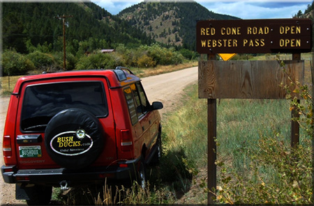
| Red Cone |
White River/Dillon
Pike/South Platte |
970-468-5400
303-275-5610 |
Open |
7/29/07 |
COMMENTS:
8/4/07 - Red Cone and Radical Hill are open all the way. One of the 4x4 groups was doing some work on Radical Hill to remove some debris and rocks from the upper part of the trail that had migrated due to the snow and rain.
7/29/07 - Drove from Hwy 285 over to Montezuma. Almost went up Radical Hill but the old
lady was getting tired. Webster looked as if we could have opened it with 15 minutes
of shoveling.
7/3/07 - I did not travel the trail, but the sign says it is still closed.
A lot of snow in the saddle where it meets Webster Pass.
6/9/07
- Still closed at the gate. Talked to members of Mile Hi 4x4 who had
been up on the road they said there was a "bunch of snow" probably 3
more weeks before it can be opened. Also lots of downed trees this
year.
|
| |
| Rollins Pass - East Side |
Clear Creek |
303-567-3000 |
Partially open |
7/1/07 |
COMMENTS:
7/1/07 - Trail is blocked by snow at the top edge of Yankee Doodle Lake. Bikes and ATVs can get past, but not SUVs.
|
| |
| Rollins Pass - West Side |
Clear Creek |
303-567-3000 |
Open |
6/28/07 |
COMMENTS:
6/28/07 - Trail is open all the way to the pass. Road is in good condition all the way to the parking lot at the top.
|
| |
| Red and White Mountain |
White River/Holy Cross |
970-827-5715 |
|
|
COMMENTS:
|
| |
| Schofield Pass |
White River/Sophris District |
970-963-2266 |
Open |
9/1/07 |
COMMENTS:
9/1/07 - Drove through all the way in a stock 93 ford explorer, no problem. Probably 20 people told
us you couldn't drive through it. So we walked up until we could turn around and drove up to there and
just worked our way through it. I think Pearl Pass was more difficult but they said we couldn't get though
that either but we did. Dry, creek crossing were about 6 inches deep. Good road just a long way to the bottom.
7/2/07 - Drove Schofield Pass
from Crested Butte to the bottom of the Devil's Punchbowl and the Iron
Bridge. Road was clear and in good shape. River crossing before the
descent was approx 18 inches deep. According to others on the trail it
was open to Marble but you had to cross through the river as opposed to
over the bridge above the Crystal Mill.
|
| |
| Scotch Creek |
Uncompahgre/Ouray |
970-240-5300 |
Partially open |
7/2/07 |
COMMENTS:
7/2/07 - Open to the top on the Rico side.
|
| |
| Shrine Pass |
White River/Sophris District |
970-963-2266 |
Open |
6/21/07 |
COMMENTS:
6/21/07 - Open all the way from Vail Pass to Red Cliff. No problems, surface dry, no obstacles.
|
| |
| Slaughterhouse Gulch |
Pike/Fairplay |
719-836-2031 |
Open all year |
1/5/08 |
COMMENTS:
1/5/08 - Though they aren't posted, the mud pits at Slaughterhouse are closed and should not be driven in. Someone tore down the signs.
12/7/07 - The trail is open! I went around the entire loop of SlaughterHouse Gulch with about 5 inches of snow on the ground. In wintery conditions I highly recommend that no one enter this trail unless with another vehicle and/or a winch!! The mud pits were frozen but if there is a warm day up there and if that snow melts it is gonna be a blast!
Completely open all year.
|
| |
| Spring Creek |
Pike |
|
|
|
COMMENTS:
|
| |
| Spring Creek Pass |
Clear Creek |
303-567-3000 |
Open |
7/4/07 |
COMMENTS:
7/4/07 - Trail is open all the
way, all the snow is melted at the top.
The last switchback prior to the Rock Garden section is washed out, The
corner is sharp with very large rocks. Lockers or winch are required.
6/16/07 - Open all the way. 5ft. snow drift at the top blocking the road to Lamartine if you want to go back down that way.
|
| |
| Stony Pass |
Uncompahgre/Ouray |
970-240-5300 |
Open |
8/12/07 |
COMMENTS:
8/12/07 - The trail is open all the way. Some parts dusty, but wild flowers are in bloom.
7/2/07 - Still closed.
|
| |
| Swan and Wise Trail, middle fork |
White River/Dillon |
970-468-5400 |
|
|
COMMENTS:
|
| |
| Taylor Pass |
Gunnison/Gunnison |
970-641-0471 |
Open |
7/1/07 |
COMMENTS:
7/1/07 - Open all the way. Normal conditions.
|
| |
| Tincup Pass |
San Isabel/Salida |
719-539-3591
|
Open |
7/7/07 |
COMMENTS:
7/7/07 - Went over the top from St Elmo to Tincup in a FJ80. Trail is a bit narrow where the snowfield is but passable.
7/5/07 - People were digging out the shelf road. Should be open now.
7/3/07 - The same snow bank is blocking the east side of the pass.
Unless it gets dug out it may well be a couple of weeks before it
melts. This is the same area that a Rubicon slid off on the ice last
year.
6/28/07 - Still blocked at same point as June 16, 2007 report.
6/16/07 - Blocked at the shelf road at the summit by a 100+ yd drift on the East side
|
| |
| Tomichi Pass |
Gunnison/Gunnison |
970-641-0471 |
8/17/07 |
Open |
COMMENTS:
8/17/07 - Open all the way! The boggy area on the north side of the pass is wet and requires remaining on the plank bridge.
Traveled the pass from Tomichi town site to the Alpine Tunnel. No obstacles on the north, narrow side of the pass.
7/31/07 - Trail is open all the way. Condition normal.
6/30/07 - When viewed from Hancock Pass, it looked like this was still closed.
|
| |
| Treasure Mountain Loop |
Uncompahgre/Ouray |
970-240-5300 |
Closed |
7/2/07 |
COMMENTS:
7/2/07 - Still closed.
|
| |
| Twin Cone |
Pike, South Platte |
719-836-2031 |
2/1/08 |
Closed |
COMMENTS:
2/1/08 - The trail is closed until spring as the mud hole in the road has returned. The gate is locked.
|
| |
| Uncompahgre Plateau Area |
|
|
|
|
COMMENTS:
|
| |
| Wager Gulch |
Uncompahgre/Ouray
BLM/Gunnison |
970-240-5300
970-641-0471 |
Open |
7/11/07 |
COMMENTS:
7/11/07 - Trail is dry and well maintained to Carson City (Bachelor
Mine). While the divide separating "Old" and "New" Carson City is wet
the road surface is solid and safe for 4x4 travel. Although the loop is
not mentioned in most trail books, this trip from Cinnamon Pass road to
South Clear Creek Falls is very scenic and well worth the trip! |
| |
| Wearyman Creek (FS747) |
White River/Sophris District |
970-963-2266 |
Open |
7/21/07 |
COMMENTS:
7/21/07 - From Shrine Pass road, we headed up FS747. Trail was open all
the way to Ptarmigan. Took FS702 down through Camp Hale Some minor
washouts, and a bit muddy going at times due to Friday night rainstorm.
We drove modified Jeep Ruby with lift, and had no problem. Only
encountered two dirt bikes, and a few ATV's from the Camp Hale side. |
| |
| Webster Pass/Handcart Gulch |
White River/Dillon
Pike/South Platte |
970-468-5400
303-275-5610 |
Partially open |
8/12/07 |
COMMENTS:
8/12/07 - Webster is open from both sides. Shelf road on 285 side narrow as always, but roadbed is solid with minimal winter fill on inside track.
Very little evidence of snow at the saddle.
7/15/07 - Webster Pass is still closed. The top 100 feet of the Grant
side is still under 10+ feet of snow. I was able to climb/walk to the
top. The Montezuma side looks clear.
7/3/07 - Open to within 80 or so yards of the top. Blocked by 20'- 40'
deep snow along those 80 yards. Still will be a few weeks even with the
record high temps. There was snow at the 1st switchback, but I was able
to drive over the top of it. That should be gone fairly soon.
6/17/07 - From the 285 side you can get all of the way to where the
switchbacks start up the pass. Looking up to the pass it'll be weeks
before it's clear of snow. Trail seems no worse from wear from years
past. The creek crossing is significant. Probably 100 yds of the road
is covered by the creek.
6/9/07 - From 285 Can get just about to the shelf about 3 miles. Guys from Mile Hi 4x4 working the snow banks when I was there.
Trail is good the top of the shelf does not look like it will be passable anytime soon.
|
| |
| Weston Pass |
Pike/Fairplay
San Isabel/Leadville |
719-836-2031
719-486-0749 |
Open all the way |
11/5/07 |
COMMENTS:
11/5/07 - Road was dry and open all the way. Lakes were frozen, but there was no snow on the ground. Should it snow, this road would not be passable.
6/25/07 - Open all the way.
|
| |
| Wheeler Lake |
|
|
Open |
7/14/07 |
COMMENTS:
7/14/07 - Open all the way. No snow on the trail. Bowling ball hill is wet and slick.
6/21/07 - 95% open. There is still a large snow field after the trail
levels out past bowling ball hill The snow is covering the last 100
feet or so of the trail before you reach the lake. The rest of the
trail is clear all the way to this point.
6/10/07 - Trail not open all the way to top, deep sheet of snow about a
mile or 2 from top of trail. Lots of water on trail from snow melt,
makes some of the rock obstacles difficult due to wet tires.
|
| |
| Williams Pass |
San Isabel/Salida |
719-539-3591 |
Open |
6/30/07 |
COMMENTS:
7/28/07 - an off road trail
association had just open it, a few days before the traditional August
1st,maybe because 8/1/2007 falls in the middle of the week.
Rough on the Pitkin side, the trail consist of rock falls, the creek
run through it with a lot of boulders, on the top you will find a nice
mud hole. On the Hancock side you have a nice 4wd road
|
| |
| Yankee Boy Basin |
Uncompahgre/Ouray
BLM/Gunnison |
970-240-5300
970-641-0471 |
Open |
7/12/07 |
COMMENTS:
7/12/07 - Yankee Boy is open
all of the way. The trail conditions are normal, the flowers are
beginning to bloom heavily, and around the last week of July should be
absolutely amazing (Not that they aren't now!)
7/6/07 - Open almost all the way to the top. Still closed as mentioned previously. Maybe a couple more days.
7/3/07 - Open almost all the way to lake at top end of trail. Road
rough. About 30" deep snow bank covering about 50' of road near top. No
one has gone through this yet, but plenty of sun on this spot.
Shouldn't be long now.
6/27/07 - Not open to top. Seasonal gate is open but you cannot get far beyond it.
Snow blocks trail about half a mile beyond gate (maybe less) No safe place to turn around.
6/21/07 - The trail is open all the way. The trail is in good shape and we had no problems in a stock Grand Cherokee.
6/10/07 - 6/10/07 - Supposedly this is open, according to the local Jeep rental company.
|
| |
| Yankee Hill |
Clear Creek |
303-567-3000 |
Open |
6/26/07 |
COMMENTS:
6/26/07 - Open all the way and across the ridge, also all other trails in the area are open.
5/26/07 - The road is open on the East side until you get to 10,600
feet. After this point the trail is wet, and muddy. A couple of guys on
trail bikes told me it is not open all the way to Alice. Probably too
much snow. I parked and did some hiking.
|
| |
|
|
|
|
 This is the page for the 2007 Colorado Pass page. we're already updating regularly. You can add to this page and
 As a guide, you can view the dates and information from the
 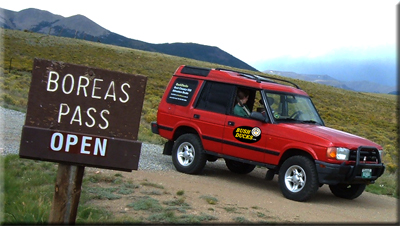 This
list is intended as a guide only and no responsibility is taken for any
incident arising from mis-information. The ultimate responsibility as
to whether the trail is safe to travel, within the capabilities of
yourself and your vehicle, or indeed open at all, is taken by YOU. If
in doubt, DO NOT TRAVEL. The inclusion of any trail on this page does
not mean it is open or legal to travel. Conditions change, and trail
status may change, sometimes without warning. Use common sense, and do
not go around closure barriers.
This
list is intended as a guide only and no responsibility is taken for any
incident arising from mis-information. The ultimate responsibility as
to whether the trail is safe to travel, within the capabilities of
yourself and your vehicle, or indeed open at all, is taken by YOU. If
in doubt, DO NOT TRAVEL. The inclusion of any trail on this page does
not mean it is open or legal to travel. Conditions change, and trail
status may change, sometimes without warning. Use common sense, and do
not go around closure barriers.