| TRAIL NAME |
NATIONAL FOREST NAME/DISTRICT |
PHONE NUMBER |
STATUS |
DATE UPD. |
| Alta Lakes Road |
Uncompahgre/Ouray |
970-240-5300 |
Open |
7/1/11 |
COMMENTS:
7/1/11 - Open and clear all the way
|
| |
| Animas Forks |
Uncompahgre/Ouray |
970-240-5300 |
Partially Closed |
10/15/11 |
COMMENTS:
10/15/11 - Closed to through traffic according to the Forest Service. Some sections still drivable.
6/4/11 - Easily traveled in a stock SUV.
4/16/11 - Trail has been plowed 3 times from Eureka to Animas Forks, but blowing snow has covered it each time.
It is said to be passable, but chains and winches are recommended. Give it another week or 2.Ok up to first big turn into the canyon, but then 12-16 inches of blown snow cover large portions of the road.
|
| |
Argentine Pass/Waldorf Mine
EGuide |
White River/Dillon |
970-468-5400 |
Open |
8/7/11 |
COMMENTS:
8/7/11 - The trail is open all the way. The last switchback gets uglier each year. Still able to pass without too much effort on the left side though. Water running on a good portion of the trail, but at negligible depth. Very busy today!
7/30/11 - As stated before. There is a drift on Argentine above the Waldorf mine. Some have skirted the drift on the low side illegally and this is deteriorating the edge of the existing road bed.
7/24/11 - Trail is blocked by a large snow drift about 1.5 miles above Waldorf. This will take at least another week to melt out.
7/3/11 - We made it up Argentine as far as Waldorf. Snow drifts prohibit you from making it to the top. I would be surprised if it's open to the top by the end of July.
|
| |
| Alpine Tunnel |
San Isabel/Salida |
719-539-3591 |
Open |
6/28/11 |
COMMENTS:
6/28/11 - The trail is open all the way. The owner of the Silver Plume, general store in Pitkin, cleared the road with his tractor. He donated his equipment, time, and fuel to open the road. If you get to Pitkin stop at the store and thank Matt.
6/22/11 - At Williams cabin a snow slide crossed the road. The snow is 5 feet deep and 70 feet across. A few ATVs have crossed the slide. Past the slide 4 large rocks are on the road. Past that there is some snow on the side of the road, but it could be driven in 4 wheel drive.
5/30/11 - Blocked by snow between mid way water tank and tunnel gulch water tank. 4 miles from turn off of Quartz Creek road.
|
| |
| Ballard Road |
Fort Collins Region |
|
|
|
COMMENTS:
|
| |
| Bangs Canyon |
BLM |
|
|
|
COMMENTS:
|
| |
| Bill Moore Lake |
Clear Creek |
303-567-3000 |
Open |
7/16/11 |
COMMENTS:
7/16/11 - Open all the way. Wet up high. The snow that remains is easily passable by a stock SUV. There was some
mud up top from the melting snow that could present a challenge without decent tires.
7/16/11 - Yes 4WD road is open to the lake. After busting through one snow drift we made it to the lake. Mosquitoes were relentless. Lots of water.
7/12/11 - 4WD road not open all the way. You can travel to within approximately 1 mile of the lake. Still closed by snow drifts.
4WD road is rutted in spots due to the rains every day for the last week. Large snow drift still blocks access to the
lake. You can get to about 1 mile of the end of the 4WD road.
7/8/11 - The trail is still inaccessible about 1 mile from the top because of large snow drifts.
6/26/11 - Bill Moore is wide open to Mill Creek/ Red Elephant. Larger drifts will block you as you head up to the lake.
6/4/11 - Trail is passable for 2.5 miles from the parking lot/staging area. This is about 300 yards past the
second turn off for Mill Creek. Few drifts that were passable by 31'' tires. The trail is stopped by 4'-5'
of continuous snow.
5/8/11 - Main trails is clear for about 300 yards past the rock garden chute until the switch back.
4' or 5' drift at the switchback. Couldn't break through. Rock garden is still buried in deep snow about 40 yards up.
|
| |
| Birdseye Gulch |
Uncompahgre/Ouray |
970-240-5300 |
Open |
8/21/11 |
COMMENTS:
8/21/11 - The mudbog area of the trail has been worked on a filled - no problems here. Made the entire trail in stock jeep wrangler. Still rough in parts below what was the mudbog.
7/3/11 - trail open all the way small patch of snow blocks half the road half mile from the top. Road is mostly dry up top lower part has water running down road. Patches of snow close to the top most have been broken through one needs some more work.
|
| |
| Black Bear Pass |
Uncompahgre/Ouray |
970-327-4835 |
Partially Closed |
10/15/11 |
COMMENTS:
10/15/11 - Closed to through traffic according to the Forest Service. Some sections still drivable.
9/25/11 - Open all the way, just a little snow near the top. Should be good until the next storm comes through.
9/15/11 - Trail open all the way. 3 inches snow on summit with packed snow on talus field leading off summit to west. Steps were dry.
7/31/11 - Trail is open all the way. Additionally, construction on a water supply line is underway causing nightly closures on Black Bear. Signs posted at the Highway 550 trail head and at the beginning of the descent from the pass state that the trail "will be closed to traffic nightly from 9:00pm to 10:00am. Construction equipment was noted on the sides of the trail below the end of the one way.
7/28/11 - Trail now open all the way, apparently for several days now, and in good shape. Some moisture on trail in many places from snow drifts but no problem. A fair amount of traffic already... word gets out fast.
7/26/11 - Rode Black Bear Pass today all the way on a motorcycle. First time to ever ride Black Bear
but trail seemed in good shape except it was extremely wet and slick on the steps from the rain.
Today was the first day open.
7/24/11 - From the East side, you can get to the summit.
From the West (Telluride) side, you can get to the 'One Way - Wrong Direction - Turn Around Here' spot.
We were there for the FJ Summit this past weekend, and were told by the authorities in San Miguel county that it was closed due to too much snow pack and that they were still working on plowing it.
However, some from our group went there to do the parts that were open, and met up with people on foot on both sides that had just come through, and were told that it is completely open, all the way through, except for some construction happening on the Telluride side (which could be seen in-person by driving there).
The last rumor we heard before leaving Ouray on Sunday was that it will be open sometime this week; possibly Tuesday.
7/3/11 - Snow drifts encountered about 1/2 mile up from Hwy 550
|
| |
| Blowout Pass |
Rio Grande/Divide |
|
|
|
COMMENTS:
|
| |
| Bolam Pass |
Uncompahgre/Ouray |
970-240-5300 |
Partially Closed |
10/15/11 |
COMMENTS:
10/15/11 - Closed to through traffic according to the Forest Service. Some sections still drivable.
7/3/11 - Came over from Hwy.145 from Rico. Went clear to top. Very little snow still on road. Very rocky. Road in bad shape but passable.
6/27/11 - Snow drifts near Hermosa Peak appx 2-3 feet deep prevent Jeeps from crossing.
|
| |
| Boreas Pass |
White River/Dillon |
970-468-5400 |
Open |
7/5/11 |
COMMENTS:
7/5/11- Open all the way, getting busy, no snow or problems.
6/26/11 - The trail is open all the way, very dry. Some of the side trails on Boreas Pass on the Breckenridge side were also open but wet and muddy.
6/26/11 - Open all the way, gates are open per Forest Service.
6/16/11 - Gate still closed on Come side.
Forest Service would not let us borrow a key to see how much snow there was, even though I offered a Snickers bar as bribe.
6/1/11 - Partially open on Summit county side. Not yet open through Park county due to snow. Partially open from Breck according to forest service.
|
| |
| Breakneck and Browns Passes |
Pike/Fairplay |
719-836-2031 |
Open |
9/26/11 |
COMMENTS:
9/26/11 - Trail is open all the way.This trail is only rated as a 3, and states tight clearance between trees
on FR 426 but is passable. DO NOT take this way unless you don't mind body damage. Space between some trees
aren't passable in small 4WD vehicles like my stock Liberty. Some alt routes are available around some
trees but you will come into contact with trees and branches! Don't know how bad FR 175 is but it's
shorter and probably not as tough as FR 426. There were a few small mud puddles here and there but cause
no trouble. Aspens in full gold!
7/5/11 - Open going from Breakneck to the summit of Brown.
Did not continue down Brown to the CR658/20 entrance but it should also be clear of snow, just some mud bogs down low.
Some runoff flowing across trail through Sheep Creek valley just before turnup to Brown Pass summit. Also, did the full loop starting on the Brown Pass side over to the Breakneck Pass side and it's completely clear with just one or two small puddles down low.
Video of upper Sheep Creek and Brown pass ascent.
|
| |
| Bunce School Trail System |
Boulder |
303�541-2500 |
Open |
6/11/11 |
COMMENTS:
|
| |
| California Gulch |
Uncompahgre/Ouray |
970-240-5300 |
Open |
7/31/11 |
COMMENTS:
7/31/11 - Open all the way. Trail is dry and in good condition. Sutable for most stock SUVs.
7/12/11 - Open all the way. The road in quite muddy and rough, but passable. I would advise against a vehicle without high clearance.
6/18/11 - Snow across trail 1000 feet north past Animas Forks. Impassible by stock or mildly lifted 4x4s. Approx. 3 feet thick slush/snow for 35 feet. Melting fast though.
6/4/11 - Closed. Impassable.
|
| |
| California Pass |
Uncompahgre/Ouray |
970-240-5300 |
Closed |
10/15/11 |
COMMENTS:
10/15/11 - Closed.
8/7/11 - NO! They have closed off the trail for construction equipment and was told by the workers it is closed for a month.
7/31/11 - Open all the way. Trail is dry and in good condition. Suitable for most stock SUVs.
7/12/11 - Open all the way. The pass s very muddy near the top, but not a problem if you are careful.
7/3/11 - We traveled today from Animas Forks through California Pass then through Hurricane Pass back down to Silverton through Gladstone.
Open all the way through from Animas Forks to Hurricane pass. Easily doable in a high clearance 4x4.
|
| |
| Caribou Creek |
Boulder |
303�541-2500 |
Open |
7/16/11 |
COMMENTS:
7/16/11 - Trail is open all the way. Both Gates are open at the Caribou town site.
Trail is passable, no more snow drifts. Mud, Water crossing frequent along with the creek crossing.
7/8/11 - The trail is closed. there is a sign stating it will be closed for 2011.
6/27/11 - Both Gates at Caribou townsite Closed to Eldora and to Rainbow Lakes.
6/9/11 - Closed at both gates
|
| |
| Carnage Canyon |
San Isabel/Salida |
719-539-3591 |
Open all year |
5/18/11 |
COMMENTS:
5/18/11 - Completely dry.
Completely open all year.
|
| |
| Chihuahua Gulch |
White River/Dillon |
970-468-5400 |
Open |
7/2/11 |
COMMENTS:
7/2/11 - Was not passable earlier today but we cleared the way to the top. Open all the way.
The trail was in very good condition, some large rocks but not a problem at all. There were a couple creek crossings that got pretty deep. at the first creek crossing coming back down the trail there seems to be a large hole in the water and if your going too fast through the water you could possibly submerge your engine and maybe hydrolock it. There were 3 different jeeps today that it happened to. Other then that a great trail and in great condition.
|
| |
| Chinaman Gulch |
San Isabel/Salida |
719-539-3591 |
Open all year |
|
COMMENTS:
Completely open all year.
|
| |
| China Wall |
Pike/Fairplay |
719-836-2031 |
Open all year |
|
COMMENTS:
Completely open all year.
|
| |
| Chinns Lake |
Clear Creek |
303-567-3000 |
Open |
7/30/11 |
COMMENTS:
7/30/11 - Open all the way to both Fall River Reservoir and Chinns Lake. The road is now completely open again after the washout closure. Much of the culvert is still exposed, but it looks like there's been a little backfilling and it's passable, if a little narrower in that spot. The road up to Chinns Lake is now completely snow-free and open. It's mostly dry all the way to the top where it gets a bit wet. Since this is the flat part of the trail, it won't cause any traction problems. Overall, the trail was more washed out than the last time we were on it, but it is easily passable by a stock SUV (I saw a Geo Tracker at the top).
7/20/11 - Update on Fall River Road to Chinns Lake. The washout occurred sometime before 7/13/2011.
The washout is located at a culvert on Fall River Road coordinates are: N39.809566 W105.664426 .
7/16/11 - Fall River Road is closed totally before you even get to the Chinns Lake fork. The entire road is washed out, who knows when they will have it reopened.
7/12/11 - Trail washed out from heavy rains the night of July 11 and now impassable 1.6 miles into the trail from Fall River Road. Local road official who was at the scene didn't know how soon repairs would be made.
7/3/11 - Open all the way to Fall River Reservoir (the remaining snow has been dug/plowed through). Chinns lake is open until a wide switchback about 1/2 mile from the end.
The trail all the way to Fall River Reservoir is mostly dry. The trail up to Chinns Lake is very wet and blocked by very
deep snow about 1/2 mile from the lake at a large switchback where it is easy to park or turn around. I'm not sure
when the road is going to open this year as the remaining snow is over 6 feet deep in many places and heavily packed
(it was easy to walk on top of without post-holing).
6/25/11 - Trail is open and dry almost to the parking lot of the reservoir. There is a big (8 to 10 foot) snow drift just before the parking lot. A couple guys with shovels could get through in about an hour or so.
The trail to Chinns Lake looked snowed in still, but the road to the reservoir was dry up to about 100 yards from the parking lot.
|
| |
| Cinammon Pass |
Uncompahgre/Ouray
BLM/Gunnison |
970-240-5300
970-641-0471 |
Partially Closed |
10/15/11 |
COMMENTS:
10/15/11 - Closed to through traffic according to the Forest Service. Some sections still drivable.
6/17/11 - Trail is open all the through to Lake City. A lot of water still on some parts of the roadway. Switchbacks on the east side have water flowing all the way down, but it isn't bad.
6/4/11 - A little wet in spots but you can drive from Silverton to Lake City in a stock SUV.
5/28/11 - Not open,they are still plowing and are about a mile from the top from the Lake City side.
5/20/11 - Plowed through but snow since may have closed it again.
|
| |
| Coney Flats |
Boulder |
303-541-2500 |
Open |
7/9/11 |
COMMENTS:
7/9/11 - 4WD road is open. Gates are unlocked at Beaver Reservoir and at the Middle St. Vrain trail head.
4WD road is still wet. Mud holes are full.
6/17/11 - A rumor about these trails opening on June 25 prompted me to check with the Boulder Ranger District,
and here is their response... "We have no set date to open Middle St Vrain or Coney Flats because road openings at this time of year are completely dependent on road bed condition. There is significant water and snow on these roads. Trailridge Runners 4WD Club will be assisting us in checking these roads on June 18. However, from reports I have received, it is unlikely the road condition will warrant opening at this time.
|
| |
| Corkscrew Gulch |
Uncompahgre/Ouray
BLM/Gunnison |
970-240-5300
970-641-0471 |
Partially Closed |
10/15/11 |
COMMENTS:
10/15/11 - Closed to through traffic according to the Forest Service. Some sections still drivable.
9/15/11 - No. Can travel to switchbacks from the 550 side. Trail was wet with snow from Forest Service bathrooms on
up. Second switchback from top had about 3-4 inches of snow on trail
and tires were not digging through to traction.
8/3/11 - The road has been scraped and lightly maintained on the East side, very easy ascent.
The West side maintance has been done on the upper switchbacks, very soft loose dirt in the switchbacks.
Still a bit muddy in the switchback from the recent rains. Lower West side has had a lot of washout
sections that run next to the road, with some work done on the road. Some of the washouts have come up on the road
in places, in minor ways, making some muddy spots. The Lowerest section of the road that cuts above a few mines
was slick from the rain, but still easily doable.
7/12/11 - Open all the way. Trail is in good condition. A few muddy spots. No real problems.
6/22/11 - trail is open all the way and in good shape.
|
| |
| Cottonwood Pass |
San Isabel/Salida |
719-539-3591
|
Open |
7/1/11 |
COMMENTS:
7/1/11- Road clear all the way to reservoir.
6/4/11 - CDOT indicates that it is open and was officially updated today.
6/4/11 - Cottonwood Pass opened this morning, June 4th. Occasional closures should be expected when adverse
conditions exist, according to Colorado D.O.T. Still a LOT of snow on the sides of the road.
6/3/11 - Cottonwood Pass is NOT open, yet (per the Colorado State Patrol).
5/27/11 - Open all of the way. No problems at all mostly dry.
|
| |
| Cumberland Gulch |
Clear Creek |
303-567-3000 |
Open |
7/3/11 |
COMMENTS:
7/3/11 - Every trail in the area (Yankee Hill, Miner's Gulch, Cumberland Gulch) is completely dry.
|
| |
| Cumberland Pass |
San Isabel/Salida |
719-539-3591
|
Open |
10/15/11 |
COMMENTS:
10/15/11 - Open all the way. Snow packed and slippery near the top on both sides.
6/28/11 - The trail is open all the way.
6/28/11 - Two wheelers and 4 wheelers getting through. Snow on North side of Pass stopping Jeeps.
6/23/11 - From the Tincup side of the pass snow blocking the trail about 1/4 to 1/2 mile from the top.
6/10/11 - Closed. From Pitkin the road is clear of snow for 5.5 miles.
|
| |
| Cunningham Gulch |
Uncompahgre/Ouray |
970-240-5300 |
Open |
10/15/11 |
COMMENTS:
10/15/11 - Still open.
|
| |
| Deer Creek |
White River/Dillon |
970-468-5400 |
Open |
7/24/11 |
COMMENTS:
7/24/11 - Gate is open, trail open all the way to the top.
7/12/11 - Still closed.
7/2/11 - Closed/gated. Reports of snow still deep at tree line but unable to see as the gate is still up.
|
| |
| Eagle Rock |
Teller County |
Near Colorado Springs |
Open |
11/12/11 |
COMMENTS:
11/12/11 - Trail is passable all the way through, with Mt. Baldy as the return route.
All but one of the bypasses are impossible due to steep snow.
6/5/11 - 100% open. Dry. Water crossing at start was 12"-16" deep.
4/16/11 - Open all the way. Some snow and ice, but very doable.
|
| |
| Elwood Pass |
Rio Grande/Conejos
San Juan/Pagosa |
719-274-8971
970-264-2268 |
|
|
COMMENTS:
|
| |
| Engineer Pass |
Uncompahgre/Ouray
BLM/Gunnison |
970-240-5300
970-641-0471 |
Partially Closed |
10/15/11 |
COMMENTS:
10/15/11 - Closed to through traffic according to the Forest Service. Some sections still drivable.
10/4/11 - It was "open" on 9-23 but my Jeep made the first tracks. It used to be an easy run; it made Poukeepsie look like a walk in the park.
I got out of my Jeep at least four times to see what the heck. The weather, quads and dual-sports have wiped out the dirt; three foot drops between shelf and dirt. It took me almost 3 hours from 550 to the look-out.
About half-way up I saw some local dual-sport guys who asked me what I was doing up there...lol.
I reported the trail condition to two Jeep rental/tour companies and they said it was crazy to go up there...doable if you have a capable rig and can think. I did it solo....not recommended.
The dirt on the lower side has been eroded; if you can't fit on the shelf, stay away.
9/28/11 - Trail is open all the way over the top, from either Ouray or Animas Forks, and clear all the way down to Lake City.
From Animas Forks to top of Engineer Pass the road was in the best condition I've ever seen in many years of driving it. Likewise, it was also very good from the top of the pass all the way down to Lake City. But it is the end of September and bad weather is coming this weekend.
The lower part of Engineer Pass coming up from Ouray however is reported to be in very bad condition after having been flooded and heavily washed out earlier in 2010. I was going to take lower Engineer down to Hwy.550 but was warned not to by a man who had gotten so badly stuck in the "bomb craters" that he had to have an AAA tow truck come over from Silverton to get him out. He was driving a Jeep Cherokee.
9/24/11 - Open all the way, no snow on the road. Aspen are peaking now!
6/18/11 - Clear from Silverton, Eureka, Animas Forks all the way to the top. Did not continue to Lake City to complete the Alpine Loop, but noticed the trail was bull-dozed clear (30+ feet tall snow at top) and traffic (stock vehicles) coming from Lake City about a vehicle every 15 minutes.
Trail is muddy in short sections. Mostly light water streams flowing over the trail. Had to back up twice to allow traffic to pass since snow ensures only one vehicle at time in most sections.
6/12/11 - Closed - Snow covered. The bulldozers start at Siverton. They plowed 2.5 miles past Animas Forks. That gets you to the spot where the trail forks to highway 550 or on to Engineer Pass. They didn't plow further on either fork but they've been working on it. One week ago you couldn't get much past Animas Forks. My guess is that one week from now you will be able to make it to Engineer Pass but no further. That's the county line and San Juan county is better about plowing than Hinsdale county.
6/12/11 - Road is good from Lake City to Rose's Cabin and snow blocks the road but I checked with the forest service
and they said it should open on the 20th of this month.Also went across the shelf road from Animas Forks and it is
clear almost all the way to Engineer. Not much water on the engineer side yet,but we went over Cinnamon and water is pretty deep in some spots due to the snow runoff,but it is clear all the way to Silverton from Lake City.
|
| |
| Fourmile Travel Area |
San Isabel |
719-486-0749 |
Partially Open |
|
COMMENTS:
The majority of this region is open all year.
|
| |
| Geneva Creek |
White River/Dillon
Pike/South Platte |
970-468-5400
303-275-5610 |
Mostly Open |
8/5/11 |
COMMENTS:
8/5/11 - The trail continues to be blocked with snow flow near the top close to the cabin structures. You can climb over snow to other side to reach remains of town, the snow is not too deep but is off-camber and sliding down to the rocky area is possible. The view is spectacular and the road is quiet. A lovely drive!
7/27/11 - Drifts block both roads above the small lake near timberline. Road is impassable to Geneva City.
7/23/11 - Still not passable as stated in previous report... drift may only be 1-3 foot tall but is easily 100 + foot long! Unless someone chops it up some to help it melt - may never open this season to the top. Great Scenery though to that point!
7/10/11 - Open to the hard left turn/cabin ruins/alpine lake. Probably within 3/4 of mile from the trail end.
There was a 1-3 foot snow drift across the road. It is hikable since there are bare spots all around.
I just didn't want to get off the trail with the Jeep. I would say another week or so before you can get to
the top in a vehicle. Trail is in good shape. There was alot of water up there. Streams were flowing across the road,
but no problems crossing. It looks like the trail was cleared previously as there was a bit of tree debris on the trail.
5/26/11 - We were stopped by 2-3 ft snow drifts all the way across the road. We ended up winching out of the drifts.
|
| |
| Georgia Pass |
White River/Dillon |
970-468-5400 |
Partially Open |
10/31/11 |
COMMENTS:
10/31/11 I believe I got to within about a half mile to a mile at most to Georgia pass from the Jefferson Side the lower half is easily passable which leads to a false sense of confidence as the elevation climbs the snow is tire tracked down but becomes deeper and slicker. I believe I was at the final switchback and it was just too sharp for me. Tried to navigate it in a stock 05 Dodge 2500 Cummins 4x4 the long wheelbase and tight slick turn didn't go so well and we ended up sliding off the side of the road in a ditch. Took about an hour an half to dig and crawl our way out. Someone in a high clearance shorter wheel base 4x4 who is either foolish/fearless enough or both "might" be able to make it but I would still be extremely cautious particularly near the top. After my attempt I'll be shopping for a winch. By the way all bets are off if it snows any more!.
10/22/11 - Approached Georgia Pass from the Hwy-285 (Jefferson side) and it was 95% dry all the way to the top. Not so sure how it will look after Denvers first real snow storm prediction (10/26-27/2011). Will try again in a couple of weeks. Previous information below (10/15/2011) mentioned the pass is closed, this was not the case, but i imagine soon...
10/15/11 - Snow on most of the trail. Stopped 3 or 4 miles from start off Tiger Road. Didn't want to try it and get stuck. Someone a little bolder than me may have made it further. No one else had attempted it yet though.
Snow and some mud.
9/18/11 - Trail open all the way. Trail was in good shape. It appeared that repairs had
recently been completed from the summit and down the north side where
the road was previously washed out.
7/23/11 - Jefferson to the top of Georgia Pass was open but trail from top down to Tiger Rd. is closed. Sign was posted 7/22 about closure. Trail is washed out.
7/13/11 - The trail is open all the way. There is quite a bit of damage to the road at the top mud bog, but some are straddling the 4 foot washed out trench! ...easy to go around for smaller atv's. We tried the eastern secondary trail back down (past Glacier Pt.), but it was blocked by snow and we didn't go around as others had. should be melted soon though.
Trail basically good and dry except for the top.
6/29/11 - Partial - Clear from Tiger Road to the upper gate (North/West portion of trail). Upper gate is closed.
6/5/11 - Still great for snowmobiling. Not open enough for 4X4's past the first campground on 285 site.
|
| |
| Gold Hill/Switzerland Trail |
Boulder |
303-541-2500 |
Open |
5/30/11 |
COMMENTS:
5/30/11 - Open all the way.
|
| |
| Governor Basin |
Uncompahgre/Ouray |
970-240-5300
970 |
Partially Open |
8/14/11 |
COMMENTS:
8/14/11 - No. There is visible snow blockage maybe a half mile above the Mountaintop Mine. You can see where people have hiked across the snow drift.
Other than the snow, the trail is in mint condition, other than the severely slipper, off-camber section near the Mountaintop Mine. There is an alternate route, but the main road should be followed.
7/23/11 - Trail open to top, gated just before mountain top mine. Dry.
6/28/11 - Road closed signage at the trailhead.
|
| |
| Green Ridge Road |
Roosevelt National Forest |
970-498-1100 |
Closed |
6/18/11 |
COMMENTS:
6/18/11 - Locked and closed.
|
| |
| Grizzly Lake |
San Isabel/Salida |
719-539-3591
|
Open |
6/27/11 |
COMMENTS:
6/27/11 - Trail is open all the way. Snow is blocking part of the trail on the talus slope but you can bypass it with relative ease. It will probably be weeks before the snow completely melts. The rest of the trail is in good shape. 33s or larger + rear locker + armor + winch recommended. Very beginning is gnarly as usual!
|
| |
| Guanella Pass |
White River/Dillon
Pike/South Platte |
970-468-5400
303-275-5610 |
Open |
6/3/11 |
COMMENTS:
6/3/11 - Trail open from Grant to Georgetown.
5/26/11 - The sign (on the Grants side) said the Guanella Pass would open at 1500. The gate is still across the
road and we waited until 1530 (gate was still closed when we left). Hopefully the gate is now open.
|
| |
| Gunsight Pass |
White River/Sopris District |
970-963-2266 |
|
|
COMMENTS:
|
| |
| Hackett Gulch |
Pike National Forest |
Near Colorado Springs |
Partially Open |
8/2/11 |
COMMENTS:
8/2/11 - Trail is closed at the county line.
4/16/11 - Open all the way. Dry all the way.
|
| |
| Hagerman Pass |
San Isabel/Leadville
White River/Sopris |
719-486-0749
970-963-2266 |
Open |
7/17/11 |
COMMENTS:
7/17/11 - Contrary to what Forest Service said a while back, the pass had been plowed open as of this weekend.
7/10/11 - The road is open to about 1/3 mile below the Skinner Hut. There are two small snow banks below the hut with
the first blocking the road (6-8' feet deep, 50 feet long). This will probably be gone in a week or so. There
are numerous deep and long snow patches beyond the Skinner Hut. These will take significant time to melt if they do
at all this year. It appears that the west side is plowed to the summit - though we did not venture down that side.
6/30/11 - West access is closed at Ivanhoe Lake.
6/27/11 - Called the US Forest Service office in Leadville today. They will not be plowing the road this year,no funds. They think it will be a long time before the road opens if at all this year. Her comments related to the east side of Hagerman as accessed from Leadville.
6/25/11 - The road is open as far as the beginning of the 4-wheel drive road to go over the pass from the Frying Pan side. There is still over a foot of snow covering the beginning of the road at the gate. Don't know about further towards the Leadville side. The road was open up to Ivanhoe Lake, but snow was everywhere and still some ice on the lake.
6/23/11 - Could not get to the big curve at east end of Busk-Ivanhoe Tunnel (lower tunnel). CDOT had the road blocked as they were trying to get a cat back up on the road that had slipped off trying to open the firs big drift.
6/18/11 - West side--open to Ivanhoe Lake/Hagerman Pass junction. Gate is locked on Ivanhoe spur.
Road clear to closure. Some small amounts of running water over the road.
6/11/11 - Trail from East side (Turquiose Lake) is blocked by a snow filed at 1.4 miles from the turn off on County Road 4. Snow field was about 150-200 ft long and soft snow. No tire tracks and snow is very soft. Snow is melting fast though.
6/4/11- No travel being allowed at all on west side yet, not even to Sellar Meadow, Hell Gate, or Ivanhoe.
Barricaded with "Road Closed" signage at the base (at the lot at the end of the pavement).
Other roads in area (Frying Pan Lakes, etc) only passable for a mile or two before remaining snow drifts block passage.
|
| |
| Halfmoon Creek |
San Isabel/Leadville
White River/Sopris |
719-486-0749
970-963-2266 |
Open |
7/27/11 - |
COMMENTS:
7/27/11 - Trail is open all the way to the Champion Mill. The beaver pond is approximately 24 to 30 inches deep. The Iron Mike Mine trail is also open all the way.
|
| |
| Hancock Pass |
San Isabel/Salida |
719-539-3591 |
Open |
7/14/11 |
COMMENTS:
7/14/11 - Open all the way. Encountered eight Wranglers arriving from St. Elmo just east of Pitkin midday on July 14.
Based on their information, took my Jeep Liberty over the pass to St. Elmo late afternoon July 14. Very rocky
east side near top but otherwise OK, including at drifted areas.
7/9/11 - The trail is open most of the way to the pass from the St. Elmo side. There is a snow blockage on one of the
switchbacks near the top. Some guys walked their motorcycles across the snow blockage. It should be melted
in a couple of weeks.
6/13/11 - Make it as far as Hancock town site. Will be awhile before the top part opens up.
6/10/11 - I opened the road to the bunkhouse at Mary Murphy Mine. Will be in good shape in a couple of days. Just past the "hadn't this building fallen over yet" there was a pickup parked in the middle of the road, either stuck or broke. Lots of snow beyond there. This was 4.8 miles up from St. Elmo.
5/31/11 - Not passable from the East. From the east side (St. Elmo) a rock slide blocks the road before getting to the old town of Romney. Local authorities and Forest service notified
|
| |
| Hayden Pass |
Rio Grande/Saguache
San Isabel/Salida |
719-655-2547
719-539-3591 |
Open |
9/19/11 |
COMMENTS:
9/19/11 - Trail is opened all the way. Traveled from Coldale to Villa Grove. No problem going up the pass. Plenty of rocks. No trouble for my stock Liberty. Going down there were a few water puddles, nothing to worry about. The last stretch going down becomes really rocky and must slowly nagivate a few times. Good short drive though!
7/29/11 - Open all the way. Lots of downed trees but none blocking road. East side in great shape. West side has a
section that is very rocky. A lot more rocks than I remember from a couple of years ago.
6/19/11 - Trail is completely dry. There are some dead trees hanging over the road in numerous places which could cause problems for taller vehicles.
|
| |
| Hermit Pass |
Rio Grande/Saguache
San Isabel/San Carlos |
719-655-2547
719-269-8500 |
Open |
7/17/11 |
COMMENTS:
7/17/11 - One drift remained about 50 vertical feet below summit area. This was easily bypassed by ATVs, and by now (July 27th), should be open.
6/18/11 - The trail is open all the way to Horseshoe lake for ATV riders, the last turn before horseshoe is still too narrow for anything bigger than an ATV.
|
| |
| Holy Cross City |
San Isabel/Leadville
White River/Sopris |
719-486-0749
970-963-2266 |
Partially Open |
7/1/11 |
COMMENTS:
7/1/11 - One group made it a little ways past the old bog. There were several drifts that had to be winched through before the old bog. French Creek was running deep and strong. Probably two more weeks before you can drive to the city.
|
| |
| Hurricane Pass |
Uncompahgre/Ouray |
970-240-5300 |
Partially Closed |
10/15/11 |
COMMENTS:
10/15/11 - Closed to through traffic according to the Forest Service. Some sections still drivable.
7/12/11 - Open all the way. Only a few muddy places. No problems.
7/3/11 - We traveled today from Animas Forks through California Pass then through Hurricane Pass back down to Silverton through Gladstone.
Hurricane pass open all the way to Corkscrew Pass. Easily doable in a high clearance 4x4.
|
| |
| Imogene Pass |
Uncompahgre/Ouray |
970-327-4835 |
Partially Closed |
10/15/11 |
COMMENTS:
10/15/11 - Closed to through traffic according to the Forest Service. Some sections still drivable.
9/30/11 - Trail is still passable all the way in spite of the sign at the bottom saying "Closed".
North-facing slope just over the pass (coming from the Telluride side) has some (12") snow but was well tracked and not a problem.
9/29/11 - I was told by a San Miguel Deputy Sheriff I spoke with in person in Ophir, CO that Imogene Pass is now closed for the winter.
9/22/11 - Not a through road now. Several feet of snow at summit. In a Jeep cherokee and was unable to pass summit.
7/16/11 - Open all the way. Did the entire trail Telluride to Ouray on Saturday July 16 in a stock Liberty. A couple rough spots but nothing too traumatic. Lots of traffic on the Ouray side to the Lunar Bowl Ski Race just before the summit.
7/15/11 - Trail is open all the way from Telluride to Camp Bird road.
The road from Telluride to Tombpy is rougher than I have ever seen it. I would hesitate to take a stock SUV over it. The high parts of Imogene have been plowed only a few days. The road is open but trecherous in places. The road is wet, slippery, and narrow. A couple of water crossings are wide but not too deep to cross.
7/14/11 - According to Telluride Tourism Board and residents Imogene opened yesterday
7/12/11 - Walked up the trail where the county pickup was blocking road and met with dozer man, he let me ride my Honda XL250 over the pass. He was unsure if he would open the pass today, still icy spots. Snow was plowed.
Slushy, muddy and slick. Water crossings were deep.
7/9/11 - NO still not open from the Ouray side. There are three snow drifts each about 100 yards long that still have to be plowed. There is a dozer blocking the road about a half mile from the top.
7/5/11 - Still blocked by snow on Ouray side, about a mile from the Summit. They are plowing it though, and will probably be open by the time of the FJ Summit in a couple weeks (July 20-24).
On the Ouray side, there are at least 3 mandatory water crossings and a couple other optional ones.
The water is higher right now than we've seen it this far into the season in the past decade that we've been running this trail.
As a reference, a stock FJ Cruiser would probably be fine if it went through each crossing quickly, but mine has bigger tires and the 'scuba mod'. So, I didn't worry about it at all.
Here are some photos from the trail run yesterday:
1st water crossing (optional)
2nd water crossing (mandatory)
3rd water crossing (mandatory)
4th water crossing (optional)
It's good that this one was optional for those stock height rigs...
5th water crossing (mandatory)
[during Summit, this one will be optional, but the bypass was blocked by snow yesterday]
....and here's where we had to turn around...
7/3/11 - Open to Tomboy mine on the Telluride side. Still not open at the pass.
6/18/11 - Passable to 10 or so miles from Telluride up to an altitude of 11,400 ft.
Heading up from Telluride, the tomboy road is in pretty rough shape. Water is flowing down the road in many locations and large boulders have fallen that would prevent many 4x4s from passing, motorcycles can pass. Impassable 6-8 ft deep snow drifts just before the Tomboy mine prevent approaching the pass.
5/28/11 - There was no start on plowing Imogene from the Yankee Boy side as of this date.
|
| |
| Independence Pass |
Park County |
|
Closed |
10/31/11 |
COMMENTS:
10/31/11 - Closed for the season.
5/28/11 - Paved and open between Twin Lakes and Aspen.
|
| |
| Independence Trail |
Canyon City |
|
|
|
COMMENTS:
|
| |
| Iron Chest |
San Isabel/Salida |
719-539-3591
|
Open |
7/3/11 |
COMMENTS:
7/3/11 - Passable all the way to the mine.
6/27/11 - Will be about a week or more before it is open. Can get up through the boulder field and around the 2 corners.
The slide area was doable, but not beyond.
|
| |
| Italian Creek Road/Upper Reno Divide |
Gunnison/Gunnison |
970-641-0471 |
Open |
7/24/11 |
COMMENTS:
7/24/11 - Serious mud in a couple of spots but passable.
7/9/11 - from FR 742 (east side) open up to the old cabin site (just past the private property cabins), then many snow drifts blocking the trail. It was hard to see which way the trail actually went due to snow and downed trees.
7/6/11 - From Crested Butte...Blocked by snow for 4wheelers and full size trucks. It looks like whoever cleared the trees on this trail only cut them wide enough for a 4wheeler to get through. Shortly after passing through the cattle gate on lower Reno I cut and winched one pine tree out of the way that had been cut already, wide enough for a 4wheeler to get through. Then encountered 6 or more snow drifts blocking the trail within walking distance. It looks like some motorcycles were able to make it through though. May be another couple weeks before all snow melts.
|
| |
| Jenny Creek Trail |
Clear Creek |
303-567-3000 |
Open |
7/30/11 |
COMMENTS:
7/30/11 - Snow drift still blocks the top, but one truck was able to drive over it and the rest winched and completed the trail.
Snow drift by the top is still large and deep. We were able to get several trucks over it using the winch anchor, and successfully complete the trail. It will take a few more weeks of heavy sun and warm temps to melt that snow drift.
The trail has been badly damaged by water and trail abuse. PLEASE STAY ON THE TRAIL and don't create/use illegal bypasses.
7/17/11 - The trail is blocked at the top end, will need considerable time to clear out.
The rest of the trail is very damaged from the high water flow. Some trail sections must be traveled in the stream instead which is fast and a foot or so with many large rocks. One spot you must stay on the trail, the trail is all but washed out and VERY tippy. This trail has gone up in difficulty.
7/2/11 - Partially Open. Hit a snow bank right after 1st creek crossing but busted through. Lots of water with
several near washouts (creek very full). Made about half the trail before multiple snow banks turned us back.
|
| |
| Jones Pass |
Clear Creek |
303-567-3000 |
Partially Open |
6/21/11 |
COMMENTS:
8/21/11 - it to the last switchback in my Subaru Impreza. The pass is blocked by a staggering snowdrift/cornice that is still 20 feet deep. The rest of the road is in great shape.
|
| |
| Kebler Pass |
|
|
Open |
6/11/11 |
COMMENTS:
6/11/11 - Kebler pass is open in both directions. When entering from CO 133 sign says open. CDOT website needs to be updated (it says it's still closed)
Road is dry and can driven by a normal passenger car.
|
| |
| Kelly Flats |
Canyon Lakes |
970-498-2770 |
|
|
COMMENTS:
|
| |
| Kendall Peak and Kendall Mountain |
Uncompahgre/Ouray |
970-240-5300 |
Partly Open |
7/2/11 |
COMMENTS:
7/2/11 - We got to mile 4.4 and the snow was starting to cover up the trail (so it appeared), so we made a 180,
went back down and took the side trail to the old bus. That side trail was open all the way.
Most likely a dirt bike or 4-wheeler could have done the entire main trail, but that's a guess. Maybe is a few days the main trail will be open all the way.
Trail was in fairly good condition, some water on the road, a little rocky and rough in a few places.
|
| |
| Kennebec Pass |
Uncompahgre/Ouray |
970-240-5300 |
Partially Closed |
10/15/11 |
COMMENTS:
10/15/11 - Closed to through traffic according to the Forest Service. Some sections still drivable.
7/2/11 - Open - A stock 4x4 can make it all the way to the top and up to the notch.
6/19/11 - Mostly open - Most of the trails in the La Plata Mountains are open but if you plan on going to the
Notch (the highest point you can take a 4x4 in the La Plata's) you will have to wait a couple more weeks. You
can get almost there. I was stopped by snow. I walked only about 150 yards and got to Cumberland basin. I could
see the notch on Cumberland Mountain. It looked like there was still snow on that last section, the shelf
road to the notch.
|
| |
| Kingston Peak |
Clear Creek |
303-567-3000 |
Open |
7/23/11 |
COMMENTS:
7/23/11 - Trail is wide open and clear the entire way. Road from Alice up to Rollinsville via Kingston Peak. Trails is bit washed out, but can can be done in stock 4x4 just fine.
7/17/11 - Trail is clear and covered in full today. There is one section at tree line up from Rollins Pass side where you have to get creative but we busted it through.
7/1/11 - Trail is dry and passable until just about treeline (1/2 mile or so past mud puddles and Pisgah Lake turnoff). There is a 1/4 mile stretch of snow at that point.
|
| |
| Lamartine/Saxon Mountain |
Clear Creek |
303-567-3000 |
Open |
6/18/11 - Clear and mostly dry all the way as is Cascade Creek. |
COMMENTS:
|
| |
| Last Dollar Road |
Uncompahgre/Ouray |
970-327-4835 |
Open |
7/26/11 |
COMMENTS:
|
| |
| Lead King Basin |
White River/Sopris District |
970-963-2266 |
Open |
7/10/11 |
COMMENTS:
7/10/11 - Trail open all the way, creek crossings are low. Trail was in great condition with no snow and very minimal mud.
6/21/11 - The lower road is open to lead king Basin, but you can not complete the loop when we were there.
We were the first to break the trail last week end removing fallen trees and busting through the 3' snow drifts.
Great should be almost dry the weekend of June 25th.
6/21/11 - Open to Crystal City, heavy snow past there. Loop from other side has EXTREMELY high creek crossing at
about 1.5 miles; don't think the local tours are even crossing it at this point. TON of snow in the high country...
|
| |
| Left Hand Canyon |
Boulder |
303�541-2500 |
Closed |
7/8/11 |
COMMENTS:
7/8/11 - Trail is close due to forest fires in the area. No date was given as to when it would open.
5/11/11 - All trails open. Left Hand Canyon (286), Upper Carnage (286E), Fireman Hill, and Big Mother Hill all completely dry.
|
| |
| Lime Creek Trail |
Uncompahgre/Ouray |
970-240-5300 |
Open |
6/18/11 |
COMMENTS:
6/18/11 - Trail parallels 550 around Coal Bank and Molas Pass south of Silverton, CO. Trail is completely void of snow and dry.
|
| |
| Loch Lomond |
Clear Creek |
303-567-3000 |
Partially Open |
7/1/11 |
COMMENTS:
7/1/11 - A sign at the second gate says it will open on 7/15/2011.
6/25/11 - The second forest service gate is still locked. After the gate there's a very long snow field. But the trail was dry up to the second gate.
|
| |
| Longwater Gulch |
Pike National Forest |
Near Colorado Springs |
8/2/11 |
COMMENTS:
8/2/11 - Trail is closed at the county line.
4/16/11 - Open all the way. Dry all the way.
|
| |
| Maggie Gulch |
Uncompahgre/Ouray |
970-240-5300 |
Partially Closed |
10/15/11 |
COMMENTS:
10/15/11 - Closed to through traffic according to the Forest Service. Some sections still drivable.
6/26/11 - Yesterday I made it all the way to the end of Minnie and Maggie Gulches on an atv. Some snow drifts in later parts of the trails but both likely passable for a stock jeep now or certainly within a day our two.
|
| |
| Mammoth Gulch |
Boulder |
303�541-2500 |
|
|
COMMENTS:
|
| |
| Marshall Pass |
San Isabel/Salida |
719-539-3591
|
Open |
6/8/11 |
COMMENTS:
6/8/11 - Open all the way. Last drift conquered.
5/28/11 - Traveled from the east, closed about 2 miles from top.
|
| |
| McAllistair Gulch |
White River/Holy Cross |
970-827-5715 |
Open |
7/9/11 |
COMMENTS:
7/9/11 - Open all the way. Had to track through some drifts and cut 2 trees off of the trail.
|
| |
| Medano Pass |
Rio Grande/Saguache
San Isabel/San Carlos |
719-655-2547
719-269-8500 |
Closed |
9/8/11 |
COMMENTS:
9/8/11 - Trail closed due to extensive damage from flash flooding. Fast-moving waters have also carved out parts of the roadbed. Vehicles could easily become trapped in these areas."
The road is currently closed from Castle Creek Picnic Area to the Medano Lake Trailhead (1/2 mile below the Medano
Pass summit). All of Medano Canyon is still open to hiking and horseback riding. Visitors may still access the
Point of No Return parking area with most passenger cars, and Castle Creek Picnic Area with high-clearance 4-wheel
drive vehicles. The main Dunes Parking Area and paved park roads remain open.
7/29/11 - Open all the way. Water crossings not too bad although we saw a vehicle that had stalled from water ingestion.
Road in good shape.
5/14/11 - Open and dry all the way. The trail was open and dry all the way through.
However, the river crossings were still a bit deep. 30-36" on some of them, with lots of ash and
silt in the water from last years forest fire. Saw a Jeep GC being towed out through the NP that had
hydrolocked going through a river crossing.
|
| |
| Metberry Gulch |
Teller County |
|
Open |
6/12/11 |
COMMENTS:
6/12/11 - Open and completely dry.
4/9/11 - Open all the way. Some snow and ice, but very doable.
|
| |
| Middle St. Vrain |
Boulder |
303-541-2500 |
Open |
7/9/11 |
COMMENTS:
7/9/11 - 4WD road is open. Gates are unlocked at both ends (Coney Creek and Middle St. Vrain).
4WD road is still wet. Water crossings are deep. Had to remove two fallen trees across the road.
7/3/11 - Gate still locked. Didn't walk it.
6/25/11 - 4WD road not open. Gates are still locked. The Middle St. Vrain has snow drifts at the cutoff to Coney Creek.
There is still a lot of water flowing at the upper part of this road and partial drifts across the road.
Plan presented to the Boulder Ranger District is to run the Middle St. Vrain and Coney Creek on July 9, 2011
to see if the cutoff has melted out.
6/17/11 - A rumor about these trails opening on June 25 prompted me to check with the Boulder Ranger District, and here is their response...
"We have no set date to open Middle St Vrain or Coney Flats because road openings at this time of year are completely dependent on road bed condition. There is significant water and snow on these roads. Trailridge Runners 4WD Club will be assisting us in checking these roads on June 18. However, from reports I have received, it is unlikely the road condition will warrant opening at this time.
|
| |
| Mill Creek/Red Elephant Trail |
Arapaho/Clear Creek |
303-567-3000 |
Open |
7/16/11 |
COMMENTS:
7/16/11 - Open all the way. Dry. Mill Creek crossings are only 10" deep, max.
6/26/11 - Red Elephant and Mill Creek are wide open. One small drift remains. A little momentum will carry you through.
|
| |
| Miller Rock |
Boulder |
303-541-2500 |
Open |
6/5/11 |
COMMENTS:
6/5/11 - Open all the way through. Glacier View Camp is staffed and opening the gate when requested.
Mostly dry; large mud hole 12"-14" deep with no bypass near the end right before the gate for the camp. Quite overgrown on the first half - anything larger than a quad is probably in for some new pinstripes.
|
| |
| Miner's Gulch |
Clear Creek |
303-567-3000 |
Open |
7/3/11 |
COMMENTS:
7/3/11 - Every trail in the area (Yankee Hill, Miner's Gulch, Cumberland Gulch) is completely dry.
|
| |
| Minnie Gulch |
Uncompahgre/Ouray |
970-240-5300 |
Partially Closed |
10/15/11 |
COMMENTS:
10/15/11 - Closed to through traffic according to the Forest Service. Some sections still drivable.
6/26/11 - Yesterday I made it all the way to the end of Minnie and Maggie Gulches on an atv. Some snow drifts in later parts of the trails but both likely passable for a stock jeep now or certainly within a day our two.
6/12/11 - Mostly open � I was the first to make it up Minnie Gulch. I know because of the snow drifts I blasted through
and the tree I cut and winched out of my way. At the fork I took the trail to the left and got within 1/4 mile of the
mine at the end of the trail. An easy walk for anyone that wants to continue. I might have been able to continue
but I would have to drive with 2 tires within a foot of the ledge and the other 2 tires on a snow drift. Someone
braver or stupider than me might be able to make it. Better yet wait one week and it should be easy.
|
| |
| Moody Hill |
Canyon Lakes |
970-295-6700 |
|
|
COMMENTS:
|
| |
| Moon/Gamble Gulch |
Boulder |
303�541-2500 |
|
|
COMMENTS:
|
| |
| Mosquito Pass |
Pike/South Park
San Isabel/Leadville |
719-836-2031
719-486-0749 |
Mostly closed |
10/19/11 |
COMMENTS:
10/19/11 - As we should expect in the third week of October the trail is blocked by snow. You can drive about 40 minutes towards the summit on the Leadville (west) side.
After that snow drifts are about a foot deep or more where wind blown. I hiked about an hour after I parked the
FJ40, and the drifts got deeper and covered 90% of the trail.
8/13/11 - Came over from the Leadville side, no problem. There are a pair of huge rocks in the road on the East side but you can easily get round. Rocky rutted and rough. Same as last time. About 2 hours from timberline to timberline.
The pass lives up to its name, if you plan to stop and look around bring the Off
8/4/11 - Left stock FJ at spot previously mentioned and walked the remaining 1.1 mile to summit. ATVs *may* be able to pass, but I make no recommendation. Saw a smattering of tire tracks past the trouble spot, though.
7/30/11 - Still snow blocked on east side. ATVs had to winch across.
7/27/11 - Open if you have winch. We crossed the last drift today with 6 Jeep Commanders. Winched first one through drift.rest could drive half way through then pulled across by first jeep.That route across drift not technically even above the trail...just rolling on top several feet of snow.
7/23/11 - Made it across the last drift. 7 of my traveling partners made it also. By next weekend a stock Jeep
and driver should be able to make it. Photo of the last drift here
7/22/11 - Went from Leadville over the top but trail is block the trail about 1/2 mile below the summit on the east side.
A large boulder blocks 4 wheelers but ATVs can pass. Little further a GMC truck slid off the trail
and blocks most of the trail.
7/13/11 - Closed on east side. lots of snow by the mining mill.
7/12/11 - From Leadville side open over the top. Went down 1/2 way to saddle where deep drift lays. Will go up 7-16-11 to try to winch over the drifts.
7/10/11 - From the west,open to the summit. From the east blocked at the North London Mine by snow. From mine to summit about 5 snow fields 4-8+feet deep.
7/2/11 - On Fairplay side we made it up to the North London Mine. A big drift across the road there. Will be two or more weeks before we will be able to get it open.
6/27/11 - Talked to the Leadville office of the San Isabel National Forest today. She says the forest service will not be plowing the road due to funds shortage. Also, it is possible the road will not open this summer due to excessive snow. You have to see the amount of snow up there to really believe it! Her comments related only to the Leadville (west)side of Mosquito Pass.
6/23/11 - Could not get to the first switchback on the Leadville side. Will be late in July before it opens, if not into August.
6/13/11 - From Leadville side, nothing but snow all the way up above treeline. Going to be a long time on this one,
it at all. Cant go up any of my normal 4x4 roads on the Leadville side now due to deep snow from the heavy winter
we had.
6/8/11 - Can barely get to the Diamond Mine road (west side of pass) due to heavy wet snow.
|
| |
| Mount Antero |
San Isabel/Salida |
719-539-3591
|
Open |
7/24/11 |
COMMENTS:
7/24/11 - Trail is open all the way up. No snow at all.
7/23/11 - Open and dry all the way to the top of Mt. Antero (278A).
6/25/11 - One drift between the creek and the top of the west face of the trail. Should be open by nest weekend at the latest. The final switchbacks may be a week later opening. The blocking drift is 80% of the way up the west face.
6/7/11 - Trail is not open except for about 2 miles. The trail (F.S. 277) is clear from C.R. 162 for approximately 2.4 miles. You then encounter a rock and snow slide that blocks the road prior to the trails junction to 278. Road blocked entirely. Maintenance required.
|
| |
| Mount Baldy/Captain Jacks |
Pike National Forest/ El Paso County |
719-836-2031 |
Open |
6/26/11 |
COMMENTS:
6/26/11 - This has been open all the way. Capt Jacks system is also open and can be ridden. All trails in the area seem to be open and snow free.
|
| |
| Mount Blanca/Como Lakes |
Rio Grande/Saguache |
719-655-2547 |
|
|
COMMENTS:
|
| |
| Mount Bross |
Pike/South Park |
719-836-2031 |
Open |
8/6/11 |
COMMENTS:
8/6/11 - Open all the way. Wet in spots, some glacier snow left in one ravine but just wet where you drive through. Fun Boot Skiing though! Good wide open trail!
7/17/11 - The trail to Kite Lake is open to the lake. The trail to Windy Ridge is wet in places with one snow drift before the pines that I got by but wider vehicles might have trouble.
6/26/11 - Partially open. Windy Ridge Fork: Got within 0.1 mile of the Windy Ridge parking area (Can hike to the parking area). The road is blocked by a snow drift 20 ft high and 80 ft long. It will be awhile.
Kite Lake Fork: Got 2.3 miles in before a snow drift is encountered. The snow drift (8-12 inches of snow for about 100 ft) has a hiking path through it, but there are additional drifts after the 1st one.
There is water running on the road in places, otherwise the raod is in good shape.
|
| |
| Mount McClellan |
Arapaho/Clear Creek |
303-567-3000 |
Open |
7/30/11 |
COMMENTS:
7/30/11 - Mcunt McClellan is open.
7/24/11 - Open all the way. Wildflowers were looking good!
7/10/11 - This is open almost to the top but what I most wanted to post is that the stream crossing are FAR deeper than I have seen before. I have run the lower section 3 times in the last month and they are getting deeper. Stream crossing 1 [most east] was over my 33s. Crossing two is about 25 inches. The stream is about 1 foot deep in the lower trail section.
7/3/11 - We then cut over to McLellan and got as far as the Santiago mine. Still a lot of snow blocking the switchbacks up on McLellan. I'd be surprised if it's open by the end of July.
|
| |
| Napoleon Pass |
San Isabel/Salida |
719-539-3591 |
Nearly Open! |
7/13/11 |
COMMENTS:
7/13/11 - Traveled from S to N and had to side down a 100' long drift. 8 Jeeps make the trip with no negatives other
that the fear facto. The whole thing should be open in a week.
7/9/11 - Gunnison side is open. You have to slide down the drift on the Tin Cup side. Will work on that side this week. All trees have been cut out of the trail.
|
| |
| Ohio Pass |
Gunnison |
970-641-0471 |
|
|
COMMENTS:
|
| |
| Ophir Pass |
Uncompahgre/Ouray |
970-327-4835 |
Partially Closed |
10/15/11 |
COMMENTS:
10/15/11 - Closed to through traffic according to the Forest Service. Some sections still drivable.
9/29/11 - Trail is open all the way from Hwy. 550 through Ophir, and on to CO State Hwy. 145.
I drove it both directions today, end to end. Road is in very good shape, but it's much steeper going east, from the Ophir side. There's much loose talus rock in a long, one-lane section that you climb to the top of the pass. 4-wheel drive and high clearance are very advisable even though you'll hear people say that Ophir is easy. It is much easier going from east to west, and you're going downhill in the difficult parts. As you go down that long one-lane stretch in the loose talus rock, remember that uphill traffic has the right of way. If you see someone coming, maybe it's better to let them complete that stretch before you head down, because backing up uphill in that talus rock would not be fun at all. There's no place for the uphill guy to pull out, either, so think ahead.
6/23/11 - Open all the way. Still deep snow banks at the top but none on the road surface.
6/17/11 - Trail is closed just west of pass. Silverton is open. Trail is in good condition with water in some parts. Still blocked on
west side, but there is a small Cat plowing up there.
6/12/11 - Information from 6/4 still valid. Pass only open to the top from the east of the pass.
West side down to Ophir still covered with deep snow (impossible to pass).
6/4/11 - Open to the top of pass on the Silverton (east) side. Good road wet at top but passable.
5/20/11 - Open on the east side (plowed) but recent snow may have closed it again.
|
| |
| Owl Creek Pass |
Uncompahgre/Ouray
BLM/Gunnison |
970-240-5300
970-641-0471 |
Partially Closed |
10/15/11 |
COMMENTS:
10/15/11 - Closed to through traffic according to the Forest Service. Some sections still drivable.
10/09/11 - Open all the way but snowpacked about 3-6 inches in spots. Went across from Ridgeway to Cimaron with no problem.
6/23/11 - Open. A few wet spots on the eastern slope.
|
| |
| Pearl Pass |
Gunnison/Gunnison |
970-641-0471 |
Closed |
10/15/11 |
COMMENTS:
10/15/11 - On the Aspen side with 4 chains made to timberline. Fought through 2 foot snow drifts of heavy snow.
Could not make it anywhere near the top, looks like it's closed for the season. Snow gets deeper the higher you go.
9/9/11 - Open all the way, very little snow on trail.
8/23/11 - Aspen side, made it all the way on ATV's following those Jeep tracks through the snow. Snow was crusty didn't break through walking on it, nor sitting down in it,
Wasn't too dusty, area has gotten rain showers.
8/19/11 - Wife and i traveled to Pearl on 8/19/2011, turned back by snow field. Discovered on this website, that a few made it, but our wrangler with 33" and lift we still decided not to, but a a very dusty and long trail.
8/18/11 - Open all the way. 3 Jeeps made it without having to dig any snow. 8 Jeeps thought better of the "no Dig" way and dug a little snow from the drift closest to the top. The Aspen side had a little snow on it but vehicles were making it with little or no trouble. Last of the passes to open.
8/17/11 - Friend and I shoveled out the Crested Butte side and left one small part should be melted out and ready to go for the weekend enjoy!
8/14/11 - First to the summit of Pearl Pass, Aug 14, 2011. Crested Butte side still blocked with snow 200 yards from
the pass. Aspen side has two snow fields still in the road. We were able to float on top of the snow,
staying on the road, and summit late afternoon. The road on both sides should be clear in a week or two. Photos here
8/14/11 - Pearl Pass should be open in a week. From the Aspen side there are two snow fields still covering the rode. We were able to stay on the trail passing over the snow, and crest the summit. From the top, the Crested Butte side still has snow blocking the summit about 200 yds from the top. It could be cleared with a little effort and a shovel. We saw in one switch back where drivers were leaving the road to bypass snow, and driving through delicate tundra. Please be responsible and stay on the road. This will help prevent trail closings, and we can continue to enjoy our back country trails.
8/7/11 - No. We traveled from Crested Butte up the trail up to about .5 miles from the summit. A large snow drift blocked the trail. It was unpassable. We could see the summit easily. FRUSTRATING!!!!
Conditions were very good right up until the snow blocking the trail. Creek Crossings were no deeper than 18in. Trail was mostly dry with the exception of some areas with flowing water from snow melt.
7/28/11 - We were only able to get to within two miles of the summit from the Aspen side.
Heavy snow drifts still block the trail at the 11,800 ft. level. I would like to encourage all fellow 4-wheelers to stay on the road right of way and not go off trail in order to try to bypass the drifts. Let's keep our trails open!
7/17/11 - The Aspen side- you can get 300 yards past the Wilson green hut. tons of water is gushing down the road.
Just past a difficult sharp rock obstacle, there is a 5 foot snow drift. Gushing water on road.
7/1/11 - Not Clear, from Ashcroft I made it about 3 miles. From Aspen side trail is open past the restoration bridge, about 1/4 mile past the Pearl Pass Road marker at conundrum turnoff there was a large avalanche, snowfield is 5' deep on the shelf section, and looks pretty snowed in all the way to summit. Lots of slides and downed trees this year!
6/12/11 - Coming from the Aspen side you can get just passed the first creek crossing with the pedestrian bridge. We walked about a 1/2 mile further up where a major slide has brought down a lot of debris. This year it is going to be a while, if at all to get over the top.
6/5/11 - You can get about 1 mile from the pavement of Castle Creek. Snow drifts are melting fast. i moved a few trees and will clear the road as the snow melts
|
| |
| Peru Creek Road |
White River/Dillon |
970-468-5400 |
Open |
7/30/11 |
COMMENTS:
7/30/11 - Open all the way. There is no longer any snow on the trail and it is pretty dry. The side trip water crossing is still somewhat deep (around 24" or so).
7/2/11 - Trail is open all the way with some snow near top and deep stream crossing for side trip.
The trail itself is DEEPLY rutted by running water with some areas at least a foot deep where I have not seen
any water before.
5/21/11 - Trail not open. 2ft of snow at trailhead. Gate closed.
|
| |
| Picayune/Placer Gulch |
Uncompahgre/Ouray |
970-240-5300 |
Partially Closed |
10/15/11 |
COMMENTS:
10/15/11 - Closed to through traffic according to the Forest Service. Some sections still drivable.
6/24/11 - Trail is open all the way - just plowed - lots of snow at the top - road in decent shape - wet from melting snow.
6/12/11 - Closed after only 1 mile. There is a cabin one mile into this trail and it looks like it may have been plowed
to that point.Many areas are dry but the intermittent snowdrifts will stop you. Placer Gulch is inaccessible � You can't even reach either end of this trail.
|
| |
| Pickle Gulch |
Arapaho/Clear Creek |
303-567-3000 |
Open |
7/10/11 |
COMMENTS:
7/10/11 - 4WD road is open all the way. Pickle Gulch is dry and free of snow.
6/4/11 - Not open all the way. The last mile before the intersection below Dakota Hill is still drifted closed.
There are snow drifts just past the Old Kentucky Mine where the log cabins are. The rock obstacle near the bottom is open as well as the bypass. The steep hill climb in the Aspen trees is open but very muddy due to the snow melt.
|
| |
| Pinyon Mesa |
|
|
|
|
COMMENTS:
3/7/11 - Both roads up to Pinion Mesa on the NE corner of the Uncompahgre Plateau are snow drifted about half way to
the mesa top. Weather permitting, about 2 more weeks will be necessary to access. Even then, the top will have deep drifts in places (historically speaking)
The lower roads are open with moderate mud conditions. When you hit the first snow, turn around while it's safe.
|
| |
| Pole Hill |
Canyon Lakes |
970-498-2770 |
Open |
7/16/11 |
COMMENTS:
7/16/11 - All trails are open for Bikes, ATV, and close to stock Jeeps, All loops are OK.
Dry and dusty. One bigger mud hole that can be straddled.
6/28/11 - According to the Canyon Lakes Ranger District, Pole Hill is open. :-)
|
| |
| Pomeroy Lake |
San Isabel/Salida |
719-539-3591 |
Open; |
7/9/11 |
COMMENTS:
7/9/11 - Trail is open all the way to the top. There are no trail blockages.
|
| |
| Poughkeepsie Gulch |
Uncompahgre/Ouray |
970-240-5300 |
Partially Closed |
10/15/11 |
COMMENTS:
10/15/11 - Closed to through traffic according to the Forest Service. Some sections still drivable.
7/21/11 - Open all the way. You can now drive all the way from Mineral Creek to Hurricane Pass without touching snow.
Just stay on the high roads after The Wall. The rest of the trail was fairly wet and the small waterfall
right before The Wall was flowing pretty decently. My stock FJ Cruiser with M/Ts had no problems.
7/17/11 - Poughkeepsie Trail open all the way. Have to cross 4 snow drifts.
Was on a motorcycle heading heading uphill, but saw a jeep going heading downhill from Poughkeepsie Pass.
Drifts were flat and only about 20 ft across. Water was running down trail in most places. Rocky.
7/15/11 - Trail is open, still has quite a bit of snow on the trail. We traveled it from Hurricane pass down to Mineral
Creek. Some big snow patches still cover the trail. We had to winch twice with a mildly modified Jeep Rubicon. The large obstacale's were clear and dry. Both times we winched was due to snow. After we dropped our tire pressure from 20 to 10 the trail became much easier to traverse. Creek crossing weren't to high, maybe 18" at the most.
7/3/11 - Poughkeepsie definitely was not passable at the top where it meets Hurricane Pass and California Pass. Lake Como still is iced over with some snow still on it.
|
| |
| Ptarmigan Pass |
White River/Holy Cross |
970-827-5715 |
Open |
7/9/11 |
COMMENTS:
7/9/11 - Open all the way. Had to cut 2 trees off of the trail and winch over the cornice at the top, but it should melt off by next weekend. Wearyman Creek running very fast and high. Don't get washed away.
|
| |
| Radical Hill |
White River/Dillon |
970-468-5400 |
Open |
8/4/11 |
COMMENTS:
8/4/11 - Open all the way.
8/4/11 - The hill has probably been drivable for a couple of days now. Didn't do it myself (had some novice drivers in the group) but we stopped at the top of Radical and watched a Cherokee climb right up to us. The big snowbank is still up to the edge of the trail, with meltwater and a narrow erosion gully across it, but enough of the trail is clear for a normal sized vehicle. Just be careful near the edge.
8/4/11 - Snow right after last switchback but 3 jeeps made it up by stradling on the snow bank.
7/30/11 - Blocked by snow half way up and through switchbacks. Not much has changed since the 7/16 report. There is still a significant (impassable) amount of snow about half-way up and the switchbacks still look pretty snowed in (viewed from Webster Pass). There were some jeeps up top, so I'm assuming that portion is open from one of the adjoining trails.
7/16/11 - Not open from the top and limited from the bottom to maybe halfway up. There is a still a lot of snow on the upper switchbacks. Doubt that is will be passable this season.
7/16/11 - Trail is completely snowed in from the Webster Pass side. The bowl is still filled with snow.
|
| |
| Rampart Range |
Pike/South Platte |
303-275-5610 |
|
|
COMMENTS:
|
| |
| Red Cone |
White River/Dillon
Pike/South Platte |
970-468-5400
303-275-5610 |
Closed |
10/15/11 |
COMMENTS:
10/15/11 - Trail marker off of 258 indicates Redcone and Webster are closed.
7/16/11 - Trail is open all the way. Rock stacking was needed for a stock Jeep in our group on one of the rocks on the lower section. The steep downhill from the top were in great shape.
Trail is in great shape. Since Webster still has a 30' wall of snow right at the top, you have to come down
through Montezuma.
7/14/11 - Gates are open according to the Platte Canyon ranger district.
6/25/11 - - Gates remain closed. Right now, you could make it above treeline before being stopped by a 300 yard snow field at the base of little rascal hill. 2-3 more weeks max.
|
| |
| Red Canyon Park |
Canyon City |
|
|
|
COMMENTS:
|
| |
| Rollins Pass - East Side |
Roosevelt/Boulder |
303-541-2500 |
Partially Open |
7/17/11 |
COMMENTS:
7/17/11 - Trail still only open to the cut a mile below Yankee Doodle Lake. Plenty of winching and digging going on for those who crossed the drift. Jeeps are coming up 502 and having to winch up a huge drift just below the lake. Road is rough with lots of running water.
7/2/11 - The pass is open to vehicles to about 1 mile below Yankee Doodle Lake. Open areas are in good shape with minimal running water.
|
| |
| Rollins Pass - West Side |
Arapaho/Sulphur |
970-887-4100 |
Partially Open |
10/16/11 |
COMMENTS:
10/16/11 - The trail is about closed at 11 miles. The trail was wet most of the way. 4ay a few hunters.
A 2 foot snow field starts at about 11 miles. With good tires we made it 13 miles just past the two lakes
below the trail. About a mile or so from Bolder Wagon Road. I would guess with much more snow past 11 miles
will be hard. Some drifts are already about 3 feet deep.
7/14/11 - Road is open all the way to the top and in good condition aside from a couple muddy (but doable) spots near the top. We did the trail with ATVs and a Jeep and saw several other vehicles going up and down and at the top.
Good, dry condition all the way, aside from a couple muddy (but passable) spots near the top.
7/3/11 - Blocked by snow shortly after Riflesight Notch Trestle. Looks like crews have been working on it, so maybe another week or so before the rest is open.
Passable by most street vehicles, but keep watch for rocks, mud, and debris on the road from logging operations.
|
| |
| Red and White Mountain |
White River/Holy Cross |
970-827-5715 |
|
|
COMMENTS:
|
| |
| Saints John |
White River/Dillon |
970-468-5400 |
Partially Open |
10/15/11 |
COMMENTS:
10/15/11 - Trail not open all the way for jeep. Large drifts above tree line. Dirt bike could probably make it. Nice and warm day though, snow is melting.
Some snow on most of the roads. Not too muddy.
7/23/11 - The gate is open and trail open all the way with no snow, and in good shape.
7/12/11 - Closed at gate on Montezuma side.
6/26/11 - Montezuma side. major avalanche about .5 mile from where cabin is past the mine site.
|
| |
| Saran Wrap |
Pike National Forest |
Near Colorado Springs |
Open |
4/16/11 |
COMMENTS:
4/16/11 - Open all the way. Small amounts of mud and snow.
|
| |
| Schofield Pass |
White River/Sophris District |
970-963-2266 |
Alt Route |
9/19/11 |
COMMENTS:
8/19/11 - Stayed in Crested Butte, went up Washington Gulch to Paradise Divide, and arrived at the top of Devils Punch Bowl canyon trail, what a hoot!! We were the only ones going down, a large GMC modified was starting the ascend, when i honked and proceeded very slowly (4:56 rear) and we made it. What a view, what a trail and what a relief. Mostly ATV's going up and down, according to folks i know, this trail has slowly detoriated over time, so eventually ATV's will be allowed. Not for the faint of heart! Trail to Crystal and Marble was slow, dusty and busy on a saturday (surprise)! Thats our story and we are sticking with it....;-)
7/27/11 - There is an alternate route around the avalanche debris to reach the Schofield Pass area. I traveled from Crested Butte up the Slate River Road (734) to Paradise Divide to (519) to gain entrance to rejoin (317) at the entrance to Schofield Park. I continued on down through the Devil's Punch Bowl and on to Lead King Basin to the town of Marble. This route to the entrance of Schofield Park is only slightly longer than going up the almost parallel route or Gothic Road (317)through the old town of Gothic then past Emerald Lake to reach Schofield Pass. These two routes meet just a few hundred feet past the actual Schofield Pass. The avalanche debris on (317) blocks the road past Emerald Lake just before reaching the pass. These routes are in their typical condition for Jeep or high clearance 4 wheel drive vehicles. There is no snow and the water crossings were not deeper than 2 feet. Many ATVs and other Jeeps were crossing these routes on 7-26-11
7/28/11 - Just read that the pass is open and it is definitely NOT. We ran from Crested Butte up Schofield to
just past Avery Peak Campground where USFS has the road closed. We walked up about a half mile and found the
snow everyone talked about previously (as we expected). The trail is COMPLETELY BLOCKED by snow and appears to
not be melting fast enough to open this wheeling season. We also ran up the lower portion from the Marble/Crystal
side the following day (which was rocky but in good shape) but please don't expect to make it over. Photo of the last drift here
7/15/11 - The Crested Butte side is blocked by the usual snow slide right before Emerald Lake. There is a huge amount of snow this year - more than I've ever seen. I can't imagine that it will melt completely this year.
7/13/11 - Trail closed 300 yards from emerald lake. 40 to 50 foot snowfield most likely will not open this year.
40 to 50 foot snowfield 300 feet from emerald lake from the Crested Butte side.
6/19/11 - No, On the Marble side its blocked going into the valley, lots of snow. Maybe 4 weeks until snow is gone if we are lucky.
|
| |
| Scotch Creek |
Uncompahgre/Ouray |
970-240-5300 |
Open |
10/13/11 |
COMMENTS:
10/15/11 - Still open.
6/27/11 - Trail is mostly dry and clear although narrow. Near the top the clay soil has lots of potholes and some small bogs.
|
| |
| Sevenmile |
San Isabel/Salida |
719-539-3591 |
Open all year |
4/2/11 |
COMMENTS:
4/2/11 - Open all year, snowy and slushy, but doable.
|
| |
| Shrine Pass |
White River/Holy Cross
White River/Dillon |
970-827-5715
970-468-5400 |
Open |
7/6/11 |
COMMENTS:
7/6/11 - The pass is completely passable, but muddy and rutted.
|
| |
| Sidney Basin |
Uncompahgre/Ouray |
970-240-5300
970 |
Open |
8/14/11 |
COMMENTS:
8/14/11 - Trail is dry and stunningly beautiful. The trail looks as if no-one uses it -- mostly just two wheel trails with flowers in the middle. Extremely rocky in places, and narrow shelf road just before it re-joins the Governor Basin road.
|
| |
| Shrine Pass |
White River/Holy Cross
White River/Dillon |
970-827-5715
970-468-5400 |
Open |
7/6/11 |
COMMENTS:
7/6/11 - The pass is completely passable, but muddy and rutted.
|
| |
| Slate River Road/Paradise Divide |
|
|
Closed |
7/6/11 |
COMMENTS:
7/6/11 - No. Coming from Crested Butte...major avalanche blockage with debris, trees, and tons of snow above Oh Be Joyful campground. Will be awhile.
|
| |
| Slaughterhouse Gulch |
Pike/South Platte |
303-275-5610 |
Open |
12/31/11 |
COMMENTS:
12/31/11 - Open all the way. Crow Creek branch is gated. Trail was in good shape and easy. Most of the trail
has an inch or two of snow on it. Deepest snow was probably around six inches and shouldn't cause any problems
where it is found. No mud.
5/14/11 - Main trail is open. Stump hill, and the mud pits are gated off. The only challenge left is heading
up the hill from the bottom. The hill is about a 4, the rest is now a 2.
5/7/11 - Trail is open all the way. Trail is in excellent condition however I would not consider it difficult anymore. Trail is more intermediate. No mud present. Couple small puddles on trail.
|
| |
| Spring Creek |
Arapaho/Clear Creek |
303-567-3000 |
Open |
7/29/11 |
COMMENTS:
7/29/11 - No mud holes on the trail despite heavy rains.
7/25/11 - Clear all the way. Some parts easier than last year, some harder due to washouts.
6/22/11 - Open from the Downieville side to the Georgetown side.
Rain has washed a lot of the trail out. large mud holes not clearly seen or avoided. Rock garden is pretty technical. other than that, it was a wonderful trip!
|
| |
| Stony Pass |
Uncompahgre/Ouray |
970-240-5300 |
Partially Closed |
10/15/11 |
COMMENTS:
10/15/11 - Closed to through traffic according to the Forest Service. Some sections still drivable.
7/27/11 - Trail open all the way across Stony Pass and up to Kite Lake, with water crossings deeper than expected for late July but not a big problem.
7/1/11 - Stony Pass is open but side road to Kite Lake is blocked by snow about 20 yards after the trailhead for the Continental Divide Trail. The first crossing of Pole Creek was about 12". The second crossing towards Kite Lake was a little more dangerous...swifter water and a bit higher.
6/28/11 - Forest Service say it is open to Pole Creek which is a dangerous crossing.
6/24/11 - Open both sides of the pass from Silverton CR4 to Hwy 149.
Snow drifts above 11,000 feet but roadbed was cleared wide enough to travel across with no problems. At the top snow drift is about 5 feet high. At lower elevations on both sides the road is mostly dry. Highest creek crossing is about 15 inches deep.
|
| |
| Swan and Wise Trail, middle fork |
White River/Dillon |
970-468-5400 |
Open, but |
7/30/11 |
COMMENTS:
7/30/11 - The North Fork has had some serious water erosion in the last week. I almost rolled my Defender on the upper parts just below timberline. This trail quite literally overnight has gone from a 4 to 7. Serious care needs to be taken by anyone who takes this trail. Body damage is extremely likely.
|
| |
| Taylor Pass |
Gunnison/Gunnison |
970-641-0471 |
Open |
8/20/11 |
COMMENTS:
8/20/11 - Definitely more big rocks than in recent years but I made it up in my almost stock (just skid plates) '99 4Runner (lockers & 5-speed manual).
8/8/11 - Taylor pass is open all the way
Trail conditions are the worst I have seen them in years,I came up from the Taylor Park side which is the most challenging ,the trail was very rocky and the creek section was very difficult,I would suggest a short wheelbase vehicle with at least a rear locker,large tires and a winch if you go Up the creek bed, going down would be easier but there are several large rocks that you cannot bypass,going down the Aspen side was very easy.
8/8/11 - Open according to both Aspen and Gunnison ranger districts. No trail conditions provided. Will update once traveled in the next few days.
7/14/11 - Traveling from Taylor Park Reservoir the road was good up until you hit the stream. The stream was doable up until the last 50 feet where high water was hiding some large boulders and holes. I did see some side by sides and Atv's come over from the Aspen side so the pass is now doable. Some guys also said that they had seen some vehicles up on top, there were no vehicle tracks on the Taylor side only ATV and Motorcycle. I suggest having some waders and a winch going east over Taylor Pass at this time, at least until the stream subsides.
The last turn on the creek has hidden holes and boulders that could cause high centering. You cannot see what you are
dealing with. Coming west from Aspen wouldn't be as big a problem.
6/5/11 - On the Aspen side, you can get just past the Markley Hut turn off, about 2 miles from Castle Creek,
where snow drifts block the road. Snow drifts are melting fast.
|
| |
| Tincup Pass |
San Isabel/Salida
Gunnison/Gunnison |
719-539-3591
970-641-0471 |
Open |
10/19/11 |
COMMENTS:
10/19/11 - Open all the way from St. Elmo to Tincup. Took us 2 1/4 hours in a CJ-7 jeep, in fair weather, going very slowly over extremely rocky conditions, especially from the top down to Mirror Lake. Scattered patches of melting snow and slush on the West side.
10/15/11 - Open all the way. Some snow 1-2 inches- some muddy slush but no problem.
9/17/11 - Trail and pass fully open. Took us about 45 minutes up from St. Elmo and 35 down towards Tincup. Convoy of stock rigs: early '90s Rodeo, late 90s Explorer, early '00s 4Runner, '11 Tundra no problems. Several large "puddle crossing" around 12-18" deep max. Tincup side rockier and a couple of large gullies to be straddled. Rain and snow along route, but no snow accumulation.
7/25/11 - The pass is fully open. Rocks, rocks, and more rocks. About 75% of the trail is very rocky. Not difficult but very slow going in our Rubicon (and we aired down to 13 psi!)
7/22/11 - Called St. Elmo store this morning. They report that Tincup Pass is now open for Jeeps.
7/14/11 - Open for ATVs on St. Elmo side. should be another week for 4x4s.
7/8/11 - Trail clear from the Tincup side to just past the summit. Still blocked from the St. Elmo side about 200 yards
from the summit, easy to walk/hike over the snow to see the summit.About 100 yards of snow blocks the St. Elmo side
of the summit trail, 6-7 feet deep at the deepest spot. It has been partially dug out by someone but not
enough to get a vehicle through. It may be another month or more unless someone plows or digs out more.
7/2/11 - Tincup Pass on St. Elmo Side still closed. The trail is blocked near the summit by snow. There is
so much snow that I don't think it will open unless it is helped along by some shoveling.
7/2/11 - West side from Tincup is passable to the summit. With a high clearance vehicle. The trail is flooded at the start next to the lake. Up the the bottom of the doors on a Jeep wrangler with 2'' lift and 33'' tires. Once at the summit, the east side has a very large 100 yard long or so drift blocking it.
7/2/11 - East side is blocked by a large snow drift for about the last 100 yards before summit. Mostly clear before that. West side likely clear, as there were vehicles parked at summit.
6/28/11 - Finally made it to the big drift at the top from St. Elmo. Will be about 2 weeks before it melts and/or is dug out.
6/26/11 - Trail is still blocked by 3 - 4 feet of snow just before timberline heading West from St Elmo. Elevation at block is 11,739. lat 38 41 57 N long 106 25 39 W.
Trail was wet in spots, but easy to traverse. Someone had cleared the downed trees. Crossed water about 3 times, but shallow.
6/25/11 - On the Mirror Lake side of the pass 60% of the trail is under water, but you can get through. Snow blocking trail about 1/4 mile from the top of the northside of the pass.
6/15/11 - Trail is blocked due because Mirror Lake is overflowing.
6/13/11 - Made it up 4.4 miles from St. Elmo. Lotta snow after that.
5/31/11 - Blocked by snow. Snow blocking road approximately 2 miles from St. Elmo, headed West towards Tincup.
|
| |
| Tomichi Pass |
Gunnison/Gunnison |
970-641-0471 |
Open |
7/16/11 |
COMMENTS:
7/16/11 - From Pikin side (North) clear all the way. roke through snow on shelf road.
7/4/11 - Whitepine side: Open all the way to junction with canyon creek trail. Then three deep snow drifts blocking last 100 yds.
Dry. creek crossings about 8inches deep.
6/22/11 - From Pitkin the road is closed at the boiler in Brittle Silver Basin. The dug way is covered all of the way to the top.
|
| |
| Treasure Mountain Loop |
Uncompahgre/Ouray |
970-240-5300 |
Partially Closed |
10/15/11 |
COMMENTS:
10/15/11 - Closed to through traffic according to the Forest Service. Some sections still drivable.
|
| |
| Twin Cone |
Pike, South Platte |
719-836-2031 |
Open |
7/9/11 |
COMMENTS:
7/9/11- Clear all the way to the top.
6/4/11 - Trail is NOT open and is only passable to just past the big hill of loose rock and definitely
not to the weather station. Shortly after the big hill there is a large snow field 2-3 feet deep for
quite a distance. We tried to bust through it but had snow up to the bumper and quit. May be two more
weeks before it is clear.
|
| |
| Uncompahgre Plateau Area |
|
|
Open |
7/16/11 |
COMMENTS:
7/16/11 - Snow is gone from the Plateau. Some mud holes remain. NEWS: Forest Road 544 is now open to Full Size 4x4 from 545 (Fenceline) to 534 (Traver).
Mud holes & creek crossings easily passable in a stock Rubicon. FR 544 would rate a Moderate.
|
| |
| Wager Gulch |
Uncompahgre/Ouray
BLM/Gunnison |
970-240-5300
970-641-0471 |
Open |
6/26/11 |
COMMENTS:
6/26/11 - Open all the way to Carson and beyond. A little rough in spots and some shallow water crossings, but absolutely no issue for our Rubicon. It can be done by a stock SUV, but it would be a rough ride unless you air down the tires.
No snow left at the Carson ghost town.
6/11/11 - Got within 1/8 mile to Carson City Ghost town. trail is rough but passable. Snow drifts across the road,
was able to get through the first 3 or 4 before it got too deep to try. Able to see Carson City from road and
walked the 1/8 mile to ghost town. Ground is very marshy and wet hiking over to town. Moose sighting on the way down!
|
| |
| Wearyman Creek (FS747) |
White River/Holy Cross |
970-827-5715 |
Open |
7/6/11 |
COMMENTS:
8/6/11 - Trail is open all of the way. Trail is in decent condition. The creek at the North (lower) end is running high and the last/first mile near Shrine Pass is basically underwater with some deep crossings.
7/6/11 - You can get to the top of Ptarmigan Pass from the south side, but there are still a few snow drifts. The top is still snowed over and it does not look like you can get up from Wearyman Creek yet. Melting fast.
|
| |
| Webster Pass/Handcart Gulch |
White River/Dillon
Pike/South Platte |
970-468-5400
303-275-5610 |
Closed |
10/15/11 |
COMMENTS:
10/15/11 - Trail marker off of 258 indicates Webster and Red Cone are closed.
8/14/11 - Handcart Gulch ledge road descent from Weston Pass okay for ATVs and narrow 4x4s but still not passable for full-size vehicles due to one remaining snowbank.
With right side mirror folded in on a 2010 Tacoma (our widest vehicle), traveled past the last snowbank located ~50 yds below Weston Pass on Handcart Gulch ledge road with a couple of inches to spare. Used spotter for safety (due to edge proximity, no other equipment). After last snowbank, some 'narrower than normal' spots do exist due to left side (toward valley) washouts but no additional snow all the way to CR60.
8/11/11 - Snow still blocks the shelf road on the east side of the pass. ATV and motorcycles can easily pass but not enough room for a full size vehicle. Snow drift is still 10 feet deep.
7/30/11 - The massive wall of snow remains and it appears to still be 15-20 feet high.
7/24/11 - There is still the massive wall of snow that the previous update mentions. You can access it from the Red Cone side but if you approach the wall of snow in a full size vehicle you won't have room to turn around. Thus, essentially this is still closed to full size vehicles. There were some ATV's driving up to the wall and turning around though.
7/16/11 - Trail is not open past Webster Pass. I would very surprised if it opens this year. There is about a 25 foot deep wall of snow blocking access.
7/16/11 - Trail is open from summit to Montezuma. Gate is open at trailhead on 285 side, but we did not drive from 285(went over Red Cone). Coming down Red Cone we saw several quads had made their way all the way up the switch backs and were stopped at the very top by a 30 foot wall of snow.
From summit to Montezuma is in great shape. Water crossing on the 7/16 was about 25-27 inches. Do not know condition on the 285 side (Handcart Gulch).
7/12/11 - Closed at gate on Montezuma side.
7/1/11 - Road in good shape up to the first switch back to climb Webster Pass then impassable due to snow. One section of the road you have to cross the creek 3 times to get by a snow field. Huge 30/40 foot cornice walls of snow at the top of Webster. We were on a ATV for the trip. Good snow fields to ski at the base of Webster. Snow should melt to allow access further up the shelf road by mid July.
|
| |
| Weston Pass |
Pike/Fairplay
San Isabel/Leadville |
719-836-2031
719-486-0749 |
Open |
10/16/11 |
COMMENTS:
10/16/11 - From the pavement of Rte 285 to the pavement of Rte 24, took about 1 1/2 hours in a stock 2dr Rubicon. Live in the area, so I'm betting that on 10/22-10/23 it's still passable. There were still some golden aspens as you dropped lower into the valley on the west side.
Significant grading has been done on the west side from the Summit down through the muddy sections. A lot of brush has been cleared back & pulled out. Makes it a much faster trail on that side now. Even that 1st rocky/holey decline, just around the bend to the right, has been smoothed. Lower west side still remains much the same after that.
East side has pot hole fields to be on the lookout for. Very unforgiving if attacked at any speed. Stll becomes rockier and rougher as you near the top. Entire trail clear of any traces of snow.
9/26/11 - Trail is open all the way. Trail has many potholes but otherwise is in decent condition and going down the west side is a Beautiful scenic area for fall viewing!
7/1/11 - Road clear, no snow or ice on road.
6/16/11 - Made the whole pass today.
6/8/11 - Still closed on the Leadville side. Got within 500' elevation of the top and hit deep, soft, wet snow.
6/5/11 - Fairplay side snow little under half mile from top gets deep quick. Couple snow piles broke through will 33s.
|
| |
| Wheeler Geological Area |
|
|
Open |
6/30/11 |
COMMENTS:
6/30/11 - Trail is open and dry all the way. A couple of 12" water crossings are easily doable. Before you get into the trees, the trail is very dusty. We had to put our windows on because the amount of dust was so bad.
|
| |
| Wheeler Lake |
Pike/South Park |
719-836-2031 |
Open |
7/25/11 |
COMMENTS:
7/25/11 - Open to the lake. One drift left about 3/4 mile down from Bowling Ball Hill. Stay the trail and don't drive in the bushes to avoid the drift. The drift was melting fast.
7/2/11 - Made it to the drift just before the muddy crossing. Will be awhile to melt open. Montgomery Res. is drained for repairs. Quite a sight.
|
| |
| Williams Pass |
San Isabel/Salida |
719-539-3591 |
Open |
8/23/5/11 |
COMMENTS:
8/23/11 - Open all the way, rode it in light rain, awesome! First time on it, can't compare to prior years.
7/5/11 - This trail is only open during the month of Aug. It is gated at each end. The trail is open through an
agreement with the F.S and a local jeep club, that did work on the trail to ensure people would stay on the trail.
|
| |
| Yankee Boy Basin |
Uncompahgre/Ouray
BLM/Gunnison |
970-240-5300
970-641-0471 |
Open |
10/13/11 |
COMMENTS:
10/13/11 - Still open.
7/23/11 - Open all the way to the Sneffels trailhead. Dry.
6/25/11 - Snow drifts prevent completing the trail without driving off the trail.
6/12/11 - Trail has been plowed to the barrier into Yankee Boy Basin which is about 1/2 mile past creek crossing below twin falls.
6/7/11 - Trail is open all the way.
5/28/11 - Open to the pit toilet at around 11,000'.
|
| |
| Yankee Hill |
Arapaho/Clear Creek |
303-567-3000 |
Open |
7/3/11 |
COMMENTS:
7/3/11 - Every trail in the area (Yankee Hill, Miner's Gulch, Cumberland Gulch) is completely dry.
|
| |
|
|
|
|
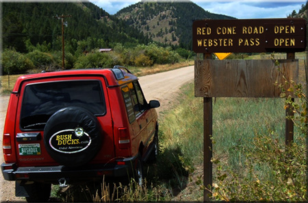 This is
the page for the 2011 Colorado Pass page. You can add to this page and
This is
the page for the 2011 Colorado Pass page. You can add to this page and


 As a guide, you can view the dates and information from the
 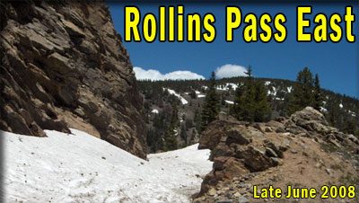 This
list is intended as a guide only and no responsibility is taken for any
incident arising from mis-information. The ultimate responsibility as
to whether the trail is safe to travel, within the capabilities of
yourself and your vehicle, or indeed open at all, is taken by YOU. If
in doubt, DO NOT TRAVEL. The inclusion of any trail on this page does
not mean it is open or legal to travel. Conditions change, and trail
status may change, sometimes without warning. Use common sense, and do
not go around closure barriers.
This
list is intended as a guide only and no responsibility is taken for any
incident arising from mis-information. The ultimate responsibility as
to whether the trail is safe to travel, within the capabilities of
yourself and your vehicle, or indeed open at all, is taken by YOU. If
in doubt, DO NOT TRAVEL. The inclusion of any trail on this page does
not mean it is open or legal to travel. Conditions change, and trail
status may change, sometimes without warning. Use common sense, and do
not go around closure barriers.
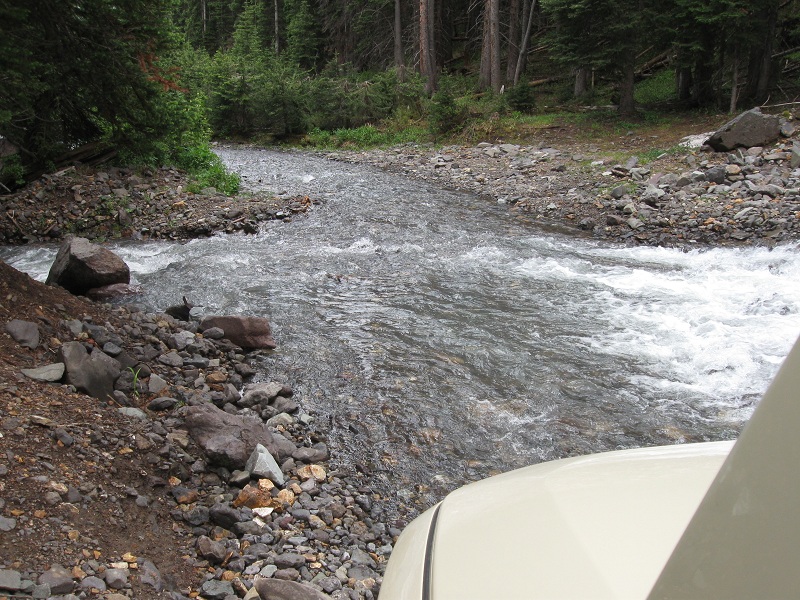
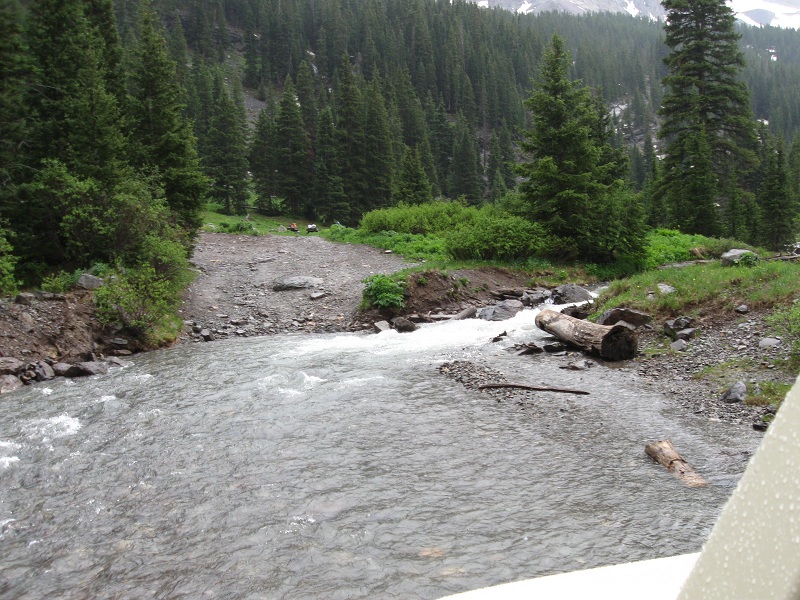
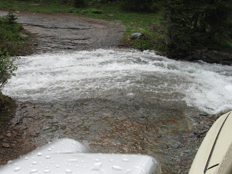
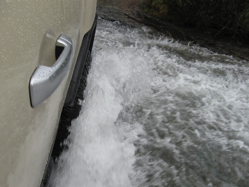
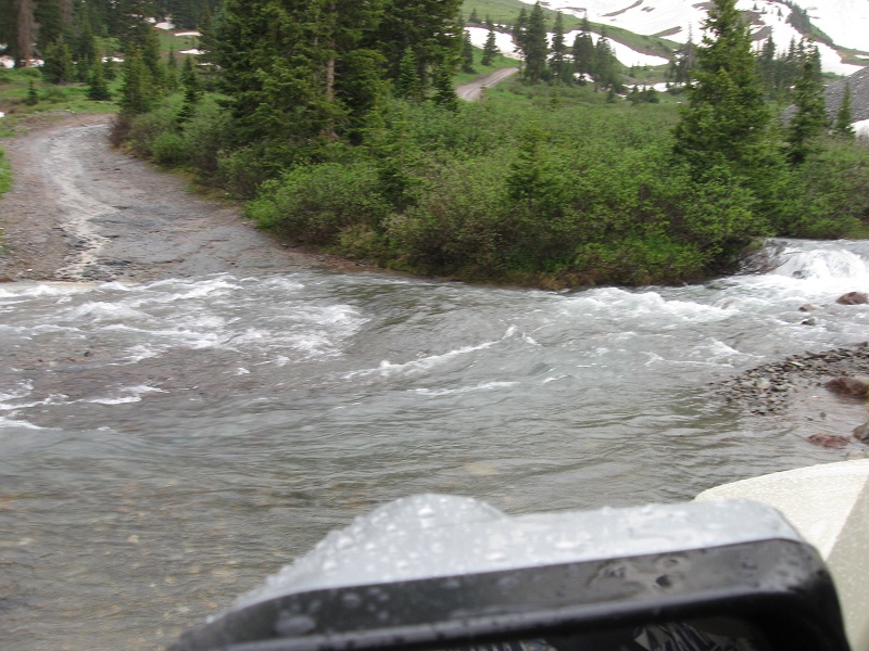