|
Schofield Pass - The Most Dangerous Jeep Trail in Colorado?September 1998The Inaugural Range Rover Club World Tour of Colorado, which took place in August traveled on some fantastic jeep trails and tracks. However there was one that we missed out on at the time as it was still closed in the height of summer. Initial reports said that a landslide had wiped out a large portion of the shelf road over Schofield Pass, and it was unlikely to open at all this year. When the trip passed through Crested Butte, the town at the south end of the pass, we asked again, and were told that the road was okay, but it was still impassable due to snow. So we drove around the long way, but we determined to return at a later date when the pass was open. Schofield Pass is supposedly the most dangerous jeep trail in Colorado, having claimed twelve lives to date. As it runs through a canyon, the snow lingers on, and in early September the forest service was still telling us it was closed due to a snow bridge in the canyon. I had been ringing them every week, and finally in mid September the Sophris Ranger District said that it was open to Jeeps but, the ranger warned, " it's a very very dangerous road." Me: "Is there any particular reason for that?" Them: "It's just a very, very dangerous road." Me: "Avalanche, washouts, landslide, snow bridge?" Them: "No, it's just a very, very dangerous road." Me: "Rampaging black bears, alien abduction, army bombardment, nuclear fallout?" Them: "No, it's just a very, very dangerous road."
We drove in from the west along the Crystal River, the same way that the Range Rover Club trip went, past the old Dead Horse Mill clinging precariously to the cliff face above the river, and through the ghost town of Crystal. This portion of the drive is wonderfully scenic as the rough track descends down to run alongside the Crystal River. With our new soft top rolled back, we were able to gaze up at the canyon walls and appreciate the enormity of their height. We met a couple of Suzukis coming in the opposite direction and we asked them if they had come over the pass, and how was it. They said, "fine", but looked dubiously at Juanito - who is hardly an oversize vehicle - and said, "it'll be a tight squeeze to get through though in that". Uh-Oh.
So, the infamous Schofield Pass. Stunningly beautiful. An exciting jeep trail. A dangerous one? Not really.
© Bushducks, 1998
Be informed when this site is updated: |
 And so on. I finally established that it was no worse than normal, no particular reason
for the warning, they were obviously sick and tired of pulling wrecks out of Devil's Punchbowl and
now work on the principle of trying to put as many people off as possible. Previous accidents have
mainly been people driving off the edge of the narrow shelf road. One Chevy Blazer rolled off the
edge with nine people on board when the driver set the handbrake and got out to take a photo, and
the handbrake alone was not enough to hold the vehicle on the steep slope.
So with the warnings of the Forest Service ringing in our ears, and the myths and horror stories
surrounding Schofield Pass, we set off to see what the fuss was about.
And so on. I finally established that it was no worse than normal, no particular reason
for the warning, they were obviously sick and tired of pulling wrecks out of Devil's Punchbowl and
now work on the principle of trying to put as many people off as possible. Previous accidents have
mainly been people driving off the edge of the narrow shelf road. One Chevy Blazer rolled off the
edge with nine people on board when the driver set the handbrake and got out to take a photo, and
the handbrake alone was not enough to hold the vehicle on the steep slope.
So with the warnings of the Forest Service ringing in our ears, and the myths and horror stories
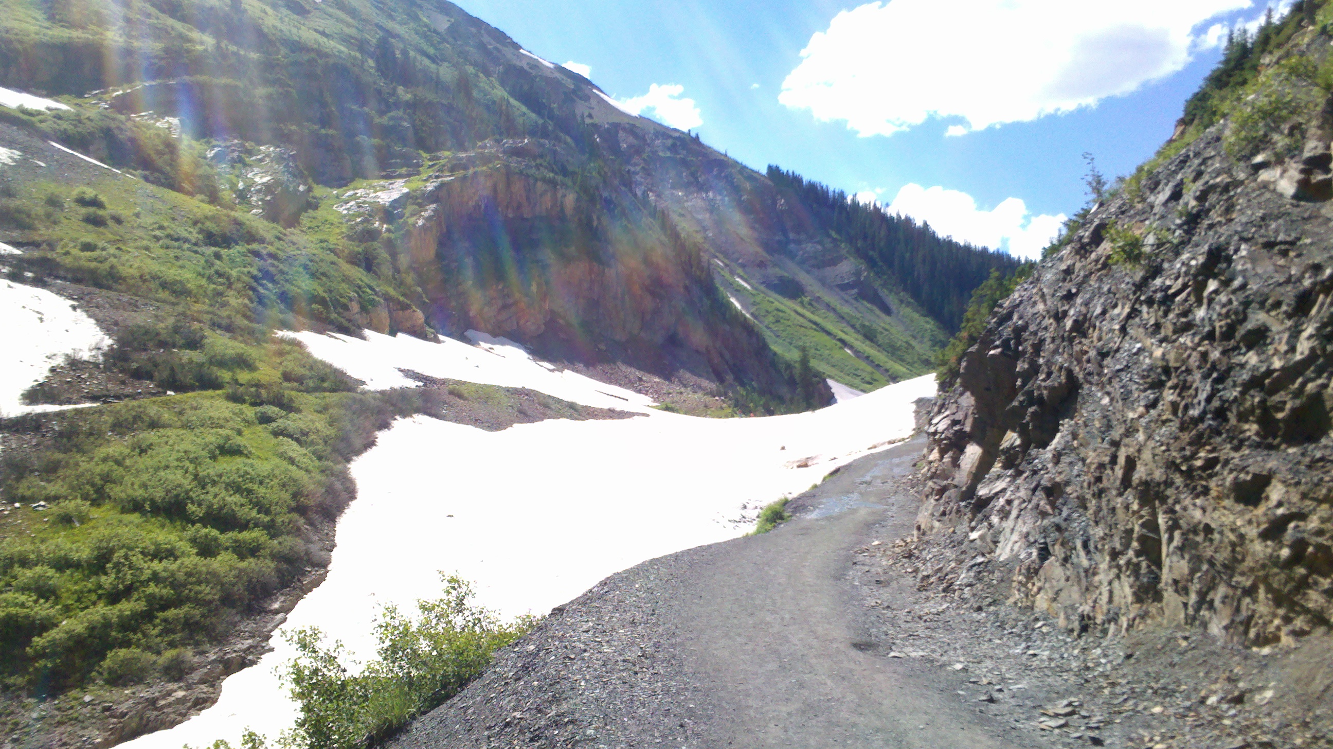
surrounding Schofield Pass, we set off to see what the fuss was about.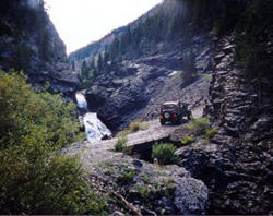 On we went anyway, crawling up the rock ledge around the start of the Devil's Canyon, a narrow
gorge climbing up alongside the river. It was very, very pretty, but so far hardly the gut churning
experience we had heard about. The track was relatively good, and a lot wider than expected. Most
of the time we had a good couple of feet or more to spare instead of teetering with two wheels
scrabbling on the edge of the shale as we were expecting. The track cris-crosses the Crystal River, and is
relatively steep, very rocky with a few off camber sections that make you glad you have good
tyres, but in no way the "very, very dangerous road" that legends are made of. The
drops were moderate, and passing places few. We were lucky in that the only vehicle we met coming
down was able to pull over at one of the few places wide enough to let us past.
On we went anyway, crawling up the rock ledge around the start of the Devil's Canyon, a narrow
gorge climbing up alongside the river. It was very, very pretty, but so far hardly the gut churning
experience we had heard about. The track was relatively good, and a lot wider than expected. Most
of the time we had a good couple of feet or more to spare instead of teetering with two wheels
scrabbling on the edge of the shale as we were expecting. The track cris-crosses the Crystal River, and is
relatively steep, very rocky with a few off camber sections that make you glad you have good
tyres, but in no way the "very, very dangerous road" that legends are made of. The
drops were moderate, and passing places few. We were lucky in that the only vehicle we met coming
down was able to pull over at one of the few places wide enough to let us past.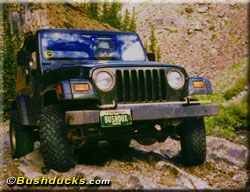 The track finally climbs out of the top of the canyon after a few miles and crosses the icy cold
Crystal River for the final time. It then turns into a packed dirt track that winds through the
Gunnison Forest, crossing a large alpine meadow before emerging at the top of the pass proper.
From here it is a 2wd dirt road down the mountain to Crested Butte. We took our photo by the sign
designating the pass at 10,707 feet, after waiting for the sedans to move off.
From there we had a lovely, easy cruise down to Crested Butte, sharing the track with mountain
bikers, hikers, horse riders and ATVs. We were drinking cappuccino in Crested Butte before you
could say "defective handbrake".
The track finally climbs out of the top of the canyon after a few miles and crosses the icy cold
Crystal River for the final time. It then turns into a packed dirt track that winds through the
Gunnison Forest, crossing a large alpine meadow before emerging at the top of the pass proper.
From here it is a 2wd dirt road down the mountain to Crested Butte. We took our photo by the sign
designating the pass at 10,707 feet, after waiting for the sedans to move off.
From there we had a lovely, easy cruise down to Crested Butte, sharing the track with mountain
bikers, hikers, horse riders and ATVs. We were drinking cappuccino in Crested Butte before you
could say "defective handbrake". 4WD Adventures: Colorado